

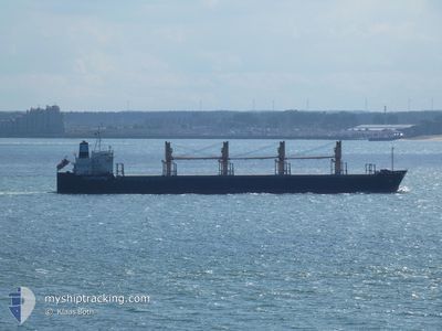
AEOLOS
Bulk Carrier

Current Trip
| Trip Time | 33 days |
|---|---|
| Trip Distance | 5253.24 nm |
| AVG Speed | 11.6 Knots |
| MAX Speed | 11.6 Knots |
| Draught | 9.8 m |
| AVG Wind | 9.6 knots |
| MAX Wind | 20.9 knots |
| MIN Temp | 16.1°C / 60.98°F |
| MAX Temp | 29.6°C / 85.28°F |
| Position Received | 10 d ago |
Current Position
| Longitude | -48.14027° |
|---|---|
| Latitude | -25.60336° |
| Status | At anchor |
| Speed | |
| Course | 165° |
| Area | South Atlantic Ocean |
| Station | T-AIS |
| Position Received | 10 d ago |
Information
The current position of AEOLOS is in South Atlantic Ocean with coordinates -25.60336° / -48.14027° as reported on 2025-05-10 22:15 by AIS to our vessel tracker app. The vessel's current speed is 0 Knots and is currently inside the port of PARANAGUA.
The vessel AEOLOS (IMO: 9228382, MMSI: 538003275) is a Bulk Carrier that was built in 2001 ( 24 years old ). It's sailing under the flag of [MH] Marshall Is.
In this page you can find informations about the vessels current position, last detected port calls, and current voyage information. If the vessels is not in coverage by AIS you will find the latest position.
The current position of AEOLOS is detected by our AIS receivers and we are not responsible for the reliability of the data. The last position was recorded while the vessel was in Coverage by the Ais receivers of our vessel tracking app.
The current draught of AEOLOS as reported by AIS is 9.8 meters
Weather
| Temperature | 20°C / 68°F |
|---|---|
| Wind Speed | 3 knots |
| Direction | 160° SSE |
| Pressure | 1017.7 hPa |
| Humidity | 97.6 % |
| Cloud Coverage | 100 % |


Featured Company
Last Trips
| Origin | Departure | Destination | Arrival | Distance | |
|---|---|---|---|---|---|
| 2025-04-13 19:23 | 2025-05-17 13:06 | 5253.24 nm | |||
| 2025-03-30 13:16 | 2025-04-09 23:42 | 1001.58 nm | |||
| 2025-03-10 21:07 | 2025-03-28 15:18 | 5186.61 nm | |||
| 2025-03-05 12:26 | 2025-03-07 06:25 | 426.44 nm | |||
| 2025-02-26 16:02 | 2025-03-03 04:02 | 512.93 nm |
Events
| Time | Event | Details | Position / Dest | Info |
|---|---|---|---|---|
| 2025-05-17 16:27 | STOP Moving |
-25.50217 / -48.51655
[BR] PARANAGUA
|
Speed: 0.2 kn Course: 95° |
|
| 2025-05-17 16:06 | PORT ARRIVAL |
|
-25.49869 / -48.51854
[BR] PARANAGUA
|
Speed: 3.7 kn Course: 257° |
| 2025-05-17 15:27 | START Moving | 2.96 nm, East of PARANAGUA |
-25.49378 / -48.46361
BR PNG
|
Speed: 5.9 kn Course: 265° |
| 2025-05-16 01:13 | STOP Moving | 3.89 nm, East of PARANAGUA |
-25.49079 / -48.44679
BR PNG
|
Speed: 0.1 kn Course: 318° |
| 2025-05-15 22:42 | START Moving | 10.09 nm, South East of ILHA DO MEL |
-25.61005 / -48.13541
BR PNG
|
Speed: 4.2 kn Course: 217° |
| 2025-05-15 04:21 | STOP Moving | 9.64 nm, South East of ILHA DO MEL |
-25.60617 / -48.14252
BR PNG
|
Speed: 0.1 kn Course: 74° |
| 2025-05-15 04:17 | START Moving | 9.64 nm, South East of ILHA DO MEL |
-25.60611 / -48.14249
BR PNG
|
Speed: 45.3 kn Course: 252° |