
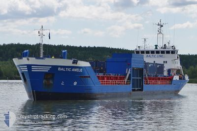
BALTIC AMELIE
General Cargo
Current Trip
| Time Travelled | 3 days |
|---|---|
| Remaining Time | 15 h, 59 mins |
| Distance Travelled | 744.38 морская миля |
| Remaining Distance | 146.39 морская миля |
| AVG Speed | 9.1 Узлы |
| MAX Speed | 11.3 Узлы |
| AVG Wind | 20.4 knots |
| MAX Wind | 29 knots |
| MIN Temp | 1.2°C / 34.16°F |
| MAX Temp | 7.7°C / 45.86°F |
| Осадка | 4.1 м |
| Позиция Получена | 3 h, 22 m тому назад |
Current Position
| Долгота | 19.66216° |
|---|---|
| Широта | 58.01978° |
| Статус | Under way using engine |
| Скорость | 8.9 Узлы |
| Курс | 25.2° |
| Район | Baltic Sea |
| Станция | T-AIS |
| Позиция Получена | 3 h, 22 m тому назад |
Info
Information
The current position of BALTIC AMELIE is in Baltic Sea with coordinates 58.01978° / 19.66216° as reported on 2026-01-03 15:58 by AIS to our vessel tracker app. The vessel's current speed is 8.9 Узлы and is heading at the port of TURKU. The estimated time of arrival as calculated by MyShipTracking vessel tracking app is 2026-01-04 13:19 LT
The vessel BALTIC AMELIE (IMO: 9083885, MMSI: 230091950) is a General Cargo that was built in 1994 ( 32 лет ). It's sailing under the flag of [FI] Finland.
In this page you can find informations about the vessels current position, last detected port calls, and current voyage information. If the vessels is not in coverage by AIS you will find the latest position.
The current position of BALTIC AMELIE is detected by our AIS receivers and we are not responsible for the reliability of the data. The last position was recorded while the vessel was in Coverage by the Ais receivers of our vessel tracking app.
The current draught of BALTIC AMELIE as reported by AIS is 4.1 meters
Weather
| Temperature | 3°C / 37.4°F |
|---|---|
| Wind Speed | 15 knots |
| Direction | 110° ESE |
| Pressure | 988 hPa |
| Humidity | 76.4 % |
| Cloud Coverage | 100 % |
Featured Company
Last Port Calls
| Port | Arrival | Departure | Time In Port |
|---|---|---|---|
| 2025-12-30 16:27 | 2025-12-31 12:40 | 20 h | |
| 2025-12-30 12:30 | 2025-12-30 16:10 | 3 h | |
| 2025-12-30 08:26 | 2025-12-30 09:07 | 40 m | |
| 2025-12-28 19:36 | 2025-12-29 17:48 | 22 h | |
| 2025-12-21 23:49 | 2025-12-25 10:11 | 3 d | |
| 2025-12-17 13:01 | 2025-12-18 09:54 | 20 h | |
| 2025-12-17 07:36 | 2025-12-17 09:59 | 2 h | |
| 2025-12-16 12:28 | 2025-12-16 16:32 | 4 h | |
| 2025-12-14 21:28 | 2025-12-15 11:06 | 13 h | |
| 2025-12-07 16:16 | 2025-12-12 09:08 | 4 d |
Last Trips
| Origin | Departure | Destination | Arrival | Distance | |
|---|---|---|---|---|---|
| 2025-12-30 16:10 | 2025-12-30 16:27 | 1.54 морская миля | |||
| 2025-12-30 09:07 | 2025-12-30 12:30 | 37.13 морская миля | |||
| 2025-12-29 17:48 | 2025-12-30 08:26 | 145.68 морская миля | |||
| 2025-12-25 10:11 | 2025-12-28 19:36 | 743.99 морская миля | |||
| 2025-12-18 09:54 | 2025-12-21 23:49 | 874.53 морская миля | |||
| 2025-12-17 09:59 | 2025-12-17 13:01 | 35.27 морская миля | |||
| 2025-12-16 16:32 | 2025-12-17 07:36 | 145.48 морская миля | |||
| 2025-12-15 11:06 | 2025-12-16 12:28 | 258.08 морская миля | |||
| 2025-12-12 09:08 | 2025-12-14 21:28 | 600.85 морская миля | |||
| 2025-12-03 22:10 | 2025-12-07 16:16 | 880.96 морская миля |
Events
| Время | Событие | Детали | Позиция / Направление | Информация |
|---|---|---|---|---|
| 2026-01-03 16:05 | Статус изменился | Default Under way using engine |
58.03509 / 19.67629
FITKU
|
Скорость: 8.9 kn Курс: 25.2° |
| 2026-01-03 15:58 | Вне покрытия |
58.01978 / 19.66216
Baltic Sea
FITKU
|
Скорость: 8.9 kn Курс: 25.2° |
|
| 2026-01-03 15:04 | Статус изменился | Under way using engine Default |
57.89565 / 19.54894
FITKU
|
Скорость: 9.2 kn Курс: 26° |
| 2026-01-03 14:53 | Статус изменился | Default Under way using engine |
57.87007 / 19.52705
FITKU
|
Скорость: 9.4 kn Курс: 22.5° |
| 2026-01-03 14:30 | Статус изменился | Under way using engine Default |
57.81547 / 19.48346
FITKU
|
Скорость: 9.3 kn Курс: 24° |
| 2026-01-03 14:09 | Статус изменился | Default Under way using engine |
57.76714 / 19.44380
FITKU
|
Скорость: 8.9 kn Курс: 23.5° |
| 2026-01-03 12:42 | Статус изменился | Under way using engine Default |
57.57167 / 19.27950
FITKU
|
Скорость: 9 kn Курс: 25° |
| 2026-01-03 12:41 | Статус изменился | Default Under way using engine |
57.56941 / 19.27753
FITKU
|
Скорость: 8.9 kn Курс: 25.3° |
| 2026-01-03 12:35 | Статус изменился | Under way using engine Default |
57.55730 / 19.26715
FITKU
|
Скорость: 8.9 kn Курс: 25° |
| 2026-01-03 11:34 | Вне покрытия |
57.41549 / 19.14597
Baltic Sea
FITKU
|
Скорость: 9.1 kn Курс: 24.2° |