

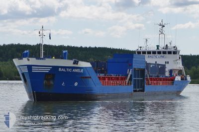
BALTIC AMELIE
General Cargo

Current Trip
| Time Travelled | 23 h, 18 mins |
|---|---|
| Remaining Time | 5 h, 44 mins |
| Distance Travelled | 237.34 nm |
| Remaining Distance | 62.11 nm |
| AVG Speed | 10.3 Knots |
| MAX Speed | 11.1 Knots |
| AVG Wind | 14.4 knots |
| MAX Wind | 19.6 knots |
| MIN Temp | 10.4°C / 50.72°F |
| MAX Temp | 18.6°C / 65.48°F |
| Draught | 4.3 m |
| Position Received | 1 m ago |
Current Position
| Longitude | 21.28626° |
|---|---|
| Latitude | 59.67648° |
| Status | Under way using engine |
| Speed | 10.1 Knots |
| Course | 43.5° |
| Area | Baltic Sea |
| Station | T-AIS |
| Position Received | 1 m ago |
Information
The current position of BALTIC AMELIE is in Baltic Sea with coordinates 59.67648° / 21.28626° as reported on 2025-06-04 12:54 by AIS to our vessel tracker app. The vessel's current speed is 10.1 Knots and is heading at the port of TURKU. The estimated time of arrival as calculated by MyShipTracking vessel tracking app is 2025-06-04 18:40 LT
The vessel BALTIC AMELIE (IMO: 9083885, MMSI: 230091950) is a General Cargo that was built in 1994 ( 31 years old ). It's sailing under the flag of [FI] Finland.
In this page you can find informations about the vessels current position, last detected port calls, and current voyage information. If the vessels is not in coverage by AIS you will find the latest position.
The current position of BALTIC AMELIE is detected by our AIS receivers and we are not responsible for the reliability of the data. The last position was recorded while the vessel was in Coverage by the Ais receivers of our vessel tracking app.
The current draught of BALTIC AMELIE as reported by AIS is 4.3 meters
Weather
| Temperature | 10.5°C / 50.9°F |
|---|---|
| Wind Speed | 17 knots |
| Direction | 173° S |
| Pressure | 1010.6 hPa |
| Humidity | 85.8 % |
| Cloud Coverage | 81 % |


Featured Company
Last Port Calls
| Port | Arrival | Departure | Time In Port |
|---|---|---|---|
| 2025-06-03 13:34 | 2025-06-03 13:38 | 4 m | |
| 2025-05-31 19:37 | 2025-06-02 12:17 | 1 d | |
| 2025-05-29 05:45 | 2025-05-29 10:09 | 4 h | |
| 2025-05-28 14:21 | 2025-05-29 02:09 | 11 h | |
| 2025-05-27 20:45 | 2025-05-28 03:15 | 6 h | |
| 2025-05-22 14:23 | 2025-05-23 13:08 | 22 h | |
| 2025-05-20 04:30 | 2025-05-20 07:42 | 3 h | |
| 2025-05-03 13:29 | 2025-05-15 09:21 | 11 d | |
| 2025-04-28 20:45 | 2025-04-29 18:34 | 21 h | |
| 2025-04-28 05:55 | 2025-04-28 16:02 | 10 h |
Last Trips
| Origin | Departure | Destination | Arrival | Distance | |
|---|---|---|---|---|---|
| 2025-06-02 14:17 | 2025-06-03 15:34 | 274.38 nm | |||
| 2025-05-29 12:09 | 2025-05-31 21:37 | 480.76 nm | |||
| 2025-05-29 04:09 | 2025-05-29 07:45 | 35.64 nm | |||
| 2025-05-28 05:15 | 2025-05-28 16:21 | 109.28 nm | |||
| 2025-05-23 16:08 | 2025-05-27 22:45 | 1004.28 nm | |||
| 2025-05-20 09:42 | 2025-05-22 17:23 | 608.49 nm | |||
| 2025-05-15 12:21 | 2025-05-20 06:30 | 764.56 nm | |||
| 2025-04-29 20:34 | 2025-05-03 16:29 | 793.33 nm | |||
| 2025-04-28 18:02 | 2025-04-28 22:45 | 54.20 nm | |||
| 2025-04-27 17:38 | 2025-04-28 07:55 | 168.12 nm |
Events
| Time | Event | Details | Position / Dest | Info |
|---|---|---|---|---|
| 2025-06-04 12:51 | Status Changed | Under way using engine Default |
59.67069 / 21.27554
FITKU
|
Speed: 10.2 kn Course: 43° |
| 2025-06-04 12:51 | IN Coverage |
59.67284 / 21.27952
Baltic Sea
FITKU
|
Speed: 10.2 kn Course: 43.1° |
|
| 2025-06-04 10:41 | Status Changed | Default Under way using engine |
59.41042 / 20.74846
FITKU
|
Speed: 10.3 kn Course: 46.8° |
| 2025-06-04 10:40 | Status Changed | Under way using engine Default |
59.40695 / 20.74130
FITKU
|
Speed: 10.3 kn Course: 46° |
| 2025-06-04 10:40 | OUT of Coverage |
59.40695 / 20.74130
Baltic Sea
FITKU
|
Speed: 10.3 kn Course: 46.8° |
|
| 2025-06-04 10:36 | Status Changed | Default Under way using engine |
59.39896 / 20.72490
FITKU
|
Speed: 10.4 kn Course: 46.7° |
| 2025-06-04 10:31 | Status Changed | Under way using engine Default |
59.38935 / 20.70526
FITKU
|
Speed: 10.4 kn Course: 47° |
| 2025-06-04 10:11 | Status Changed | Default Under way using engine |
59.34906 / 20.62317
FITKU
|
Speed: 10.4 kn Course: 45.5° |
| 2025-06-04 10:01 | Detected in Sea | Finnish part of the Baltic Sea |
59.33048 / 20.58598
Baltic Sea
FITKU
|
Speed: 10.3 kn Course: 45.6° |
| 2025-06-04 10:01 | Status Changed | Under way using engine Default |
59.33048 / 20.58598
FITKU
|
Speed: 10.4 kn Course: 45° |