
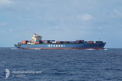
HYUNDAI SUPREME
Container Ship
Current Trip
| Time Travelled | 17 days |
|---|---|
| Remaining Time | 53 mins |
| Distance Travelled | 5117.25 морская миля |
| Remaining Distance | 14.33 морская миля |
| AVG Speed | 13.7 Узлы |
| MAX Speed | 20.4 Узлы |
| AVG Wind | 18.2 knots |
| MAX Wind | 34.7 knots |
| MIN Temp | -5.6°C / 21.92°F |
| MAX Temp | 9.8°C / 49.64°F |
| Осадка | 12.6 м |
| Позиция Получена | 3 d тому назад |
Current Position
| Долгота | 140.81343° |
|---|---|
| Широта | 41.63498° |
| Статус | Under way using engine |
| Скорость | 12.2 Узлы |
| Курс | 248° |
| Район | Japan Sea |
| Станция | T-AIS |
| Позиция Получена | 3 d тому назад |
Info
Information
The current position of HYUNDAI SUPREME is in Japan Sea with coordinates 41.63498° / 140.81343° as reported on 2026-01-01 02:00 by AIS to our vessel tracker app. The vessel's current speed is 12.2 Узлы and is heading at the port of BUSAN. The estimated time of arrival as calculated by MyShipTracking vessel tracking app is 2026-01-04 14:05 LT
The vessel HYUNDAI SUPREME (IMO: 9347619, MMSI: 538007487) is a Container Ship that was built in 2008 ( 18 лет ). It's sailing under the flag of [MH] Marshall Is.
In this page you can find informations about the vessels current position, last detected port calls, and current voyage information. If the vessels is not in coverage by AIS you will find the latest position.
The current position of HYUNDAI SUPREME is detected by our AIS receivers and we are not responsible for the reliability of the data. The last position was recorded while the vessel was in Coverage by the Ais receivers of our vessel tracking app.
The current draught of HYUNDAI SUPREME as reported by AIS is 12.6 meters
Weather
| Temperature | 5.8°C / 42.44°F |
|---|---|
| Wind Speed | 9 knots |
| Direction | 293° WNW |
| Pressure | 1022 hPa |
| Humidity | 54.3 % |
| Cloud Coverage | 2 % |
Featured Company
Last Port Calls
| Port | Arrival | Departure | Time In Port |
|---|---|---|---|
| 2025-12-15 12:20 | 2025-12-17 19:02 | 2 d | |
| 2025-12-13 02:53 | 2025-12-15 01:37 | 1 d | |
| 2025-11-26 06:16 | 2025-11-26 19:20 | 13 h | |
| 2025-11-21 13:12 | 2025-11-21 19:48 | 6 h | |
| 2025-11-16 03:45 | 2025-11-17 12:49 | 1 d |
Most Visited Ports (Last year)
| Port | Arrivals | |
|---|---|---|
| 9 | ||
| 6 | ||
| 5 | ||
| 5 | ||
| 5 | ||
| 1 |
Last Trips
| Origin | Departure | Destination | Arrival | Distance | |
|---|---|---|---|---|---|
| 2025-12-15 01:37 | 2025-12-15 12:20 | 155.70 морская миля | |||
| 2025-11-26 19:20 | 2025-12-13 02:53 | 4696.68 морская миля | |||
| 2025-11-21 19:48 | 2025-11-26 06:16 | 686.32 морская миля | |||
| 2025-11-17 12:49 | 2025-11-21 13:12 | 511.72 морская миля | |||
| 2025-10-30 21:56 | 2025-11-16 03:45 | 535.81 морская миля |
Events
| Время | Событие | Детали | Позиция / Направление | Информация |
|---|---|---|---|---|
| 2026-01-01 02:00 | Вне покрытия |
41.63498 / 140.81343
Japan Sea
KRPUS
|
Скорость: 12.2 kn Курс: 248° |
|
| 2026-01-01 02:00 | Изменение морского района | Japanese part of the Japan Sea Canadian part of the North Pacific Ocean |
41.63498 / 140.81343
Japan Sea
KRPUS
|
Скорость: 12.2 kn Курс: 248° |
| 2026-01-01 01:50 | В покрытии |
41.64488 / 140.84542
North Pacific Ocean
KRPUS
|
Скорость: 10.8 kn Курс: 247° |
|
| 2025-12-30 22:57 | Окончание движения |
41.54862 / 143.31982
KRPUS
|
Скорость: 0.2 kn Курс: 311° |