
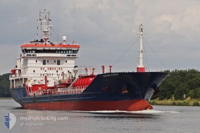
IPEK S
Oil/Chemical Tanker
Current Trip
| Time Travelled | 2 days |
|---|---|
| Remaining Time | 2 days |
| Distance Travelled | 404.34 морская миля |
| Remaining Distance | 1127.09 морская миля |
| AVG Speed | 10.9 Узлы |
| MAX Speed | 14.5 Узлы |
| AVG Wind | 19.9 knots |
| MAX Wind | 29 knots |
| MIN Temp | 2.8°C / 37.04°F |
| MAX Temp | 10°C / 50°F |
| Осадка | 6.1 м |
| Позиция Получена | 1 d тому назад |
Current Position
| Долгота | 23.89415° |
|---|---|
| Широта | 37.28568° |
| Статус | Under way using engine |
| Скорость | 11.7 Узлы |
| Курс | 209.1° |
| Район | Aegean Sea |
| Станция | T-AIS |
| Позиция Получена | 1 d тому назад |
Info
Information
The current position of IPEK S is in Aegean Sea with coordinates 37.28568° / 23.89415° as reported on 2025-02-06 11:07 by AIS to our vessel tracker app. The vessel's current speed is 11.7 Узлы and is heading at the port of LAVERA. The estimated time of arrival as calculated by MyShipTracking vessel tracking app is 2025-02-10 11:34 LT
The vessel IPEK S (IMO: 9499541, MMSI: 538090654) is a Oil/Chemical Tanker that was built in 2009 ( 16 лет ). It's sailing under the flag of [MH] Marshall Is.
In this page you can find informations about the vessels current position, last detected port calls, and current voyage information. If the vessels is not in coverage by AIS you will find the latest position.
The current position of IPEK S is detected by our AIS receivers and we are not responsible for the reliability of the data. The last position was recorded while the vessel was in Coverage by the Ais receivers of our vessel tracking app.
The current draught of IPEK S as reported by AIS is 6.1 meters
Weather
| Temperature | 10.1°C / 50.18°F |
|---|---|
| Wind Speed | 17 knots |
| Direction | 17° NNE |
| Pressure | 1030.3 hPa |
| Humidity | 56.2 % |
| Cloud Coverage | 98 % |
Featured Company
Last Port Calls
| Port | Arrival | Departure | Time In Port |
|---|---|---|---|
| 2025-02-04 05:41 | 2025-02-04 22:37 | 16 h | |
| 2025-02-02 05:33 | 2025-02-03 13:00 | 1 d | |
| 2025-01-25 13:22 | |||
| 2024-12-27 14:28 | 2024-12-30 07:22 | 2 d | |
| 2024-12-23 01:44 | 2024-12-24 15:10 | 1 d | |
| 2024-12-15 10:47 | 2024-12-21 12:05 | 6 d | |
| 2024-12-13 05:29 | 2024-12-14 09:56 | 1 d |
Last Trips
| Origin | Departure | Destination | Arrival | Distance | |
|---|---|---|---|---|---|
| 2025-02-03 16:00 | 2025-02-04 08:41 | 16.53 морская миля | |||
| 2025-01-25 15:22 | 2025-02-02 08:33 | 677.57 морская миля | |||
| 2024-12-24 17:10 | 2024-12-27 16:28 | 540.36 морская миля | |||
| 2024-12-21 15:05 | 2024-12-23 03:44 | 253.54 морская миля | |||
| 2024-12-14 12:56 | 2024-12-15 13:47 | 30.87 морская миля | |||
| 2024-11-29 23:53 | 2024-12-13 08:29 | 1234.29 морская миля |
Events
| Время | Событие | Детали | Позиция / Направление | Информация |
|---|---|---|---|---|
| 2025-02-06 11:07 | Вне покрытия |
37.28568 / 23.89415
Aegean Sea
FRLAV
|
Скорость: 11.7 kn Курс: 209.1° |
|
| 2025-02-06 01:10 | В покрытии |
38.88770 / 25.21097
Aegean Sea
FRLAV
|
Скорость: 11.6 kn Курс: 208.6° |
|
| 2025-02-05 22:17 | Вне покрытия |
39.38459 / 25.53353
Aegean Sea
FRLAV
|
Скорость: 11.6 kn Курс: 206.6° |
|
| 2025-02-05 19:36 | Обнаружено в море | Greek part of the Aegean Sea |
39.85994 / 25.84255
Aegean Sea
FRLAV
|
Скорость: 12.1 kn Курс: 209.7° |
| 2025-02-05 19:11 | Изменение морского района | Turkish part of the Aegean Sea Turkish part of the Sea of Marmara |
39.93490 / 25.89643
Aegean Sea
FRLAV
|
Скорость: 12.2 kn Курс: 210° |
| 2025-02-05 19:10 | В покрытии |
39.93490 / 25.89643
Aegean Sea
FRLAV
|
Скорость: 12.2 kn Курс: 210° |
|
| 2025-02-05 17:29 | Вне покрытия |
40.07245 / 26.30275
Sea of Marmara
FRLAV
|
Скорость: 14.4 kn Курс: 233.3° |
|
| 2025-02-05 15:36 | В покрытии |
40.35259 / 26.64161
Sea of Marmara
FRLAV
|
Скорость: 12.7 kn Курс: 215.4° |
|
| 2025-02-05 12:02 | Вне покрытия |
40.64394 / 27.28588
Sea of Marmara
FRLAV
|
Скорость: 11.1 kn Курс: 246.3° |
|
| 2025-02-05 07:32 | Начало движения | 8.68 nm, South West of MARTAS |
40.84781 / 27.81597
FRLAV
|
Скорость: 3.3 kn Курс: 86° |