
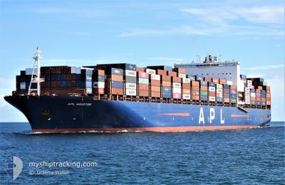
APL HOUSTON
Container Ship
Current Trip
| Time Travelled | 4 days |
|---|---|
| Remaining Time | --- |
| Distance Travelled | 1928.85 nm |
| Remaining Distance | --- |
| AVG Speed | 15.8 Knop |
| MAX Speed | 20 Knop |
| AVG Wind | 10.5 knots |
| MAX Wind | 17.9 knots |
| MIN Temp | 25.8°C / 78.44°F |
| MAX Temp | 29.8°C / 85.64°F |
| Djupgående | 15.1 m |
| Position mottagen | 4 d sen |
Current Position
| Longitud | 103.37616° |
|---|---|
| Latitude | 1.26213° |
| Status | Under way using engine |
| Fart | 18.7 Knop |
| Kurs | 303.4° |
| Område | Malacca Strait |
| Station | T-AIS |
| Position mottagen | 4 d sen |
Info
Information
The current position of APL HOUSTON is in Malacca Strait with coordinates 1.26213° / 103.37616° as reported on 2025-02-10 05:51 by AIS to our vessel tracker app. The vessel's current speed is 18.7 Knop and is heading at the port of POINTE NOIRE. The estimated time of arrival as calculated by MyShipTracking vessel tracking app is 2025-02-26 18:30 LT
The vessel APL HOUSTON (IMO: 9597537, MMSI: 566956000) is a Container Ship that was built in 2014 ( 11 År gammal ). It's sailing under the flag of [SG] Singapore.
In this page you can find informations about the vessels current position, last detected port calls, and current voyage information. If the vessels is not in coverage by AIS you will find the latest position.
The current position of APL HOUSTON is detected by our AIS receivers and we are not responsible for the reliability of the data. The last position was recorded while the vessel was in Coverage by the Ais receivers of our vessel tracking app.
The current draught of APL HOUSTON as reported by AIS is 15.1 meters
Weather
| Temperature | 27.3°C / 81.14°F |
|---|---|
| Wind Speed | 13 knots |
| Direction | 298° WNW |
| Pressure | 1009.3 hPa |
| Humidity | 79.4 % |
| Cloud Coverage | 49 % |
Featured Company
Last Port Calls
| Port | Arrival | Departure | Time In Port |
|---|---|---|---|
| 2025-02-08 23:38 | 2025-02-10 03:22 | 1 d | |
| 2025-02-07 16:40 | 2025-02-08 14:33 | 21 h | |
| 2025-02-03 00:13 | 2025-02-04 06:25 | 1 d | |
| 2025-01-25 11:53 | 2025-01-26 03:29 | 15 h | |
| 2025-01-20 04:29 | 2025-01-21 05:49 | 1 d | |
| 2025-01-13 06:17 | 2025-01-14 00:30 | 18 h | |
| 2024-12-25 15:08 | 2024-12-28 01:44 | 2 d | |
| 2024-12-14 16:52 | 2024-12-18 01:35 | 3 d | |
| 2024-12-12 09:27 | 2024-12-14 13:37 | 2 d | |
| 2024-12-03 13:51 | 2024-12-05 02:55 | 1 d |
Last Trips
| Origin | Departure | Destination | Arrival | Distance | |
|---|---|---|---|---|---|
| 2025-02-08 22:33 | 2025-02-09 07:38 | 85.63 nm | |||
| 2025-02-04 14:25 | 2025-02-08 00:40 | 1474.65 nm | |||
| 2025-01-26 11:29 | 2025-02-03 08:13 | 1188.37 nm | |||
| 2025-01-21 13:49 | 2025-01-25 19:53 | 419.07 nm | |||
| 2025-01-14 08:30 | 2025-01-20 12:29 | 2530.41 nm | |||
| 2024-12-28 03:44 | 2025-01-13 14:17 | 6396.82 nm | |||
| 2024-12-18 02:35 | 2024-12-25 17:08 | 922.42 nm | |||
| 2024-12-14 14:37 | 2024-12-14 17:52 | 12.53 nm | |||
| 2024-12-05 03:55 | 2024-12-12 10:27 | 1389.69 nm | |||
| 2024-11-13 19:17 | 2024-12-03 14:51 | 7545.47 nm |
Events
| Tid | Event | Detaljer | Position / Dest | Information |
|---|---|---|---|---|
| 2025-02-10 05:57 | Status ändrad | Default Under way using engine |
1.28098 / 103.35113
CGPNR
|
Fart: 18.7 kn Kurs: 303.4° |
| 2025-02-10 05:51 | UTANFÖR täckningsområde |
1.26213 / 103.37616
Malacca Strait
CGPNR
|
Fart: 18.7 kn Kurs: 303.4° |
|
| 2025-02-10 05:39 | Byter havsområde | Malaysian part of the Malacca Strait Malaysian part of the Singapore Strait |
1.22807 / 103.42798
Malacca Strait
CGPNR
|
Fart: 18.3 kn Kurs: 289.2° |
| 2025-02-10 05:39 | Status ändrad | Under way using engine Default |
1.22760 / 103.42935
CGPNR
|
Fart: 18.2 kn Kurs: 285° |
| 2025-02-10 05:37 | Status ändrad | Default Under way using engine |
1.22444 / 103.43861
CGPNR
|
Fart: 18.1 kn Kurs: 283° |
| 2025-02-10 05:29 | Status ändrad | Under way using engine Default |
1.21300 / 103.47585
CGPNR
|
Fart: 17.8 kn Kurs: 278° |
| 2025-02-10 05:25 | Status ändrad | Default Under way using engine |
1.20854 / 103.49622
CGPNR
|
Fart: 17.5 kn Kurs: 277.7° |
| 2025-02-10 05:07 | Byter havsområde | Malaysian part of the Singapore Strait Indonesian part of the Singapore Strait |
1.19183 / 103.58564
Singapore Strait
CGPNR
|
Fart: 17 kn Kurs: 273.8° |
| 2025-02-10 04:44 | Byter havsområde | Indonesian part of the Singapore Strait Singaporean part of the Singapore Strait |
1.17293 / 103.67885
Singapore Strait
CGPNR
|
Fart: 14.5 kn Kurs: 295.5° |
| 2025-02-10 03:22 | AVGÅTT HAMN |
|
1.25212 / 103.78894
CGPNR
|
Fart: 6.8 kn Kurs: 220° |