

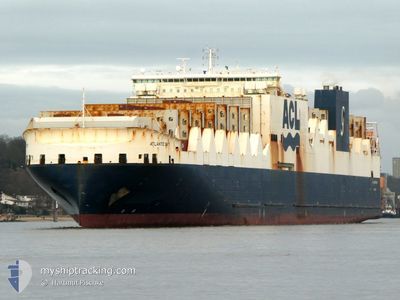
ATLANTIC SKY
Cargo

Current Trip
| Time Travelled | 19 h, 55 mins |
|---|---|
| Remaining Time | 1 day |
| Distance Travelled | 343.01 nm |
| Remaining Distance | 650.76 nm |
| AVG Speed | 15.6 Knop |
| MAX Speed | 19.5 Knop |
| AVG Wind | 13.5 knots |
| MAX Wind | 20 knots |
| MIN Temp | 10.5°C / 50.9°F |
| MAX Temp | 15°C / 59°F |
| Djupgående | 8.5 m |
| Position mottagen | Nu |
Current Position
| Longitud | -4.61526° |
|---|---|
| Latitude | 49.84992° |
| Status | Under way using engine |
| Fart | 18.7 Knop |
| Kurs | 88.8° |
| Område | English Channel |
| Station | T-AIS |
| Position mottagen | Nu |
Information
The current position of ATLANTIC SKY is in English Channel with coordinates 49.84992° / -4.61526° as reported on 2025-06-09 04:36 by AIS to our vessel tracker app. The vessel's current speed is 18.7 Knop and is heading at the port of HAMBURG. The estimated time of arrival as calculated by MyShipTracking vessel tracking app is 2025-06-10 17:28 LT
The vessel ATLANTIC SKY (IMO: 9670602, MMSI: 215804000) is a Cargo It's sailing under the flag of [MT] Malta.
In this page you can find informations about the vessels current position, last detected port calls, and current voyage information. If the vessels is not in coverage by AIS you will find the latest position.
The current position of ATLANTIC SKY is detected by our AIS receivers and we are not responsible for the reliability of the data. The last position was recorded while the vessel was in Coverage by the Ais receivers of our vessel tracking app.
The current draught of ATLANTIC SKY as reported by AIS is 8.5 meters
Weather
| Temperature | 15°C / 59°F |
|---|---|
| Wind Speed | 9 knots |
| Direction | 264° W |
| Pressure | 1022.9 hPa |
| Humidity | 74.5 % |
| Cloud Coverage | 100 % |


Featured Company
Last Port Calls
| Port | Arrival | Departure | Time In Port |
|---|---|---|---|
| 2025-06-07 19:25 | 2025-06-08 09:42 | 14 h | |
| 2025-05-31 16:30 | 2025-05-31 23:02 | 6 h | |
| 2025-05-29 09:05 | 2025-05-29 18:19 | 9 h | |
| 2025-05-27 19:04 | 2025-05-28 19:44 | 1 d | |
| 2025-05-27 06:29 | 2025-05-27 17:47 | 11 h | |
| 2025-05-25 00:24 | 2025-05-27 06:25 | 2 d | |
| 2025-05-22 03:14 | 2025-05-23 17:42 | 1 d | |
| 2025-05-20 05:32 | 2025-05-20 14:05 | 8 h | |
| 2025-05-11 09:04 | 2025-05-12 23:46 | 1 d | |
| 2025-05-07 20:26 | 2025-05-09 12:21 | 1 d |
Last Trips
| Origin | Departure | Destination | Arrival | Distance | |
|---|---|---|---|---|---|
| 2025-05-31 23:02 | 2025-06-07 19:25 | 2722.06 nm | |||
| 2025-05-29 18:19 | 2025-05-31 16:30 | 785.38 nm | |||
| 2025-05-28 19:44 | 2025-05-29 09:05 | 187.39 nm | |||
| 2025-05-27 17:47 | 2025-05-27 19:04 | 5.30 nm | |||
| 2025-05-27 06:25 | 2025-05-27 06:29 | 0.10 nm | |||
| 2025-05-23 17:42 | 2025-05-25 00:24 | 454.00 nm | |||
| 2025-05-20 14:05 | 2025-05-22 03:14 | 608.41 nm | |||
| 2025-05-12 23:46 | 2025-05-20 05:32 | 2700.06 nm | |||
| 2025-05-09 12:21 | 2025-05-11 09:04 | 703.51 nm | |||
| 2025-05-06 16:57 | 2025-05-07 20:26 | 402.15 nm |
Events
| Tid | Event | Detaljer | Position / Dest | Information |
|---|---|---|---|---|
| 2025-06-09 02:40 | Byter havsområde | United Kingdom part of the English Channel United Kingdom part of the Celtic Sea |
49.88793 / -5.54930
English Channel
GBLIV>DEHAM
|
Fart: 18.4 kn Kurs: 94.8° |
| 2025-06-09 02:19 | Status ändrad | Under way using engine Default |
49.89375 / -5.71669
GBLIV>DEHAM
|
Fart: 18.3 kn Kurs: 93° |
| 2025-06-09 02:17 | Status ändrad | Default Under way using engine |
49.89447 / -5.73638
GBLIV>DEHAM
|
Fart: 18.3 kn Kurs: 92.4° |
| 2025-06-09 02:12 | Status ändrad | Under way using engine Default |
49.89576 / -5.77650
GBLIV>DEHAM
|
Fart: 18.4 kn Kurs: 93° |
| 2025-06-09 02:05 | Status ändrad | Default Under way using engine |
49.89732 / -5.83104
GBLIV>DEHAM
|
Fart: 17.9 kn Kurs: 90.3° |
| 2025-06-09 01:58 | Status ändrad | Under way using engine Default |
49.89803 / -5.88569
GBLIV>DEHAM
|
Fart: 17.9 kn Kurs: 90° |
| 2025-06-09 01:53 | Status ändrad | Default Under way using engine |
49.89771 / -5.92284
GBLIV>DEHAM
|
Fart: 17.7 kn Kurs: 139.1° |
| 2025-06-09 00:13 | Status ändrad | Under way using engine Default |
50.35499 / -5.99960
GBLIV>DEHAM
|
Fart: 17.4 kn Kurs: 180° |
| 2025-06-08 23:45 | Status ändrad | Default Under way using engine |
50.49324 / -5.99991
GBLIV>DEHAM
|
Fart: 17.8 kn Kurs: 179.3° |
| 2025-06-08 23:29 | Status ändrad | Under way using engine Default |
50.56865 / -5.99918
GBLIV>DEHAM
|
Fart: 18 kn Kurs: 180° |