
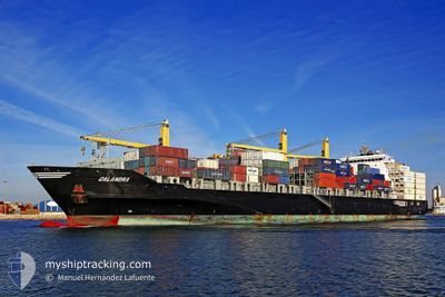
CALANDRA
Container Ship
Current Trip
| Time Travelled | 3 days |
|---|---|
| Remaining Time | 5 days |
| Distance Travelled | 1172.21 nm |
| Remaining Distance | 2864.33 nm |
| AVG Speed | 15.8 Knop |
| MAX Speed | 18.8 Knop |
| AVG Wind | 7.9 knots |
| MAX Wind | 15 knots |
| MIN Temp | 23.9°C / 75.02°F |
| MAX Temp | 28.6°C / 83.48°F |
| Djupgående | 12.1 m |
| Position mottagen | 3 d sen |
Current Position
| Longitud | 103.65217° |
|---|---|
| Latitude | 1.17631° |
| Status | Under way using engine |
| Fart | 14.9 Knop |
| Kurs | 272.3° |
| Område | Singapore Strait |
| Station | T-AIS |
| Position mottagen | 3 d sen |
Info
Information
The current position of CALANDRA is in Singapore Strait with coordinates 1.17631° / 103.65217° as reported on 2025-02-21 15:55 by AIS to our vessel tracker app. The vessel's current speed is 14.9 Knop and is heading at the port of MOMBASA. The estimated time of arrival as calculated by MyShipTracking vessel tracking app is 2025-03-03 05:47 LT
The vessel CALANDRA (IMO: 9445887, MMSI: 305538000) is a Container Ship that was built in 2010 ( 15 År gammal ). It's sailing under the flag of [AG] Antigua Barbuda.
In this page you can find informations about the vessels current position, last detected port calls, and current voyage information. If the vessels is not in coverage by AIS you will find the latest position.
The current position of CALANDRA is detected by our AIS receivers and we are not responsible for the reliability of the data. The last position was recorded while the vessel was in Coverage by the Ais receivers of our vessel tracking app.
The current draught of CALANDRA as reported by AIS is 12.1 meters
Weather
| Temperature | 28°C / 82.4°F |
|---|---|
| Wind Speed | 12 knots |
| Direction | 45° NE |
| Pressure | 1010.4 hPa |
| Humidity | 78.2 % |
| Cloud Coverage | 14 % |
Featured Company
Last Port Calls
| Port | Arrival | Departure | Time In Port |
|---|---|---|---|
| 2025-02-20 12:53 | 2025-02-21 14:21 | 1 d | |
| 2025-02-14 05:25 | 2025-02-14 13:49 | 8 h | |
| 2025-02-10 08:45 | 2025-02-10 15:07 | 6 h | |
| 2025-02-07 18:37 | 2025-02-08 16:37 | 21 h | |
| 2025-01-28 09:20 | 2025-01-29 04:25 | 19 h | |
| 2025-01-13 15:33 | 2025-01-15 15:32 | 1 d | |
| 2025-01-09 16:52 | 2025-01-13 14:40 | 3 d | |
| 2024-12-21 11:44 | 2024-12-21 23:00 | 11 h | |
| 2024-12-17 05:32 | 2024-12-17 16:13 | 10 h | |
| 2024-12-12 15:32 | 2024-12-13 01:14 | 9 h |
Most Visited Ports (Last year)
| Port | Arrivals | |
|---|---|---|
| 8 | ||
| 7 | ||
| 6 | ||
| 4 | ||
| 4 | ||
| 4 |
Last Trips
| Origin | Departure | Destination | Arrival | Distance | |
|---|---|---|---|---|---|
| 2025-02-14 21:49 | 2025-02-20 20:53 | 1455.41 nm | |||
| 2025-02-10 23:07 | 2025-02-14 13:25 | 1070.67 nm | |||
| 2025-02-09 00:37 | 2025-02-10 16:45 | 399.17 nm | |||
| 2025-01-29 12:25 | 2025-02-08 02:37 | 2548.69 nm | |||
| 2025-01-15 18:32 | 2025-01-28 17:20 | 4379.13 nm | |||
| 2025-01-13 17:40 | 2025-01-13 18:33 | 2.56 nm | |||
| 2024-12-22 07:00 | 2025-01-09 19:52 | 4435.68 nm | |||
| 2024-12-18 00:13 | 2024-12-21 19:44 | 1442.33 nm | |||
| 2024-12-13 09:14 | 2024-12-17 13:32 | 1035.21 nm | |||
| 2024-12-09 03:56 | 2024-12-12 23:32 | 405.69 nm |
Events
| Tid | Event | Detaljer | Position / Dest | Information |
|---|---|---|---|---|
| 2025-02-21 16:01 | Status ändrad | Default Under way using engine |
1.17987 / 103.62218
MOMBASA KENYA
|
Fart: 14.9 kn Kurs: 272.3° |
| 2025-02-21 15:55 | Status ändrad | Under way using engine Default |
1.17632 / 103.65217
MOMBASA KENYA
|
Fart: 14.1 kn Kurs: 272° |
| 2025-02-21 15:55 | UTANFÖR täckningsområde |
1.17632 / 103.65217
Singapore Strait
MOMBASA KENYA
|
Fart: 14.9 kn Kurs: 272.3° |
|
| 2025-02-21 15:49 | Status ändrad | Default Under way using engine |
1.17196 / 103.67258
MOMBASA KENYA
|
Fart: 14.1 kn Kurs: 300.2° |
| 2025-02-21 15:43 | Byter havsområde | Indonesian part of the Singapore Strait Singaporean part of the Singapore Strait |
1.16077 / 103.69436
Singapore Strait
MOMBASA KENYA
|
Fart: 14.1 kn Kurs: 300.2° |
| 2025-02-21 15:27 | Status ändrad | Under way using engine Default |
1.15077 / 103.75339
MOMBASA KENYA
|
Fart: 14 kn Kurs: 250° |
| 2025-02-21 15:25 | Status ändrad | Default Under way using engine |
1.15277 / 103.75819
MOMBASA KENYA
|
Fart: 12.8 kn Kurs: 231.1° |
| 2025-02-21 14:21 | AVGÅTT HAMN |
|
1.24942 / 103.85463
MOMBASA KENYA
|
Fart: 8.2 kn Kurs: 135° |
| 2025-02-21 14:06 | STARTAR förflyttning |
1.26575 / 103.83492
[SG] SINGAPORE
|
Fart: 3.2 kn Kurs: 96° |
|
| 2025-02-21 13:49 | Status ändrad | Under way using engine Moored |
1.26452 / 103.83305
[SG] SINGAPORE
|
Fart: 0.4 kn Kurs: 270° |