
FISHING CREEK
Towing
Current Trip
| Trip Time | 16 h, 18 mins |
|---|---|
| Trip Distance | 77.26 nm |
| AVG Speed | 10.6 Knop |
| MAX Speed | 16.5 Knop |
| Djupgående | 4 m |
| AVG Wind | 8.5 knots |
| MAX Wind | 14.7 knots |
| MIN Temp | 5.4°C / 41.72°F |
| MAX Temp | 9.9°C / 49.82°F |
| Position mottagen | 2 h, 45 m sen |
Current Position
| Longitud | -121.45777° |
|---|---|
| Latitude | 38.01188° |
| Status | Under way using engine |
| Fart | 14.4 Knop |
| Kurs | 160.5° |
| Område | North Pacific Ocean |
| Station | T-AIS |
| Position mottagen | 2 h, 45 m sen |
Info
Information
The current position of FISHING CREEK is in North Pacific Ocean with coordinates 38.01188° / -121.45777° as reported on 2025-03-14 22:22 by AIS to our vessel tracker app. The vessel's current speed is 14.4 Knop and is currently inside the port of STOCKTON.
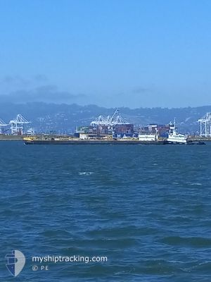
The vessel FISHING CREEK (IMO: 9681297, MMSI: 368173000) is a Towing It's sailing under the flag of [US] USA.
In this page you can find informations about the vessels current position, last detected port calls, and current voyage information. If the vessels is not in coverage by AIS you will find the latest position.
The current position of FISHING CREEK is detected by our AIS receivers and we are not responsible for the reliability of the data. The last position was recorded while the vessel was in Coverage by the Ais receivers of our vessel tracking app.
The current draught of FISHING CREEK as reported by AIS is 4 meters
Weather
| Temperature | 7.3°C / 45.14°F |
|---|---|
| Wind Speed | 8 knots |
| Direction | 130° SE |
| Pressure | 1010.7 hPa |
| Humidity | 92.9 % |
| Cloud Coverage | 100 % |
Featured Company
Last Port Calls
| Port | Arrival | Departure | Time In Port |
|---|---|---|---|
| 2025-03-14 15:52 | |||
| 2025-03-11 15:17 | 2025-03-13 23:34 | 2 d | |
| 2025-03-06 00:07 | 2025-03-11 09:46 | 5 d | |
| 2025-02-28 10:26 | 2025-03-05 11:43 | 5 d | |
| 2025-02-22 17:44 | 2025-02-26 16:00 | 3 d | |
| 2025-02-17 19:54 | 2025-02-21 10:57 | 3 d | |
| 2025-02-12 15:47 | 2025-02-14 05:12 | 1 d | |
| 2025-01-29 15:29 | 2025-01-31 07:24 | 1 d | |
| 2025-01-12 08:50 | 2025-01-22 21:09 | 10 d | |
| 2025-01-04 09:53 | 2025-01-10 16:16 | 6 d |
Most Visited Ports (Last year)
| Port | Arrivals | |
|---|---|---|
| 32 | ||
| 7 | ||
| 3 | ||
| 3 | ||
| 2 | ||
| 1 |
Last Trips
| Origin | Departure | Destination | Arrival | Distance | |
|---|---|---|---|---|---|
| 2025-03-13 23:34 | 2025-03-14 15:52 | 77.26 nm | |||
| 2025-03-11 09:46 | 2025-03-11 15:17 | 44.90 nm | |||
| 2025-03-05 11:43 | 2025-03-06 00:07 | 3.79 nm | |||
| 2025-02-26 16:00 | 2025-02-28 10:26 | 70.05 nm | |||
| 2025-02-21 10:57 | 2025-02-22 17:44 | 69.32 nm | |||
| 2025-02-14 05:12 | 2025-02-17 19:54 | 89.32 nm | |||
| 2025-01-31 07:24 | 2025-02-12 15:47 | 101.26 nm | |||
| 2025-01-22 21:09 | 2025-01-29 15:29 | 137.74 nm | |||
| 2025-01-10 16:16 | 2025-01-12 08:50 | 23.56 nm | |||
| 2025-01-04 09:30 | 2025-01-04 09:53 | 2.78 nm |
Events
| Tid | Event | Detaljer | Position / Dest | Information |
|---|---|---|---|---|
| 2025-03-14 23:15 | Status ändrad | Default Under way using engine |
37.95006 / -121.32562
[US] STOCKTON
|
Fart: 14.4 kn Kurs: 160.5° |
| 2025-03-14 22:52 | ANLÄNDER HAMN |
|
37.95006 / -121.32562
[US] STOCKTON
|
Fart: 14.4 kn Kurs: 160.5° |
| 2025-03-14 22:22 | UTANFÖR täckningsområde |
38.01188 / -121.45777
North Pacific Ocean
[US] STOCKTON
|
Fart: 14.4 kn Kurs: 160.5° |
|
| 2025-03-14 20:27 | Djupgående ändrat | 4 0 |
38.08742 / -121.57436
STOCKTON 8
|
Fart: 15.3 kn Kurs: 184.4° |
| 2025-03-14 19:58 | Djupgående ändrat | 0 3.7 |
38.08730 / -121.63755
|
Fart: 14.7 kn Kurs: 86.2° |
| 2025-03-14 19:57 | Status ändrad | Under way using engine Default |
38.08730 / -121.63755
ANCHORAGE 26
|
Fart: 7.5 kn Kurs: 74° |
| 2025-03-14 19:40 | I täckningsområde |
38.08730 / -121.63755
North Pacific Ocean
|
Fart: 14.7 kn Kurs: 86.2° |
|
| 2025-03-14 14:09 | UTANFÖR täckningsområde |
38.06018 / -122.10907
North Pacific Ocean
|
Fart: Kurs: 228° |
|
| 2025-03-14 13:38 | I täckningsområde |
38.06044 / -122.10899
North Pacific Ocean
|
Fart: Kurs: 249° |
|
| 2025-03-14 10:30 | STOPPAR förflyttning | 1.66 nm, North East of BENICIA |
38.06010 / -122.10999
ANCHORAGE 26
|
Fart: Kurs: 206° |