
FISHING CREEK
Towing
Current Trip
| Time Travelled | 8 days |
|---|---|
| Remaining Time | --- |
| Distance Travelled | 50.80 nm |
| Remaining Distance | --- |
| AVG Speed | 11.3 Knots |
| MAX Speed | 15 Knots |
| AVG Wind | 4.7 knots |
| MAX Wind | 15.7 knots |
| MIN Temp | 5.2°C / 41.36°F |
| MAX Temp | 14.7°C / 58.46°F |
| Dybgang | 4 m |
| Position Modtaget | 8 d siden |
Current Position
| Longitude | -121.59590° |
|---|---|
| Latitude | 38.10055° |
| Status | Under way using engine |
| Fart | 15 Knots |
| Kurs | 290.1° |
| Område | North Pacific Ocean |
| Station | T-AIS |
| Position Modtaget | 8 d siden |
Info
Information
The current position of FISHING CREEK is in North Pacific Ocean with coordinates 38.10055° / -121.59590° as reported on 2025-01-31 18:48 by AIS to our vessel tracker app. The vessel's current speed is 15 Knots and is heading at the port of ANCHORAGE.
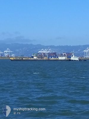
The vessel FISHING CREEK (IMO: 9681297, MMSI: 368173000) is a Towing It's sailing under the flag of [US] USA.
In this page you can find informations about the vessels current position, last detected port calls, and current voyage information. If the vessels is not in coverage by AIS you will find the latest position.
The current position of FISHING CREEK is detected by our AIS receivers and we are not responsible for the reliability of the data. The last position was recorded while the vessel was in Coverage by the Ais receivers of our vessel tracking app.
The current draught of FISHING CREEK as reported by AIS is 4 meters
Weather
| Temperature | 6.2°C / 43.16°F |
|---|---|
| Wind Speed | 1 knots |
| Direction | 280° W |
| Pressure | 1024.9 hPa |
| Humidity | 68.5 % |
| Cloud Coverage | --- |
Featured Company
Last Port Calls
| Port | Arrival | Departure | Time In Port |
|---|---|---|---|
| 2025-01-29 15:29 | 2025-01-31 07:24 | 1 d | |
| 2025-01-12 08:50 | 2025-01-22 21:09 | 10 d | |
| 2025-01-04 09:53 | 2025-01-10 16:16 | 6 d | |
| 2025-01-04 06:15 | 2025-01-04 09:30 | 3 h | |
| 2025-01-03 03:13 | 2025-01-04 05:41 | 1 d | |
| 2024-12-24 05:26 | 2025-01-01 10:30 | 8 d | |
| 2024-12-19 11:45 | 2024-12-22 19:56 | 3 d | |
| 2024-12-18 09:50 | |||
| 2024-12-11 22:11 | 2024-12-15 21:25 | 3 d | |
| 2024-12-02 14:58 |
Most Visited Ports (Last year)
| Port | Arrivals | |
|---|---|---|
| 29 | ||
| 5 | ||
| 3 | ||
| 3 | ||
| 2 | ||
| 1 |
Last Trips
| Origin | Departure | Destination | Arrival | Distance | |
|---|---|---|---|---|---|
| 2025-01-22 21:09 | 2025-01-29 15:29 | 137.74 nm | |||
| 2025-01-10 16:16 | 2025-01-12 08:50 | 23.56 nm | |||
| 2025-01-04 09:30 | 2025-01-04 09:53 | 2.78 nm | |||
| 2025-01-04 05:41 | 2025-01-04 06:15 | 2.57 nm | |||
| 2025-01-01 10:30 | 2025-01-03 03:13 | 63.55 nm | |||
| 2024-12-22 19:56 | 2024-12-24 05:26 | 24.70 nm | |||
| 2024-12-18 09:50 | 2024-12-19 11:45 | 75.43 nm | |||
| 2024-12-02 14:58 | 2024-12-11 22:11 | 139.35 nm |
Events
| Tid | Hændelsen | Detaljer | Position / Dest | Info |
|---|---|---|---|---|
| 2025-02-06 17:33 | STOP Sejllads | 1.07 nm, North East of BENICIA |
38.05249 / -122.11790
ANCHORAGE 26
|
Fart: Kurs: 42° |
| 2025-01-31 22:59 | STOP Sejllads | 1.33 nm, North East of BENICIA |
38.05568 / -122.11409
ANCHORAGE 26
|
Fart: 0.3 kn Kurs: 210° |
| 2025-01-31 19:07 | Status er ændret | Default Under way using engine |
38.03099 / -121.72966
ANCHORAGE 26
|
Fart: 15 kn Kurs: 290.1° |
| 2025-01-31 18:48 | Udenfor Dækning |
38.10055 / -121.59590
North Pacific Ocean
|
Fart: 15 kn Kurs: 290.1° |
|
| 2025-01-31 16:52 | Dybgangen er ændret | 4 0 |
38.03606 / -121.48714
ANCHORAGE 26
|
Fart: 13.2 kn Kurs: 306° |
| 2025-01-31 16:14 | Dybgangen er ændret | 0 4 |
37.99541 / -121.42293
|
Fart: 12.2 kn Kurs: 267.6° |
| 2025-01-31 16:13 | Status er ændret | Under way using engine Default |
37.99541 / -121.42293
STOCKTON 8
|
Fart: 6.3 kn Kurs: 286° |
| 2025-01-31 15:57 | Indenfor Dækning |
37.99541 / -121.42293
North Pacific Ocean
|
Fart: 12.2 kn Kurs: 267.6° |
|
| 2025-01-31 15:24 | Afsejlet fra sidste havn |
|
37.95211 / -121.33819
STOCKTON 8
|
Fart: 5.9 kn Kurs: 267° |