

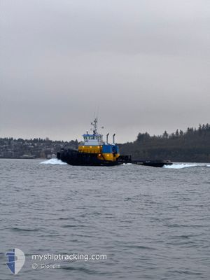
GULF TITAN
Towing > 200m OR Breadth > 25m

Current Trip
KETCHIKAN
| Time Travelled | 22 h, 38 mins |
|---|---|
| Remaining Time | --- |
| Distance Travelled | 164.14 nm |
| Remaining Distance | --- |
| AVG Speed | 9.6 Knop |
| MAX Speed | 12 Knop |
| AVG Wind | 7 knots |
| MAX Wind | 17 knots |
| MIN Temp | 3.1°C / 37.58°F |
| MAX Temp | 8°C / 46.4°F |
| Djupgående | 0 m |
| Position mottagen | 1 d sen |
Current Position
| Longitud | -130.91813° |
|---|---|
| Latitude | 54.76044° |
| Status | Towing Astern |
| Fart | 9.8 Knop |
| Kurs | 325.4° |
| Område | The Coastal Waters of Southeast Alaska and British Columbia |
| Station | T-AIS |
| Position mottagen | 1 d sen |
Information
The current position of GULF TITAN is in The Coastal Waters of Southeast Alaska and British Columbia with coordinates 54.76044° / -130.91813° as reported on 2025-04-05 12:55 by AIS to our vessel tracker app. The vessel's current speed is 9.8 Knop
The vessel GULF TITAN (IMO: 8967589, MMSI: 369514000) is a Towing > 200m OR Breadth > 25m It's sailing under the flag of [US] USA.
In this page you can find informations about the vessels current position, last detected port calls, and current voyage information. If the vessels is not in coverage by AIS you will find the latest position.
The current position of GULF TITAN is detected by our AIS receivers and we are not responsible for the reliability of the data. The last position was recorded while the vessel was in Coverage by the Ais receivers of our vessel tracking app.
Weather
| Temperature | 6.1°C / 42.98°F |
|---|---|
| Wind Speed | 6 knots |
| Direction | 194° SSW |
| Pressure | 1010.8 hPa |
| Humidity | 76.3 % |
| Cloud Coverage | 96 % |


Featured Company
Last Port Calls
| Port | Arrival | Departure | Time In Port |
|---|---|---|---|
| 2025-04-05 09:40 | 2025-04-05 16:12 | 6 h | |
| 2025-04-02 18:03 | 2025-04-02 18:47 | 44 m | |
| 2025-04-02 15:20 | 2025-04-02 15:45 | 25 m | |
| 2025-03-29 23:40 | 2025-04-02 14:47 | 3 d | |
| 2025-03-29 22:49 | 2025-03-29 23:11 | 22 m | |
| 2025-03-29 21:10 | 2025-03-29 22:07 | 56 m | |
| 2025-03-26 18:08 | 2025-03-26 21:28 | 3 h | |
| 2025-03-25 08:28 | 2025-03-25 14:00 | 5 h | |
| 2025-03-24 14:48 | 2025-03-24 18:04 | 3 h | |
| 2025-03-23 19:04 | 2025-03-24 02:12 | 7 h |
Last Trips
| Origin | Departure | Destination | Arrival | Distance | |
|---|---|---|---|---|---|
| 2025-04-02 18:47 | 2025-04-05 09:40 | 628.98 nm | |||
| 2025-04-02 15:45 | 2025-04-02 18:03 | 0.76 nm | |||
| 2025-04-02 14:47 | 2025-04-02 15:20 | 6.15 nm | |||
| 2025-03-29 23:11 | 2025-03-29 23:40 | 6.16 nm | |||
| 2025-03-29 22:07 | 2025-03-29 22:49 | 0.84 nm | |||
| 2025-03-26 21:28 | 2025-03-29 21:10 | 646.52 nm | |||
| 2025-03-25 14:00 | 2025-03-26 18:08 | 213.46 nm | |||
| 2025-03-24 18:04 | 2025-03-25 08:28 | 106.86 nm | |||
| 2025-03-24 02:12 | 2025-03-24 14:48 | 102.34 nm | |||
| 2025-03-22 14:36 | 2025-03-23 19:04 | 218.59 nm |
Events
| Tid | Event | Detaljer | Position / Dest | Information |
|---|---|---|---|---|
| 2025-04-06 17:08 | STARTAR förflyttning | 2.35 nm, South of PETERSBURG (AK) |
56.77403 / -132.96989
KETCHIKAN
|
Fart: 3.5 kn Kurs: 38° |
| 2025-04-06 12:04 | STOPPAR förflyttning | 2.28 nm, South of PETERSBURG (AK) |
56.77513 / -132.96719
KETCHIKAN
|
Fart: 0.2 kn Kurs: 339° |
| 2025-04-06 00:12 | AVGÅTT HAMN |
|
55.38462 / -131.75180
KETCHIKAN
|
Fart: 11.4 kn Kurs: 315° |
| 2025-04-05 23:36 | STARTAR förflyttning |
55.34730 / -131.68820
[US] KETCHIKAN
|
Fart: 4 kn Kurs: 306° |
|
| 2025-04-05 18:00 | STOPPAR förflyttning |
55.35180 / -131.68968
[US] KETCHIKAN
|
Fart: 0.3 kn Kurs: 291° |
|
| 2025-04-05 17:40 | ANLÄNDER HAMN |
|
55.33826 / -131.67488
[US] KETCHIKAN
|
Fart: 7.8 kn Kurs: 320° |
| 2025-04-05 12:56 | Status ändrad | Default Towing Astern |
54.76081 / -130.91859
KETCHIKAN
|
Fart: 9.8 kn Kurs: 325.4° |
| 2025-04-05 12:55 | UTANFÖR täckningsområde |
54.76044 / -130.91813
The Coastal Waters of Southeast Alaska and British Columbia
KETCHIKAN
|
Fart: 9.8 kn Kurs: 325.4° |
|
| 2025-04-05 12:25 | Byter havsområde | United States (Alaska) part of the The Coastal Waters of Southeast Alaska and British Columbia Canadian part of the The Coastal Waters of Southeast Alaska and British Columbia |
54.68991 / -130.82673
The Coastal Waters of Southeast Alaska and British Columbia
KETCHIKAN
|
Fart: 10.5 kn Kurs: 321° |
| 2025-04-05 06:08 | Status ändrad | Towing Astern Default |
53.77665 / -129.92103
KETCHIKAN
|
Fart: 10.5 kn Kurs: 315° |