

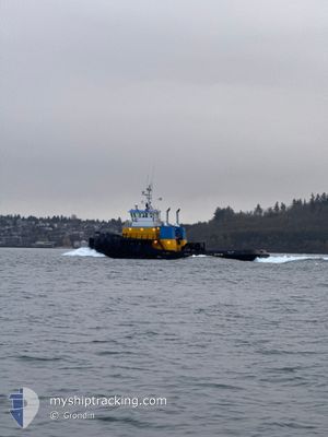
GULF TITAN
Towing > 200m OR Breadth > 25m

Current Trip
| Time Travelled | 2 days |
|---|---|
| Remaining Time | 26 mins |
| Distance Travelled | 645.25 nm |
| Remaining Distance | 8.36 nm |
| AVG Speed | 9 Noeuds |
| MAX Speed | 15.1 Noeuds |
| AVG Wind | 4.9 knots |
| MAX Wind | 20.2 knots |
| MIN Temp | -0.3°C / 31.46°F |
| MAX Temp | 12.4°C / 54.32°F |
| Tirant d eau | 0 m |
| Position reçue | 1 m depuis |
Current Position
| Longitude | -122.45380° |
|---|---|
| Latitude | 47.74790° |
| Etat | Under way using engine |
| Vitesse | 11.2 Noeuds |
| Parcours | 187.9° |
| Zone | The Coastal Waters of Southeast Alaska and British Columbia |
| Station | T-AIS |
| Position reçue | 1 m depuis |
Information
The current position of GULF TITAN is in The Coastal Waters of Southeast Alaska and British Columbia with coordinates 47.74790° / -122.45380° as reported on 2025-04-13 20:18 by AIS to our vessel tracker app. The vessel's current speed is 11.2 Noeuds and is heading at the port of SEATTLE. The estimated time of arrival as calculated by MyShipTracking vessel tracking app is 2025-04-13 13:46 LT
The vessel GULF TITAN (IMO: 8967589, MMSI: 369514000) is a Towing > 200m OR Breadth > 25m It's sailing under the flag of [US] USA.
In this page you can find informations about the vessels current position, last detected port calls, and current voyage information. If the vessels is not in coverage by AIS you will find the latest position.
The current position of GULF TITAN is detected by our AIS receivers and we are not responsible for the reliability of the data. The last position was recorded while the vessel was in Coverage by the Ais receivers of our vessel tracking app.
Weather
| Temperature | 12.4°C / 54.32°F |
|---|---|
| Wind Speed | 6 knots |
| Direction | 4° N |
| Pressure | 1028.4 hPa |
| Humidity | 49.9 % |
| Cloud Coverage | 61 % |


Featured Company
Last Port Calls
| Port | Arrival | Departure | Time In Port |
|---|---|---|---|
| 2025-04-10 10:08 | 2025-04-10 15:32 | 5 h | |
| 2025-04-08 06:48 | 2025-04-08 11:52 | 5 h | |
| 2025-04-07 14:56 | 2025-04-07 17:32 | 2 h | |
| 2025-04-06 20:08 | 2025-04-07 02:40 | 6 h | |
| 2025-04-05 09:40 | 2025-04-05 16:12 | 6 h | |
| 2025-04-02 18:03 | 2025-04-02 18:47 | 44 m | |
| 2025-04-02 15:20 | 2025-04-02 15:45 | 25 m | |
| 2025-03-29 23:40 | 2025-04-02 14:47 | 3 d | |
| 2025-03-29 22:49 | 2025-03-29 23:11 | 22 m | |
| 2025-03-29 21:10 | 2025-03-29 22:07 | 56 m |
Last Trips
| Origin | Departure | Destination | Arrival | Distance | |
|---|---|---|---|---|---|
| 2025-04-08 11:52 | 2025-04-10 10:08 | 218.90 nm | |||
| 2025-04-07 17:32 | 2025-04-08 06:48 | 106.07 nm | |||
| 2025-04-07 02:40 | 2025-04-07 14:56 | 102.41 nm | |||
| 2025-04-05 16:12 | 2025-04-06 20:08 | 218.46 nm | |||
| 2025-04-02 18:47 | 2025-04-05 09:40 | 628.98 nm | |||
| 2025-04-02 15:45 | 2025-04-02 18:03 | 0.76 nm | |||
| 2025-04-02 14:47 | 2025-04-02 15:20 | 6.15 nm | |||
| 2025-03-29 23:11 | 2025-03-29 23:40 | 6.16 nm | |||
| 2025-03-29 22:07 | 2025-03-29 22:49 | 0.84 nm | |||
| 2025-03-26 21:28 | 2025-03-29 21:10 | 646.52 nm |
Events
| Heure | Evenement | Détails | Position/ Destination | Info |
|---|---|---|---|---|
| 2025-04-13 19:26 | Changement d'ETA | 2025/04/13 15:00 |
47.89437 / -122.49426
SEATTLE
|
Vitesse: 9.7 kn Parcours: 168.5° |
| 2025-04-13 10:34 | Changement de zone | United States part of the The Coastal Waters of Southeast Alaska and British Columbia Canadian part of the The Coastal Waters of Southeast Alaska and British Columbia |
48.99909 / -123.30404
The Coastal Waters of Southeast Alaska and British Columbia
SEATTLE
|
Vitesse: 10 kn Parcours: 131.1° |
| 2025-04-13 05:20 | Etat Changé | Under way using engine Default |
49.55882 / -124.34830
SEATTLE
|
Vitesse: 9.9 kn Parcours: 115° |
| 2025-04-13 04:59 | Etat Changé | Default Under way using engine |
49.58503 / -124.42796
SEATTLE
|
Vitesse: 10 kn Parcours: 124.4° |
| 2025-04-13 02:01 | Démarrage | 16.12 nm, South East of DUNCAN BAY |
49.87891 / -125.00707
SEATTLE
|
Vitesse: 5.5 kn Parcours: 132.5° |
| 2025-04-13 01:59 | Arret | 15.99 nm, South East of DUNCAN BAY |
49.88061 / -125.00902
SEATTLE
|
Vitesse: 0.2 kn Parcours: 124° |
| 2025-04-12 22:18 | Etat Changé | Under way using engine Default |
50.27211 / -125.40431
SEATTLE
|
Vitesse: 6.4 kn Parcours: 139° |
| 2025-04-12 22:12 | Etat Changé | Default Under way using engine |
50.27951 / -125.41434
SEATTLE
|
Vitesse: 6.4 kn Parcours: 185.9° |
| 2025-04-12 20:45 | Etat Changé | Under way using engine Default |
50.34001 / -125.45270
SEATTLE
|
Vitesse: 8.4 kn Parcours: 101° |
| 2025-04-12 20:19 | Etat Changé | Default Under way using engine |
50.36176 / -125.54679
SEATTLE
|
Vitesse: 9 kn Parcours: 120.5° |