
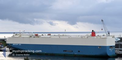
MERCURY ACE
Vehicles Carrier
Current Trip
ES SAG
| Time Travelled | 5 days |
|---|---|
| Remaining Time | --- |
| Distance Travelled | 994.47 nm |
| Remaining Distance | --- |
| AVG Speed | 12.8 Knop |
| MAX Speed | 17.7 Knop |
| AVG Wind | 14 knots |
| MAX Wind | 29 knots |
| MIN Temp | 11.6°C / 52.88°F |
| MAX Temp | 18°C / 64.4°F |
| Djupgående | 9.7 m |
| Position mottagen | 2 h, 38 m sen |
Current Position
| Longitud | -9.86342° |
|---|---|
| Latitude | 40.03596° |
| Status | Under way using engine |
| Fart | 17 Knop |
| Kurs | 0.1° |
| Område | North Atlantic Ocean |
| Station | T-AIS |
| Position mottagen | 2 h, 38 m sen |
Info
Information
The current position of MERCURY ACE is in North Atlantic Ocean with coordinates 40.03596° / -9.86342° as reported on 2025-03-12 06:52 by AIS to our vessel tracker app. The vessel's current speed is 17 Knop
The vessel MERCURY ACE (IMO: 9591052, MMSI: 370644000) is a Vehicles Carrier that was built in 2011 ( 14 År gammal ). It's sailing under the flag of [PA] Panama.
In this page you can find informations about the vessels current position, last detected port calls, and current voyage information. If the vessels is not in coverage by AIS you will find the latest position.
The current position of MERCURY ACE is detected by our AIS receivers and we are not responsible for the reliability of the data. The last position was recorded while the vessel was in Coverage by the Ais receivers of our vessel tracking app.
The current draught of MERCURY ACE as reported by AIS is 9.7 meters
Weather
| Temperature | 13.2°C / 55.76°F |
|---|---|
| Wind Speed | 4 knots |
| Direction | 230° SW |
| Pressure | 1006.5 hPa |
| Humidity | 75.3 % |
| Cloud Coverage | 100 % |
Featured Company
Last Port Calls
| Port | Arrival | Departure | Time In Port |
|---|---|---|---|
| 2025-03-06 17:57 | 2025-03-07 03:44 | 9 h | |
| 2025-01-30 05:50 | 2025-01-31 12:17 | 1 d | |
| 2025-01-28 06:03 | 2025-01-29 17:10 | 1 d | |
| 2025-01-11 05:01 | 2025-01-11 15:54 | 10 h | |
| 2025-01-09 09:07 | 2025-01-09 17:32 | 8 h | |
| 2025-01-05 16:33 | 2025-01-06 04:40 | 12 h | |
| 2025-01-04 11:18 | 2025-01-04 23:27 | 12 h |
Last Trips
| Origin | Departure | Destination | Arrival | Distance | |
|---|---|---|---|---|---|
| 2025-01-31 12:17 | 2025-03-06 17:57 | 13753.28 nm | |||
| 2025-01-29 17:10 | 2025-01-30 05:50 | 120.94 nm | |||
| 2025-01-11 15:54 | 2025-01-28 06:03 | 6297.66 nm | |||
| 2025-01-09 17:32 | 2025-01-11 05:01 | 420.20 nm | |||
| 2025-01-06 04:40 | 2025-01-09 09:07 | 905.21 nm | |||
| 2025-01-04 23:27 | 2025-01-05 16:33 | 219.56 nm | |||
| 2024-12-20 14:43 | 2025-01-04 11:18 | 5718.94 nm |
Events
| Tid | Event | Detaljer | Position / Dest | Information |
|---|---|---|---|---|
| 2025-03-12 08:08 | Djupgående ändrat | 9.7 9.3 |
40.29697 / -9.85662
ES SAG
|
Fart: 17.1 kn Kurs: 4° |
| 2025-03-12 08:08 | Destination ändrad | ES SAG GB BRS |
40.29697 / -9.85662
ES SAG
|
Fart: 17.1 kn Kurs: 4° |
| 2025-03-12 08:08 | ETA ändrat | 2025/03/06 08:00 2025/03/14 04:00 |
40.29697 / -9.85662
ES SAG
|
Fart: 17.1 kn Kurs: 4° |
| 2025-03-12 06:59 | Status ändrad | Default Under way using engine |
40.07279 / -9.86260
GB BRS
|
Fart: 17 kn Kurs: 0.1° |
| 2025-03-12 06:52 | UTANFÖR täckningsområde |
40.03596 / -9.86342
North Atlantic Ocean
GB BRS
|
Fart: 17 kn Kurs: 0.1° |
|
| 2025-03-12 06:50 | Status ändrad | Under way using engine Default |
40.03018 / -9.86359
GB BRS
|
Fart: 17.4 kn Kurs: 1° |
| 2025-03-12 06:44 | Status ändrad | Default Under way using engine |
39.99780 / -9.86461
GB BRS
|
Fart: 16.6 kn Kurs: 2.2° |
| 2025-03-12 06:38 | Status ändrad | Under way using engine Default |
39.97208 / -9.86595
GB BRS
|
Fart: 17 kn Kurs: 3° |
| 2025-03-12 06:12 | Status ändrad | Default Under way using engine |
39.84486 / -9.87121
GB BRS
|
Fart: 17.5 kn Kurs: 359° |
| 2025-03-11 21:30 | Status ändrad | Under way using engine Default |
37.42669 / -9.49691
GB BRS
|
Fart: 16 kn Kurs: 348° |