

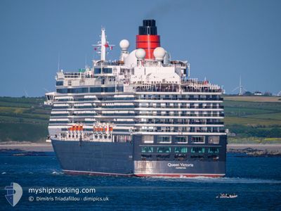
QUEEN VICTORIA
Passengers Ship

Current Trip
| Time Travelled | 18 h, 1 mins |
|---|---|
| Remaining Time | 14 h, 16 mins |
| Distance Travelled | 304.07 nm |
| Remaining Distance | 230.34 nm |
| AVG Speed | 16 Knop |
| MAX Speed | 20.6 Knop |
| AVG Wind | 16 knots |
| MAX Wind | 21 knots |
| MIN Temp | 6.7°C / 44.06°F |
| MAX Temp | 9.6°C / 49.28°F |
| Djupgående | 8 m |
| Position mottagen | 1 m sen |
Current Position
| Longitud | 4.39238° |
|---|---|
| Latitude | 53.04668° |
| Status | Under way using engine |
| Fart | 16.1 Knop |
| Kurs | 31° |
| Område | North Sea |
| Station | T-AIS |
| Position mottagen | 1 m sen |
Information
The current position of QUEEN VICTORIA is in North Sea with coordinates 53.04668° / 4.39238° as reported on 2025-03-29 11:11 by AIS to our vessel tracker app. The vessel's current speed is 16.1 Knop and is heading at the port of HAMBURG. The estimated time of arrival as calculated by MyShipTracking vessel tracking app is 2025-03-30 01:28 LT
The vessel QUEEN VICTORIA (IMO: 9320556, MMSI: 310624000) is a Passengers Ship that was built in 2007 ( 18 År gammal ). It's sailing under the flag of [BM] Bermuda.
In this page you can find informations about the vessels current position, last detected port calls, and current voyage information. If the vessels is not in coverage by AIS you will find the latest position.
The current position of QUEEN VICTORIA is detected by our AIS receivers and we are not responsible for the reliability of the data. The last position was recorded while the vessel was in Coverage by the Ais receivers of our vessel tracking app.
The current draught of QUEEN VICTORIA as reported by AIS is 8 meters
Weather
| Temperature | 7.2°C / 44.96°F |
|---|---|
| Wind Speed | 10 knots |
| Direction | 277° W |
| Pressure | 1020.5 hPa |
| Humidity | 87.2 % |
| Cloud Coverage | 2 % |


Featured Company
Last Port Calls
| Port | Arrival | Departure | Time In Port |
|---|---|---|---|
| 2025-03-28 04:29 | 2025-03-28 17:11 | 12 h | |
| 2025-03-15 08:56 | 2025-03-15 23:43 | 14 h | |
| 2025-03-14 09:28 | 2025-03-15 01:32 | 16 h | |
| 2025-03-13 11:22 | 2025-03-13 21:15 | 9 h | |
| 2025-03-02 12:10 | 2025-03-03 23:26 | 1 d | |
| 2025-02-28 10:34 | 2025-02-28 20:02 | 9 h | |
| 2025-02-25 09:14 | 2025-02-25 21:40 | 12 h | |
| 2025-02-17 10:38 | 2025-02-17 20:19 | 9 h | |
| 2025-02-14 10:27 | 2025-02-14 21:12 | 10 h | |
| 2025-02-10 10:22 | 2025-02-12 00:36 | 1 d |
Most Visited Ports (Last year)
| Port | Arrivals | |
|---|---|---|
| 14 | ||
| 10 | ||
| 6 | ||
| 6 | ||
| 6 | ||
| 6 |
Last Trips
| Origin | Departure | Destination | Arrival | Distance | |
|---|---|---|---|---|---|
| 2025-03-15 19:43 | 2025-03-28 04:29 | 4168.24 nm | |||
| 2025-03-14 21:32 | 2025-03-15 04:56 | 79.99 nm | |||
| 2025-03-13 17:15 | 2025-03-14 05:28 | 184.85 nm | |||
| 2025-03-03 18:26 | 2025-03-13 07:22 | 3611.33 nm | |||
| 2025-02-28 17:02 | 2025-03-02 07:10 | 592.94 nm | |||
| 2025-02-25 18:40 | 2025-02-28 07:34 | 937.00 nm | |||
| 2025-02-17 17:19 | 2025-02-25 06:14 | 2266.15 nm | |||
| 2025-02-14 18:12 | 2025-02-17 07:38 | 876.12 nm | |||
| 2025-02-11 21:36 | 2025-02-14 07:27 | 832.65 nm | |||
| 2025-02-09 17:18 | 2025-02-10 07:22 | 150.32 nm |
Events
| Tid | Event | Detaljer | Position / Dest | Information |
|---|---|---|---|---|
| 2025-03-29 10:17 | Status ändrad | Under way using engine Default |
52.83497 / 4.20690
DEHAM
|
Fart: 15.9 kn Kurs: 41° |
| 2025-03-29 09:37 | Status ändrad | Default Under way using engine |
52.70869 / 4.00995
DEHAM
|
Fart: 15.8 kn Kurs: 42.3° |
| 2025-03-29 08:33 | Status ändrad | Under way using engine Default |
52.49495 / 3.70867
DEHAM
|
Fart: 15.6 kn Kurs: 45° |
| 2025-03-29 08:27 | Status ändrad | Default Under way using engine |
52.47590 / 3.67759
DEHAM
|
Fart: 15.5 kn Kurs: 45.3° |
| 2025-03-29 07:22 | Status ändrad | Under way using engine Default |
52.27920 / 3.35341
DEHAM
|
Fart: 15.7 kn Kurs: 46° |
| 2025-03-29 06:56 | Status ändrad | Default Under way using engine |
52.20306 / 3.22501
DEHAM
|
Fart: 16 kn Kurs: 45.8° |
| 2025-03-29 06:49 | Status ändrad | Under way using engine Default |
52.18069 / 3.18724
DEHAM
|
Fart: 16 kn Kurs: 46° |
| 2025-03-29 06:44 | Status ändrad | Default Under way using engine |
52.16302 / 3.15752
DEHAM
|
Fart: 16.1 kn Kurs: 46° |
| 2025-03-29 05:01 | Byter havsområde | Dutch part of the North Sea Belgian part of the North Sea |
51.81122 / 2.65149
North Sea
DEHAM
|
Fart: 17.1 kn Kurs: 40.9° |
| 2025-03-29 03:46 | Byter havsområde | Belgian part of the North Sea French part of the North Sea |
51.54361 / 2.25373
North Sea
DEHAM
|
Fart: 18.1 kn Kurs: 41.4° |