

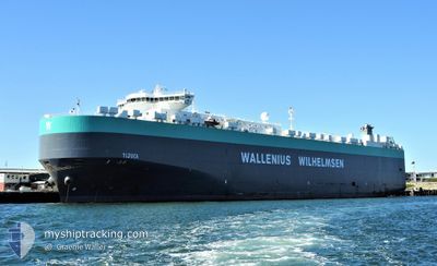
TIJUCA
Vehicles Carrier
Current Trip
| Time Travelled | 1 day |
|---|---|
| Remaining Time | --- |
| Distance Travelled | 163.81 nm |
| Remaining Distance | 510.08 nm |
| AVG Speed | 15.2 Knop |
| MAX Speed | 20.2 Knop |
| AVG Wind | 9 knots |
| MAX Wind | 21 knots |
| MIN Temp | 14.1°C / 57.38°F |
| MAX Temp | 19.5°C / 67.1°F |
| Djupgående | 9.2 m |
| Position mottagen | 1 d sen |
Current Position
| Longitud | -76.08692° |
|---|---|
| Latitude | 37.05978° |
| Status | Under way using engine |
| Fart | 16.1 Knop |
| Kurs | 143.3° |
| Område | North Atlantic Ocean |
| Station | T-AIS |
| Position mottagen | 1 d sen |
Information
The current position of TIJUCA is in North Atlantic Ocean with coordinates 37.05978° / -76.08692° as reported on 2025-05-28 11:46 by AIS to our vessel tracker app. The vessel's current speed is 16.1 Knop and is heading at the port of BRUNSWICK. The estimated time of arrival as calculated by MyShipTracking vessel tracking app is 2025-05-29 22:00 LT
The vessel TIJUCA (IMO: 9377511, MMSI: 259805000) is a Vehicles Carrier that was built in 2008 ( 17 År gammal ). It's sailing under the flag of [NO] Norway.
In this page you can find informations about the vessels current position, last detected port calls, and current voyage information. If the vessels is not in coverage by AIS you will find the latest position.
The current position of TIJUCA is detected by our AIS receivers and we are not responsible for the reliability of the data. The last position was recorded while the vessel was in Coverage by the Ais receivers of our vessel tracking app.
The current draught of TIJUCA as reported by AIS is 9.2 meters
Weather
| Temperature | 25°C / 77°F |
|---|---|
| Wind Speed | 8 knots |
| Direction | 246° WSW |
| Pressure | 1017.9 hPa |
| Humidity | 85 % |
| Cloud Coverage | 56 % |
Featured Company
Last Port Calls
| Port | Arrival | Departure | Time In Port |
|---|---|---|---|
| 2025-05-26 22:34 | 2025-05-27 23:41 | 1 d | |
| 2025-05-24 05:28 | 2025-05-26 22:30 | 2 d | |
| 2025-05-20 15:49 | 2025-05-21 13:17 | 21 h | |
| 2025-05-10 14:28 | 2025-05-11 11:04 | 20 h | |
| 2025-05-07 22:50 | 2025-05-10 01:39 | 2 d | |
| 2025-05-05 03:57 | 2025-05-07 00:34 | 1 d | |
| 2025-04-24 16:16 | 2025-04-25 02:04 | 9 h | |
| 2025-04-24 15:30 | 2025-04-24 15:35 | 4 m | |
| 2025-04-21 04:49 | 2025-04-23 01:38 | 1 d | |
| 2025-04-19 03:27 | 2025-04-19 19:33 | 16 h |
Most Visited Ports (Last year)
| Port | Arrivals | |
|---|---|---|
| 5 | ||
| 4 | ||
| 4 | ||
| 3 | ||
| 3 | ||
| 2 |
Last Trips
| Origin | Departure | Destination | Arrival | Distance | |
|---|---|---|---|---|---|
| 2025-05-26 22:30 | 2025-05-26 22:34 | 0.69 nm | |||
| 2025-05-21 13:17 | 2025-05-24 05:28 | 910.01 nm | |||
| 2025-05-11 11:04 | 2025-05-20 15:49 | 2924.95 nm | |||
| 2025-05-10 01:39 | 2025-05-10 14:28 | 204.78 nm | |||
| 2025-05-07 00:34 | 2025-05-07 22:50 | 330.84 nm | |||
| 2025-04-25 02:04 | 2025-05-05 03:57 | 3831.97 nm | |||
| 2025-04-24 15:35 | 2025-04-24 16:16 | 1.97 nm | |||
| 2025-04-23 01:38 | 2025-04-24 15:30 | 396.89 nm | |||
| 2025-04-19 19:33 | 2025-04-21 04:49 | 560.25 nm | |||
| 2025-04-18 17:13 | 2025-04-19 03:27 | 154.93 nm |
Events
| Tid | Event | Detaljer | Position / Dest | Information |
|---|---|---|---|---|
| 2025-05-28 11:53 | Status ändrad | Default Under way using engine |
37.03675 / -76.06470
US SSI
|
Fart: 16.1 kn Kurs: 143.3° |
| 2025-05-28 11:46 | UTANFÖR täckningsområde |
37.05978 / -76.08692
North Atlantic Ocean
US SSI
|
Fart: 16.1 kn Kurs: 143.3° |
|
| 2025-05-28 11:34 | ETA ändrat | 2025/05/30 02:00 2025/05/30 03:00 |
37.10725 / -76.12323
US SSI
|
Fart: 17.2 kn Kurs: 151.4° |
| 2025-05-28 11:22 | Status ändrad | Under way using engine Default |
37.16140 / -76.15169
US SSI
|
Fart: 18.3 kn Kurs: 172° |
| 2025-05-28 11:20 | I täckningsområde |
37.16140 / -76.15169
North Atlantic Ocean
US SSI
|
Fart: 18.4 kn Kurs: 173.9° |
|
| 2025-05-28 08:13 | Status ändrad | Default Under way using engine |
38.10265 / -76.22409
US SSI
|
Fart: 18.1 kn Kurs: 160.6° |
| 2025-05-28 07:37 | UTANFÖR täckningsområde |
38.27916 / -76.28315
North Atlantic Ocean
US SSI
|
Fart: 18.1 kn Kurs: 160.6° |
|
| 2025-05-28 06:33 | Status ändrad | Under way using engine Default |
38.57566 / -76.43498
US SSI
|
Fart: 18.8 kn Kurs: 166° |
| 2025-05-28 06:12 | Status ändrad | Default Under way using engine |
38.68483 / -76.42478
US SSI
|
Fart: 18.6 kn Kurs: 170.2° |
| 2025-05-28 05:37 | Djupgående ändrat | 9.2 9 |
38.86819 / -76.40127
US SSI
|
Fart: 19 kn Kurs: 189.3° |