

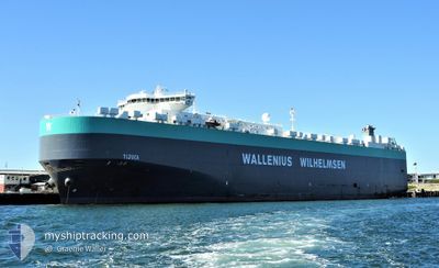
TIJUCA
Vehicles Carrier

Current Trip
| Time Travelled | 1 day |
|---|---|
| Remaining Time | 7 h, 47 mins |
| Distance Travelled | 14.99 nm |
| Remaining Distance | 758.77 nm |
| AVG Speed | 13.8 Knots |
| MAX Speed | 14.8 Knots |
| AVG Wind | 8.3 knots |
| MAX Wind | 8.9 knots |
| MIN Temp | 6.7°C / 44.06°F |
| MAX Temp | 8°C / 46.4°F |
| Draught | 9.8 m |
| Position Received | 1 d ago |
Current Position
| Longitude | -63.50667° |
|---|---|
| Latitude | 44.49537° |
| Status | Under way using engine |
| Speed | 13.7 Knots |
| Course | 163.8° |
| Area | North Atlantic Ocean |
| Station | T-AIS |
| Position Received | 1 d ago |
Information
The current position of TIJUCA is in North Atlantic Ocean with coordinates 44.49537° / -63.50667° as reported on 2025-05-21 16:48 by AIS to our vessel tracker app. The vessel's current speed is 13.7 Knots and is heading at the port of BALTIMORE. The estimated time of arrival as calculated by MyShipTracking vessel tracking app is 2025-05-23 19:53 LT
The vessel TIJUCA (IMO: 9377511, MMSI: 259805000) is a Vehicles Carrier that was built in 2008 ( 17 years old ). It's sailing under the flag of [NO] Norway.
In this page you can find informations about the vessels current position, last detected port calls, and current voyage information. If the vessels is not in coverage by AIS you will find the latest position.
The current position of TIJUCA is detected by our AIS receivers and we are not responsible for the reliability of the data. The last position was recorded while the vessel was in Coverage by the Ais receivers of our vessel tracking app.
The current draught of TIJUCA as reported by AIS is 9.8 meters
Weather
| Temperature | 14°C / 57.2°F |
|---|---|
| Wind Speed | 28 knots |
| Direction | 108° ESE |
| Pressure | 1005.8 hPa |
| Humidity | 91.6 % |
| Cloud Coverage | 100 % |


Featured Company
Last Port Calls
| Port | Arrival | Departure | Time In Port |
|---|---|---|---|
| 2025-05-20 18:49 | 2025-05-21 16:17 | 21 h | |
| 2025-05-10 13:28 | 2025-05-11 10:04 | 20 h | |
| 2025-05-07 20:50 | 2025-05-09 23:39 | 2 d | |
| 2025-05-05 01:57 | 2025-05-06 22:34 | 1 d | |
| 2025-04-24 20:16 | 2025-04-25 06:04 | 9 h | |
| 2025-04-24 19:30 | 2025-04-24 19:35 | 4 m | |
| 2025-04-21 08:49 | 2025-04-23 05:38 | 1 d | |
| 2025-04-19 07:27 | 2025-04-19 23:33 | 16 h | |
| 2025-04-17 04:16 | 2025-04-18 21:13 | 1 d | |
| 2025-04-15 02:18 | 2025-04-17 00:21 | 1 d |
Most Visited Ports (Last year)
| Port | Arrivals | |
|---|---|---|
| 5 | ||
| 4 | ||
| 3 | ||
| 3 | ||
| 3 | ||
| 2 |
Last Trips
| Origin | Departure | Destination | Arrival | Distance | |
|---|---|---|---|---|---|
| 2025-05-11 11:04 | 2025-05-20 15:49 | 2924.95 nm | |||
| 2025-05-10 01:39 | 2025-05-10 14:28 | 204.78 nm | |||
| 2025-05-07 00:34 | 2025-05-07 22:50 | 330.84 nm | |||
| 2025-04-25 02:04 | 2025-05-05 03:57 | 3831.97 nm | |||
| 2025-04-24 15:35 | 2025-04-24 16:16 | 1.97 nm | |||
| 2025-04-23 01:38 | 2025-04-24 15:30 | 396.89 nm | |||
| 2025-04-19 19:33 | 2025-04-21 04:49 | 560.25 nm | |||
| 2025-04-18 17:13 | 2025-04-19 03:27 | 154.93 nm | |||
| 2025-04-16 20:21 | 2025-04-17 00:16 | 13.61 nm | |||
| 2025-04-10 20:41 | 2025-04-14 22:18 | 1573.00 nm |
Events
| Time | Event | Details | Position / Dest | Info |
|---|---|---|---|---|
| 2025-05-21 16:56 | Status Changed | Default Under way using engine |
44.46215 / -63.49698
US BAL
|
Speed: 13.7 kn Course: 163.8° |
| 2025-05-21 16:48 | OUT of Coverage |
44.49537 / -63.50667
North Atlantic Ocean
US BAL
|
Speed: 13.7 kn Course: 163.8° |
|
| 2025-05-21 16:17 | PORT DEPARTURE |
|
44.60220 / -63.53972
US BAL
|
Speed: 15.3 kn Course: 159° |
| 2025-05-21 15:59 | START Moving |
44.62286 / -63.51908
[CA] HALIFAX
|
Speed: 6.1 kn Course: 294° |
|
| 2025-05-21 15:51 | Status Changed | Under way using engine Moored |
44.62083 / -63.51271
[CA] HALIFAX
|
Speed: Course: 310° |
| 2025-05-21 15:01 | Status Changed | Moored Default |
44.62083 / -63.51271
[CA] HALIFAX
|
Speed: Course: 311° |
| 2025-05-21 14:57 | Draught Changed | 9.8 9.7 |
44.62083 / -63.51271
[CA] HALIFAX
|
Speed: Course: 311° |
| 2025-05-21 14:55 | Status Changed | Default Moored |
44.62083 / -63.51271
[CA] HALIFAX
|
Speed: Course: 311° |
| 2025-05-21 14:01 | Status Changed | Moored Default |
44.62082 / -63.51271
[CA] HALIFAX
|
Speed: Course: 311° |
| 2025-05-21 13:52 | Status Changed | Default Moored |
44.62082 / -63.51271
[CA] HALIFAX
|
Speed: Course: 311° |