
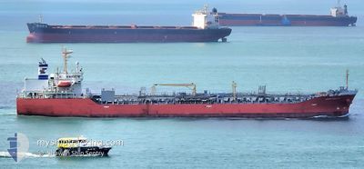
AMAGI GALAXY
Oil/Chemical Tanker
Current Trip
| Time Travelled | 23 days |
|---|---|
| Remaining Time | --- |
| Distance Travelled | 7209.91 nm |
| Remaining Distance | --- |
| AVG Speed | 12.8 Knots |
| MAX Speed | 15.4 Knots |
| AVG Wind | 10.3 knots |
| MAX Wind | 28 knots |
| MIN Temp | 14.3°C / 57.74°F |
| MAX Temp | 29.3°C / 84.74°F |
| Draught | 10 m |
| Position Received | 7 d ago |
Current Position
| Longitude | 22.27133° |
|---|---|
| Latitude | -35.07030° |
| Status | Under way using engine |
| Speed | 12.5 Knots |
| Course | 73° |
| Area | Indian Ocean |
| Station | T-AIS |
| Position Received | 7 d ago |
Info
Information
The current position of AMAGI GALAXY is in Indian Ocean with coordinates -35.07030° / 22.27133° as reported on 2025-02-04 04:14 by AIS to our vessel tracker app. The vessel's current speed is 12.5 Knots and is heading at the port of MAPUTO. The estimated time of arrival as calculated by MyShipTracking vessel tracking app is 2025-02-07 08:00 LT
The vessel AMAGI GALAXY (IMO: 9490313, MMSI: 538004105) is a Oil/Chemical Tanker that was built in 2010 ( 15 years old ). It's sailing under the flag of [MH] Marshall Is.
In this page you can find informations about the vessels current position, last detected port calls, and current voyage information. If the vessels is not in coverage by AIS you will find the latest position.
The current position of AMAGI GALAXY is detected by our AIS receivers and we are not responsible for the reliability of the data. The last position was recorded while the vessel was in Coverage by the Ais receivers of our vessel tracking app.
The current draught of AMAGI GALAXY as reported by AIS is 10 meters
Weather
| Temperature | 29.1°C / 84.38°F |
|---|---|
| Wind Speed | 8 knots |
| Direction | 283° WNW |
| Pressure | 1008.3 hPa |
| Humidity | 72.2 % |
| Cloud Coverage | 3 % |
Featured Company
Last Port Calls
| Port | Arrival | Departure | Time In Port |
|---|---|---|---|
| 2025-01-15 16:26 | 2025-01-18 18:47 | 3 d | |
| 2025-01-08 13:06 | 2025-01-10 10:23 | 1 d | |
| 2025-01-07 22:46 | 2025-01-08 12:39 | 13 h | |
| 2024-12-31 15:39 | 2025-01-07 09:26 | 6 d | |
| 2024-12-13 20:31 | 2024-12-14 19:00 | 22 h | |
| 2024-12-11 07:06 | 2024-12-12 02:54 | 19 h | |
| 2024-12-07 11:22 | 2024-12-10 20:39 | 3 d | |
| 2024-12-03 18:52 |
Most Visited Ports (Last year)
| Port | Arrivals | |
|---|---|---|
| 4 | ||
| 3 | ||
| 3 | ||
| 3 | ||
| 3 | ||
| 2 |
Last Trips
| Origin | Departure | Destination | Arrival | Distance | |
|---|---|---|---|---|---|
| 2025-01-10 11:23 | 2025-01-15 17:26 | 1584.05 nm | |||
| 2025-01-08 13:39 | 2025-01-08 14:06 | 1.23 nm | |||
| 2025-01-07 10:26 | 2025-01-07 23:46 | 112.34 nm | |||
| 2024-12-14 13:00 | 2024-12-31 16:39 | 5069.72 nm | |||
| 2024-12-11 20:54 | 2024-12-13 14:31 | 437.03 nm | |||
| 2024-12-10 14:39 | 2024-12-11 01:06 | 56.62 nm | |||
| 2024-12-03 13:52 | 2024-12-07 05:22 | 785.42 nm |
Events
| Time | Event | Details | Position / Dest | Info |
|---|---|---|---|---|
| 2025-02-07 20:28 | START Moving | 16.36 nm, East of MAPUTO |
-25.94188 / 32.86666
MZ MPM
|
Speed: 4.5 kn Course: 15° |
| 2025-02-07 10:00 | STOP Moving | 16.14 nm, East of MAPUTO |
-25.94798 / 32.86338
MZ MPM
|
Speed: 0.3 kn Course: 61° |
| 2025-02-04 04:18 | Status Changed | Default Under way using engine |
-35.06628 / 22.28882
MZ MPM
|
Speed: 12.5 kn Course: 73° |
| 2025-02-04 04:14 | Status Changed | Under way using engine Default |
-35.07030 / 22.27133
MZ MPM
|
Speed: 12.7 kn Course: 68° |
| 2025-02-04 04:14 | OUT of Coverage |
-35.07030 / 22.27133
Indian Ocean
MZ MPM
|
Speed: 12.5 kn Course: 73° |
|
| 2025-02-04 03:56 | Status Changed | Default Under way using engine |
-35.08655 / 22.19983
MZ MPM
|
Speed: 12.3 kn Course: 73° |
| 2025-02-04 03:54 | Status Changed | Under way using engine Default |
-35.08860 / 22.19088
MZ MPM
|
Speed: 12.7 kn Course: 81° |
| 2025-02-04 03:19 | Status Changed | Default Under way using engine |
-35.10190 / 22.03925
MZ MPM
|
Speed: 12.8 kn Course: 86° |
| 2025-02-04 03:15 | Status Changed | Under way using engine Default |
-35.10310 / 22.02143
MZ MPM
|
Speed: 12.5 kn Course: 96° |
| 2025-02-04 02:58 | IN Coverage |
-35.10310 / 22.02143
Indian Ocean
MZ MPM
|
Speed: 12.8 kn Course: 86° |