

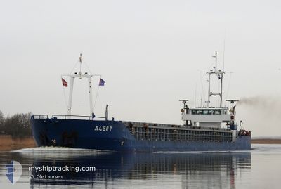
ANNE-S
General Cargo

Current Trip
| Time Travelled | 5 h, 48 mins |
|---|---|
| Remaining Time | 1 day |
| Distance Travelled | 38.32 nm |
| Remaining Distance | 199.72 nm |
| AVG Speed | 8.4 Knots |
| MAX Speed | 10 Knots |
| AVG Wind | 14.1 knots |
| MAX Wind | 18 knots |
| MIN Temp | 10.3°C / 50.54°F |
| MAX Temp | 11.9°C / 53.42°F |
| Draught | 3.2 m |
| Position Received | 1 h, 51 m ago |
Current Position
| Longitude | 3.66869° |
|---|---|
| Latitude | 52.10807° |
| Status | Under way using engine |
| Speed | 6.5 Knots |
| Course | 293.1° |
| Area | North Sea |
| Station | T-AIS |
| Position Received | 1 h, 51 m ago |
Information
The current position of ANNE-S is in North Sea with coordinates 52.10807° / 3.66869° as reported on 2025-05-22 21:17 by AIS to our vessel tracker app. The vessel's current speed is 6.5 Knots and is heading at the port of GOOLE. The estimated time of arrival as calculated by MyShipTracking vessel tracking app is 2025-05-24 02:42 LT
The vessel ANNE-S (IMO: 9213715, MMSI: 245921000) is a General Cargo that was built in 2000 ( 25 years old ). It's sailing under the flag of [NL] Netherlands.
In this page you can find informations about the vessels current position, last detected port calls, and current voyage information. If the vessels is not in coverage by AIS you will find the latest position.
The current position of ANNE-S is detected by our AIS receivers and we are not responsible for the reliability of the data. The last position was recorded while the vessel was in Coverage by the Ais receivers of our vessel tracking app.
The current draught of ANNE-S as reported by AIS is 3.2 meters
Weather
| Temperature | 10.3°C / 50.54°F |
|---|---|
| Wind Speed | 18 knots |
| Direction | 320° NW |
| Pressure | 1018.7 hPa |
| Humidity | 68.3 % |
| Cloud Coverage | 5 % |


Featured Company
Last Port Calls
| Port | Arrival | Departure | Time In Port |
|---|---|---|---|
| 2025-05-21 21:11 | 2025-05-22 19:20 | 22 h | |
| 2025-05-21 01:47 | 2025-05-21 18:56 | 17 h | |
| 2025-05-18 23:40 | 2025-05-19 22:41 | 23 h | |
| 2025-05-17 09:33 | 2025-05-17 12:14 | 2 h | |
| 2025-05-16 02:09 | 2025-05-16 19:02 | 16 h | |
| 2025-05-15 10:38 | 2025-05-15 10:50 | 11 m | |
| 2025-05-14 23:43 | 2025-05-15 00:38 | 54 m | |
| 2025-05-12 20:13 | 2025-05-13 18:17 | 22 h | |
| 2025-05-11 03:55 | 2025-05-11 04:56 | 1 h | |
| 2025-05-09 14:41 | 2025-05-10 13:47 | 23 h |
Most Visited Ports (Last year)
| Port | Arrivals | |
|---|---|---|
| 28 | ||
| 16 | ||
| 12 | ||
| 11 | ||
| 8 | ||
| 5 |
Last Trips
| Origin | Departure | Destination | Arrival | Distance | |
|---|---|---|---|---|---|
| 2025-05-21 18:56 | 2025-05-21 21:11 | 16.00 nm | |||
| 2025-05-19 22:41 | 2025-05-21 01:47 | 219.55 nm | |||
| 2025-05-17 12:14 | 2025-05-18 23:40 | 242.35 nm | |||
| 2025-05-16 19:02 | 2025-05-17 09:33 | 128.61 nm | |||
| 2025-05-15 10:50 | 2025-05-16 02:09 | 66.06 nm | |||
| 2025-05-15 00:38 | 2025-05-15 10:38 | 61.73 nm | |||
| 2025-05-13 18:17 | 2025-05-14 23:43 | 243.32 nm | |||
| 2025-05-11 04:56 | 2025-05-12 20:13 | 247.39 nm | |||
| 2025-05-10 13:47 | 2025-05-11 03:55 | 126.19 nm | |||
| 2025-05-08 22:21 | 2025-05-09 14:41 | 68.45 nm |
Events
| Time | Event | Details | Position / Dest | Info |
|---|---|---|---|---|
| 2025-05-22 21:21 | Status Changed | Default Under way using engine |
52.11075 / 3.65898
GBGOO
|
Speed: 6.5 kn Course: 293.1° |
| 2025-05-22 21:17 | Status Changed | Under way using engine Default |
52.10807 / 3.66869
GBGOO
|
Speed: 6.5 kn Course: 294° |
| 2025-05-22 21:17 | OUT of Coverage |
52.10807 / 3.66869
North Sea
GBGOO
|
Speed: 6.5 kn Course: 293.1° |
|
| 2025-05-22 21:13 | Status Changed | Default Under way using engine |
52.10506 / 3.67985
GBGOO
|
Speed: 6.3 kn Course: 289.3° |
| 2025-05-22 21:06 | Status Changed | Under way using engine Default |
52.10029 / 3.69796
GBGOO
|
Speed: 6.4 kn Course: 293° |
| 2025-05-22 20:58 | Status Changed | Default Under way using engine |
52.09432 / 3.71966
GBGOO
|
Speed: 6.8 kn Course: 297.6° |
| 2025-05-22 20:54 | Status Changed | Under way using engine Default |
52.09098 / 3.73060
GBGOO
|
Speed: 6.7 kn Course: 296° |
| 2025-05-22 20:49 | Status Changed | Default Under way using engine |
52.08655 / 3.74452
GBGOO
|
Speed: 6.3 kn Course: 298.5° |
| 2025-05-22 17:20 | PORT DEPARTURE |
|
51.90193 / 4.43309
GBGOO
|
Speed: 8.4 kn Course: 307° |
| 2025-05-22 17:11 | START Moving |
51.89347 / 4.45402
[NL] ROTTERDAM WAALHAVEN
|
Speed: 4.1 kn Course: 287° |