
AS NARA
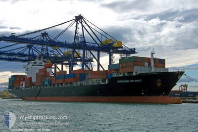
Container Ship
Current Trip
| Time Travelled | 1 day |
|---|---|
| Remaining Time | --- |
| Distance Travelled | 95.07 nm |
| Remaining Distance | --- |
| AVG Speed | 6.3 Knots |
| MAX Speed | 10.4 Knots |
| AVG Wind | 12.1 knots |
| MAX Wind | 15 knots |
| MIN Temp | 24.9°C / 76.82°F |
| MAX Temp | 27.6°C / 81.68°F |
| Draught | 12.1 m |
| Position Received | 1 d ago |
Current Position
| Longitude | 120.73627° |
|---|---|
| Latitude | 14.48454° |
| Status | Under way using engine |
| Speed | 7.4 Knots |
| Course | 248° |
| Area | South China Sea |
| Station | T-AIS |
| Position Received | 1 d ago |
Info
Information
The current position of AS NARA is in South China Sea with coordinates 14.48454° / 120.73627° as reported on 2025-02-06 09:08 by AIS to our vessel tracker app. The vessel's current speed is 7.4 Knots
The vessel AS NARA (IMO: 9353230, MMSI: 636091783) is a Container Ship that was built in 2009 ( 16 years old ). It's sailing under the flag of [LR] Liberia.
In this page you can find informations about the vessels current position, last detected port calls, and current voyage information. If the vessels is not in coverage by AIS you will find the latest position.
The current position of AS NARA is detected by our AIS receivers and we are not responsible for the reliability of the data. The last position was recorded while the vessel was in Coverage by the Ais receivers of our vessel tracking app.
The current draught of AS NARA as reported by AIS is 12.1 meters
Weather
| Temperature | 24.7°C / 76.46°F |
|---|---|
| Wind Speed | 12 knots |
| Direction | 64° ENE |
| Pressure | 1010.3 hPa |
| Humidity | 83.7 % |
| Cloud Coverage | 100 % |
Featured Company
Last Port Calls
| Port | Arrival | Departure | Time In Port |
|---|---|---|---|
| 2025-02-05 07:54 | 2025-02-06 15:17 | 1 d | |
| 2025-02-01 13:18 | 2025-02-02 01:19 | 12 h | |
| 2025-01-26 14:21 | 2025-01-27 05:11 | 14 h | |
| 2025-01-24 19:40 | 2025-01-25 20:25 | 1 d | |
| 2025-01-22 14:32 | 2025-01-23 07:32 | 17 h | |
| 2025-01-19 10:48 | 2025-01-20 12:45 | 1 d | |
| 2025-01-17 06:28 | 2025-01-18 00:08 | 17 h | |
| 2025-01-15 07:45 | 2025-01-15 18:45 | 11 h | |
| 2025-01-10 06:29 | 2025-01-10 20:01 | 13 h | |
| 2025-01-07 08:09 | 2025-01-08 06:37 | 22 h |
Most Visited Ports (Last year)
| Port | Arrivals | |
|---|---|---|
| 7 | ||
| 6 | ||
| 5 | ||
| 5 | ||
| 5 | ||
| 4 |
Last Trips
| Origin | Departure | Destination | Arrival | Distance | |
|---|---|---|---|---|---|
| 2025-02-02 01:19 | 2025-02-05 07:54 | 141.01 nm | |||
| 2025-01-27 05:11 | 2025-02-01 13:18 | 1333.32 nm | |||
| 2025-01-25 20:25 | 2025-01-26 14:21 | 126.47 nm | |||
| 2025-01-23 07:32 | 2025-01-24 19:40 | 607.55 nm | |||
| 2025-01-20 12:45 | 2025-01-22 14:32 | 249.53 nm | |||
| 2025-01-18 00:08 | 2025-01-19 10:48 | 262.81 nm | |||
| 2025-01-15 18:45 | 2025-01-17 06:28 | 622.00 nm | |||
| 2025-01-10 20:01 | 2025-01-15 07:45 | 1476.98 nm | |||
| 2025-01-08 06:37 | 2025-01-10 06:29 | 801.36 nm | |||
| 2025-01-02 19:05 | 2025-01-07 08:09 | 1075.54 nm |
Events
| Time | Event | Details | Position / Dest | Info |
|---|---|---|---|---|
| 2025-02-07 08:53 | STOP Moving | 1.03 nm, South West of GRANDE ISLAND |
14.80483 / 120.26400
PH BTG
|
Speed: Course: 129° |
| 2025-02-06 09:13 | Status Changed | Default Under way using engine |
14.48040 / 120.72564
PH BTG
|
Speed: 7.4 kn Course: 248° |
| 2025-02-06 09:08 | OUT of Coverage |
14.48454 / 120.73627
South China Sea
|
Speed: 7.4 kn Course: 248° |
|
| 2025-02-06 08:54 | Status Changed | Under way using engine Default |
14.49562 / 120.76345
PH BTG
|
Speed: 7.5 kn Course: 244° |
| 2025-02-06 08:53 | Status Changed | Default Under way using engine |
14.49700 / 120.76632
PH BTG
|
Speed: 7.4 kn Course: 244° |
| 2025-02-06 08:53 | Status Changed | Under way using engine Default |
14.49717 / 120.76667
PH BTG
|
Speed: 7.5 kn Course: 244° |
| 2025-02-06 08:05 | Status Changed | Default Under way using engine |
14.56008 / 120.84161
PH BTG
|
Speed: 7.6 kn Course: 225° |
| 2025-02-06 08:05 | Status Changed | Under way using engine Default |
14.56134 / 120.84288
PH BTG
|
Speed: 7.5 kn Course: 226° |
| 2025-02-06 07:53 | Status Changed | Default Under way using engine |
14.57702 / 120.86099
PH BTG
|
Speed: 7.6 kn Course: 230° |
| 2025-02-06 07:47 | Change Sea Area | Philippines part of the South China Sea Indonesian part of the Singapore Strait |
14.58539 / 120.87130
South China Sea
|
Speed: 7.6 kn Course: 230° |