
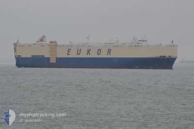
ASIAN VISION
Vehicles Carrier
Current Trip
| Time Travelled | 24 days |
|---|---|
| Remaining Time | 42 mins |
| Distance Travelled | 8705.72 nm |
| Remaining Distance | 13.25 nm |
| AVG Speed | 14.8 Knots |
| MAX Speed | 19.1 Knots |
| AVG Wind | 11.7 knots |
| MAX Wind | 27 knots |
| MIN Temp | 6.1°C / 42.98°F |
| MAX Temp | 29.6°C / 85.28°F |
| Draught | 9.1 m |
| Position Received | 5 m ago |
Current Position
| Longitude | -79.45233° |
|---|---|
| Latitude | 8.81297° |
| Status | Under way using engine |
| Speed | 12.6 Knots |
| Course | 317.6° |
| Area | North Pacific Ocean |
| Station | T-AIS |
| Position Received | 5 m ago |
Information
The current position of ASIAN VISION is in North Pacific Ocean with coordinates 8.81297° / -79.45233° as reported on 2025-06-06 16:56 by AIS to our vessel tracker app. The vessel's current speed is 12.6 Knots and is heading at the port of BALBOA. The estimated time of arrival as calculated by MyShipTracking vessel tracking app is 2025-06-06 17:44 LT
The vessel ASIAN VISION (IMO: 9122966, MMSI: 441992000) is a Vehicles Carrier that was built in 1997 ( 28 years old ). It's sailing under the flag of [KR] Korea.
In this page you can find informations about the vessels current position, last detected port calls, and current voyage information. If the vessels is not in coverage by AIS you will find the latest position.
The current position of ASIAN VISION is detected by our AIS receivers and we are not responsible for the reliability of the data. The last position was recorded while the vessel was in Coverage by the Ais receivers of our vessel tracking app.
The current draught of ASIAN VISION as reported by AIS is 9.1 meters
Weather
| Temperature | 26.1°C / 78.98°F |
|---|---|
| Wind Speed | 10 knots |
| Direction | 310° NW |
| Pressure | 1011.4 hPa |
| Humidity | 87.3 % |
| Cloud Coverage | 100 % |
Featured Company
Last Port Calls
| Port | Arrival | Departure | Time In Port |
|---|---|---|---|
| 2025-05-12 22:37 | 2025-05-13 08:32 | 9 h | |
| 2025-05-11 21:58 | 2025-05-12 05:01 | 7 h | |
| 2025-05-10 05:14 | 2025-05-10 15:06 | 9 h | |
| 2025-05-02 20:48 | 2025-05-04 02:36 | 1 d | |
| 2025-05-01 20:36 | 2025-05-02 11:05 | 14 h | |
| 2025-04-05 23:38 | 2025-04-29 01:10 | 23 d |
Most Visited Ports (Last year)
| Port | Arrivals | |
|---|---|---|
| 4 | ||
| 3 | ||
| 3 | ||
| 2 | ||
| 2 | ||
| 2 |
Last Trips
| Origin | Departure | Destination | Arrival | Distance | |
|---|---|---|---|---|---|
| 2025-05-12 14:01 | 2025-05-13 07:37 | 226.85 nm | |||
| 2025-05-11 00:06 | 2025-05-12 06:58 | 294.21 nm | |||
| 2025-05-04 11:36 | 2025-05-10 14:14 | 1423.72 nm | |||
| 2025-05-02 20:05 | 2025-05-03 05:48 | 132.69 nm | |||
| 2025-04-29 09:10 | 2025-05-02 05:36 | 608.98 nm | |||
| 2025-03-20 23:36 | 2025-04-06 07:38 | 5754.93 nm |
Events
| Time | Event | Details | Position / Dest | Info |
|---|---|---|---|---|
| 2025-06-06 16:56 | Status Changed | Under way using engine Default |
8.81297 / -79.45233
PA BLB
|
Speed: 13 kn Course: 329° |
| 2025-06-06 16:33 | Status Changed | Default Under way using engine |
8.74059 / -79.41119
PA BLB
|
Speed: 13.2 kn Course: 338.9° |
| 2025-06-06 16:01 | Change Sea Area | Panamanian part of the North Pacific Ocean United States (Hawaii) part of the North Pacific Ocean |
8.62575 / -79.38156
North Pacific Ocean
PA BLB
|
Speed: 13.5 kn Course: 347.1° |
| 2025-06-06 16:01 | Status Changed | Under way using engine Default |
8.62575 / -79.38156
PA BLB
|
Speed: 13.4 kn Course: 346° |
| 2025-06-06 15:44 | IN Coverage |
8.62575 / -79.38156
North Pacific Ocean
PA BLB
|
Speed: 13.5 kn Course: 347.1° |