

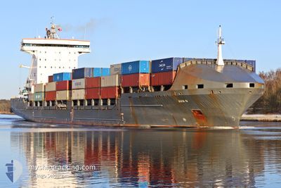
AVA D
Container Ship

Current Trip
| Time Travelled | 6 days |
|---|---|
| Remaining Time | 1 h, 40 mins |
| Distance Travelled | 1493.13 nm |
| Remaining Distance | 27.24 nm |
| AVG Speed | 10.3 Knots |
| MAX Speed | 17.4 Knots |
| AVG Wind | 5.6 knots |
| MAX Wind | 15.7 knots |
| MIN Temp | 4.7°C / 40.46°F |
| MAX Temp | 18.9°C / 66.02°F |
| Draught | 9 m |
| Position Received | 1 m ago |
Current Position
| Longitude | 2.62234° |
|---|---|
| Latitude | 51.47589° |
| Status | Under way using engine |
| Speed | 14.3 Knots |
| Course | 152.9° |
| Area | North Sea |
| Station | T-AIS |
| Position Received | 1 m ago |
Information
The current position of AVA D is in North Sea with coordinates 51.47589° / 2.62234° as reported on 2025-04-23 03:04 by AIS to our vessel tracker app. The vessel's current speed is 14.3 Knots and is heading at the port of ZEEBRUGGE. The estimated time of arrival as calculated by MyShipTracking vessel tracking app is 2025-04-23 06:45 LT
The vessel AVA D (IMO: 9306225, MMSI: 255705000) is a Container Ship that was built in 2007 ( 18 years old ). It's sailing under the flag of [PT] Portugal.
In this page you can find informations about the vessels current position, last detected port calls, and current voyage information. If the vessels is not in coverage by AIS you will find the latest position.
The current position of AVA D is detected by our AIS receivers and we are not responsible for the reliability of the data. The last position was recorded while the vessel was in Coverage by the Ais receivers of our vessel tracking app.
The current draught of AVA D as reported by AIS is 9 meters
Weather
| Temperature | 10°C / 50°F |
|---|---|
| Wind Speed | 12 knots |
| Direction | 159° SSE |
| Pressure | 1013.9 hPa |
| Humidity | 76.4 % |
| Cloud Coverage | 100 % |


Featured Company
Last Port Calls
| Port | Arrival | Departure | Time In Port |
|---|---|---|---|
| 2025-04-16 12:16 | 2025-04-16 12:20 | 3 m | |
| 2025-04-13 08:31 | 2025-04-15 06:55 | 1 d | |
| 2025-04-01 20:34 | 2025-04-01 20:38 | 3 m | |
| 2025-03-27 21:42 | 2025-03-31 07:25 | 3 d | |
| 2025-03-14 09:56 | 2025-03-14 21:12 | 11 h | |
| 2025-03-13 15:35 | 2025-03-14 09:44 | 18 h | |
| 2025-03-12 05:03 | 2025-03-13 15:22 | 1 d | |
| 2025-03-12 03:18 | 2025-03-12 03:29 | 11 m | |
| 2025-03-11 18:45 | 2025-03-12 03:16 | 8 h | |
| 2025-02-28 11:36 | 2025-02-28 17:57 | 6 h |
Most Visited Ports (Last year)
| Port | Arrivals | |
|---|---|---|
| 32 | ||
| 13 | ||
| 13 | ||
| 13 | ||
| 8 | ||
| 6 |
Last Trips
| Origin | Departure | Destination | Arrival | Distance | |
|---|---|---|---|---|---|
| 2025-04-15 06:55 | 2025-04-16 12:16 | 318.75 nm | |||
| 2025-04-01 20:38 | 2025-04-13 08:31 | 1966.02 nm | |||
| 2025-03-31 07:25 | 2025-04-01 20:34 | 319.19 nm | |||
| 2025-03-14 21:12 | 2025-03-27 21:42 | 2380.81 nm | |||
| 2025-03-14 09:44 | 2025-03-14 09:56 | 1.39 nm | |||
| 2025-03-13 15:22 | 2025-03-13 15:35 | 2.49 nm | |||
| 2025-03-12 03:29 | 2025-03-12 05:03 | 15.30 nm | |||
| 2025-03-12 03:16 | 2025-03-12 03:18 | 0.07 nm | |||
| 2025-02-28 17:57 | 2025-03-11 18:45 | 2080.26 nm | |||
| 2025-02-28 11:33 | 2025-02-28 11:36 | 0.34 nm |
Events
| Time | Event | Details | Position / Dest | Info |
|---|---|---|---|---|
| 2025-04-23 01:26 | Change Sea Area | Belgian part of the North Sea Dutch part of the North Sea |
51.82665 / 2.60112
North Sea
BEZEE VIA NOK
|
Speed: 12.4 kn Course: 185.7° |
| 2025-04-23 00:01 | Status Changed | Under way using engine Default |
52.05929 / 2.83600
BEZEE VIA NOK
|
Speed: 11.3 kn Course: 215° |
| 2025-04-22 23:56 | Status Changed | Default Under way using engine |
52.07120 / 2.85001
BEZEE VIA NOK
|
Speed: 11.2 kn Course: 215.1° |
| 2025-04-22 20:55 | Status Changed | Under way using engine Default |
52.49332 / 3.35787
BEZEE VIA NOK
|
Speed: 10.1 kn Course: 215° |
| 2025-04-22 20:54 | Status Changed | Default Under way using engine |
52.49480 / 3.35960
BEZEE VIA NOK
|
Speed: 10.1 kn Course: 215° |
| 2025-04-22 19:18 | Status Changed | Under way using engine Default |
52.71735 / 3.65121
BEZEE VIA NOK
|
Speed: 11.3 kn Course: 221° |
| 2025-04-22 18:30 | Status Changed | Default Under way using engine |
52.82970 / 3.81004
BEZEE VIA NOK
|
Speed: 11.7 kn Course: 222.1° |
| 2025-04-22 18:27 | Status Changed | Under way using engine Default |
52.83744 / 3.82121
BEZEE VIA NOK
|
Speed: 11.7 kn Course: 223° |
| 2025-04-22 18:15 | IN Coverage |
52.83744 / 3.82121
North Sea
BEZEE VIA NOK
|
Speed: 11.7 kn Course: 222.1° |
|
| 2025-04-22 15:10 | OUT of Coverage |
53.32847 / 4.52404
North Sea
BEZEE VIA NOK
|
Speed: 11.6 kn Course: 204.6° |