

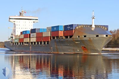
AVA D
Container Ship

Current Trip
| Time Travelled | 1 h, 33 mins |
|---|---|
| Remaining Time | 2 days |
| Distance Travelled | 19.01 nm |
| Remaining Distance | 671.43 nm |
| AVG Speed | 11.4 Knots |
| MAX Speed | 14.9 Knots |
| AVG Wind | 6.4 knots |
| MAX Wind | 7 knots |
| MIN Temp | 5.3°C / 41.54°F |
| MAX Temp | 6.8°C / 44.24°F |
| Dybgang | 8.6 m |
| Position Modtaget | 1 m siden |
Current Position
| Longitude | 10.57611° |
|---|---|
| Latitude | 54.55980° |
| Status | Under way using engine |
| Fart | 14.9 Knots |
| Kurs | 68.4° |
| Område | Baltic Sea |
| Station | T-AIS |
| Position Modtaget | 1 m siden |
Information
The current position of AVA D is in Baltic Sea with coordinates 54.55980° / 10.57611° as reported on 2025-04-01 20:10 by AIS to our vessel tracker app. The vessel's current speed is 14.9 Knots and is heading at the port of KOTKA. The estimated time of arrival as calculated by MyShipTracking vessel tracking app is 2025-04-04 05:37 LT
The vessel AVA D (IMO: 9306225, MMSI: 255705000) is a Container Ship that was built in 2007 ( 18 år gamle ). It's sailing under the flag of [PT] Portugal.
In this page you can find informations about the vessels current position, last detected port calls, and current voyage information. If the vessels is not in coverage by AIS you will find the latest position.
The current position of AVA D is detected by our AIS receivers and we are not responsible for the reliability of the data. The last position was recorded while the vessel was in Coverage by the Ais receivers of our vessel tracking app.
The current draught of AVA D as reported by AIS is 8.6 meters
Weather
| Temperature | 6.7°C / 44.06°F |
|---|---|
| Wind Speed | 5 knots |
| Direction | 67° ENE |
| Pressure | 1030.9 hPa |
| Humidity | 81.6 % |
| Cloud Coverage | --- |


Featured Company
Last Port Calls
| Port | Arrival | Departure | Time In Port |
|---|---|---|---|
| 2025-04-01 20:34 | 2025-04-01 20:38 | 3 m | |
| 2025-03-27 21:42 | 2025-03-31 07:25 | 3 d | |
| 2025-03-14 09:56 | 2025-03-14 21:12 | 11 h | |
| 2025-03-13 15:35 | 2025-03-14 09:44 | 18 h | |
| 2025-03-12 05:03 | 2025-03-13 15:22 | 1 d | |
| 2025-03-12 03:18 | 2025-03-12 03:29 | 11 m | |
| 2025-03-11 18:45 | 2025-03-12 03:16 | 8 h | |
| 2025-02-28 11:36 | 2025-02-28 17:57 | 6 h | |
| 2025-02-24 00:36 | 2025-02-28 11:33 | 4 d | |
| 2025-02-23 22:52 | 2025-02-23 23:06 | 14 m |
Most Visited Ports (Last year)
| Port | Arrivals | |
|---|---|---|
| 31 | ||
| 13 | ||
| 12 | ||
| 12 | ||
| 8 | ||
| 6 |
Last Trips
| Origin | Departure | Destination | Arrival | Distance | |
|---|---|---|---|---|---|
| 2025-03-31 07:25 | 2025-04-01 20:34 | 319.19 nm | |||
| 2025-03-14 21:12 | 2025-03-27 21:42 | 2380.81 nm | |||
| 2025-03-14 09:44 | 2025-03-14 09:56 | 1.39 nm | |||
| 2025-03-13 15:22 | 2025-03-13 15:35 | 2.49 nm | |||
| 2025-03-12 03:29 | 2025-03-12 05:03 | 15.30 nm | |||
| 2025-03-12 03:16 | 2025-03-12 03:18 | 0.07 nm | |||
| 2025-02-28 17:57 | 2025-03-11 18:45 | 2080.26 nm | |||
| 2025-02-28 11:33 | 2025-02-28 11:36 | 0.34 nm | |||
| 2025-02-23 23:06 | 2025-02-24 00:36 | 15.45 nm | |||
| 2025-02-23 22:50 | 2025-02-23 22:52 | 0.03 nm |
Events
| Tid | Hændelsen | Detaljer | Position / Dest | Info |
|---|---|---|---|---|
| 2025-04-01 19:34 | ETA er ændret | 2025/04/03 17:00 2025/04/03 20:00 |
54.50169 / 10.36044
KOTKA VIA KIEL
|
Fart: 12.7 kn Kurs: 64° |
| 2025-04-01 19:14 | Ændre havområde | German part of the Baltic Sea German part of the North Sea |
54.47071 / 10.26317
Baltic Sea
KOTKA VIA KIEL
|
Fart: 13.5 kn Kurs: 28.1° |
| 2025-04-01 18:38 | Afsejlet fra sidste havn |
|
54.36418 / 10.16888
KOTKA VIA KIEL
|
Fart: 9.6 kn Kurs: 59° |
| 2025-04-01 18:34 | Skibe i havn |
|
54.36393 / 10.15272
[DE] KIEL
|
Fart: 8.1 kn Kurs: 101.6° |
| 2025-04-01 18:31 | START Sejllads | 1.37 nm, South West of STICKENHΟRN SPORT |
54.36525 / 10.14332
KOTKA VIA KIEL
|
Fart: 3.1 kn Kurs: 103° |
| 2025-04-01 18:05 | STOP Sejllads | 1.42 nm, South West of STICKENHΟRN SPORT |
54.36579 / 10.14000
KOTKA VIA KIEL
|
Fart: 0.2 kn Kurs: 104° |
| 2025-04-01 10:39 | START Sejllads | 1.99 nm, North East of OSTERMOOR |
53.94340 / 9.22680
KOTKA VIA KIEL
|
Fart: 3.2 kn Kurs: 36° |
| 2025-04-01 09:21 | STOP Sejllads | 1.8 nm, North East of OSTERMOOR |
53.94107 / 9.22332
KOTKA VIA KIEL
|
Fart: 0.2 kn Kurs: 42° |
| 2025-04-01 08:24 | START Sejllads | 0.52 nm, South West of BRUNSBUETTEL |
53.89673 / 9.14969
KOTKA VIA KIEL
|
Fart: 3.1 kn Kurs: 53° |
| 2025-04-01 07:23 | STOP Sejllads | 0.77 nm, South West of BRUNSBUETTEL |
53.89385 / 9.14450
KOTKA VIA KIEL
|
Fart: 0.3 kn Kurs: 48° |