
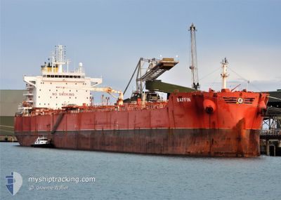
BAFFIN
Cargo
Current Trip
| Time Travelled | 2 days |
|---|---|
| Remaining Time | 5 mins |
| Distance Travelled | 378.24 nm |
| Remaining Distance | 8.82 nm |
| AVG Speed | 6.9 Knots |
| MAX Speed | 13.6 Knots |
| AVG Wind | 15.9 knots |
| MAX Wind | 22.4 knots |
| MIN Temp | 19.6°C / 67.28°F |
| MAX Temp | 24.1°C / 75.38°F |
| Draught | 9 m |
| Position Received | 4 m ago |
Current Position
| Longitude | 114.50905° |
|---|---|
| Latitude | -28.66464° |
| Status | At anchor |
| Speed | 0.4 Knots |
| Course | 205° |
| Area | Indian Ocean |
| Station | T-AIS |
| Position Received | 4 m ago |
Info
Information
The current position of BAFFIN is in Indian Ocean with coordinates -28.66464° / 114.50905° as reported on 2025-02-21 02:58 by AIS to our vessel tracker app. The vessel's current speed is 0.4 Knots and is heading at the port of GERALDTON. The estimated time of arrival as calculated by MyShipTracking vessel tracking app is 2025-02-21 11:08 LT
The vessel BAFFIN (IMO: 9739496, MMSI: 538007098) is a Cargo It's sailing under the flag of [MH] Marshall Is.
In this page you can find informations about the vessels current position, last detected port calls, and current voyage information. If the vessels is not in coverage by AIS you will find the latest position.
The current position of BAFFIN is detected by our AIS receivers and we are not responsible for the reliability of the data. The last position was recorded while the vessel was in Coverage by the Ais receivers of our vessel tracking app.
The current draught of BAFFIN as reported by AIS is 9 meters
Weather
| Temperature | 22.9°C / 73.22°F |
|---|---|
| Wind Speed | 16 knots |
| Direction | 179° S |
| Pressure | 1015.9 hPa |
| Humidity | 68.9 % |
| Cloud Coverage | --- |
Featured Company
Last Trips
| Origin | Departure | Destination | Arrival | Distance | |
|---|---|---|---|---|---|
| 2025-01-25 00:49 | 2025-02-17 11:24 | 4770.81 nm | |||
| 2025-01-18 11:25 | 2025-01-24 02:23 | 1376.64 nm | |||
| 2025-01-02 04:04 | 2025-01-16 13:37 | 4031.81 nm | |||
| 2024-12-29 11:30 | 2024-12-31 11:50 | 549.20 nm |
Events
| Time | Event | Details | Position / Dest | Info |
|---|---|---|---|---|
| 2025-02-21 01:58 | STOP Moving | 7.89 nm, North West of GERALDTON |
-28.66465 / 114.50909
AUGET
|
Speed: 0.3 kn Course: 199° |
| 2025-02-21 01:40 | Status Changed | At anchor Under way using engine |
-28.66668 / 114.50936
AUGET
|
Speed: 0.7 kn Course: 220° |
| 2025-02-20 23:34 | ETA Changed | 2025/02/21 01:00 2025/02/20 07:00 |
-28.83103 / 114.33801
AUGET
|
Speed: 7.8 kn Course: 33.8° |
| 2025-02-20 22:45 | Status Changed | Under way using engine Default |
-28.91990 / 114.26660
AUGET
|
Speed: 8 kn Course: 38° |
| 2025-02-20 22:36 | IN Coverage |
-28.91701 / 114.26922
Indian Ocean
|
Speed: 7.9 kn Course: 38.6° |
|
| 2025-02-20 20:03 | START Moving |
-29.21332 / 114.01317
AUGET
|
Speed: 7 kn Course: 49° |
|
| 2025-02-20 12:51 | STOP Moving |
-29.24676 / 114.02397
AUGET
|
Speed: 0.3 kn Course: 226° |
|
| 2025-02-20 09:11 | Status Changed | Default Under way using engine |
-29.01383 / 114.19997
AUGET
|
Speed: 4.9 kn Course: 215° |
| 2025-02-20 09:04 | OUT of Coverage |
-29.00599 / 114.20650
Indian Ocean
AUGET
|
Speed: 4.9 kn Course: 215.9° |
|
| 2025-02-20 09:02 | Status Changed | Under way using engine Default |
-29.00378 / 114.20835
AUGET
|
Speed: 5.1 kn Course: 216° |