
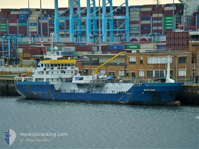
BAYAMO
Lpg Tanker
Current Trip
| Trip Time | 7 days |
|---|---|
| Trip Distance | 538.81 nm |
| AVG Speed | 8.7 Knots |
| MAX Speed | 12.8 Knots |
| Draught | 3.7 m |
| AVG Wind | 10.2 knots |
| MAX Wind | 19 knots |
| MIN Temp | 8.2°C / 46.76°F |
| MAX Temp | 13.3°C / 55.94°F |
| Position Received | 19 h, 12 m ago |
Current Position
| Longitude | -5.13339° |
|---|---|
| Latitude | 51.68919° |
| Status | Under way using engine |
| Speed | 9.2 Knots |
| Course | 4.3° |
| Area | Celtic Sea |
| Station | T-AIS |
| Position Received | 19 h, 12 m ago |
Information
The current position of BAYAMO is in Celtic Sea with coordinates 51.68919° / -5.13339° as reported on 2025-03-26 19:25 by AIS to our vessel tracker app. The vessel's current speed is 9.2 Knots and is currently inside the port of PEMBROKE.
The vessel BAYAMO (IMO: 9655004, MMSI: 245669000) is a Lpg Tanker that was built in 2013 ( 12 years old ). It's sailing under the flag of [NL] Netherlands.
In this page you can find informations about the vessels current position, last detected port calls, and current voyage information. If the vessels is not in coverage by AIS you will find the latest position.
The current position of BAYAMO is detected by our AIS receivers and we are not responsible for the reliability of the data. The last position was recorded while the vessel was in Coverage by the Ais receivers of our vessel tracking app.
The current draught of BAYAMO as reported by AIS is 3.7 meters
Weather
| Temperature | 10.9°C / 51.62°F |
|---|---|
| Wind Speed | 13 knots |
| Direction | 211° SSW |
| Pressure | 1018.6 hPa |
| Humidity | 90.7 % |
| Cloud Coverage | 100 % |
Featured Company
Last Port Calls
| Port | Arrival | Departure | Time In Port |
|---|---|---|---|
| 2025-03-26 19:44 | |||
| 2025-03-18 08:17 | 2025-03-18 20:36 | 12 h | |
| 2025-03-15 17:56 | 2025-03-16 07:39 | 13 h | |
| 2025-03-11 20:04 | 2025-03-12 22:10 | 1 d | |
| 2025-03-08 07:48 | 2025-03-09 01:07 | 17 h | |
| 2025-02-27 08:56 | 2025-02-28 21:19 | 1 d | |
| 2025-02-25 19:58 | 2025-02-26 16:10 | 20 h | |
| 2025-02-16 12:12 | 2025-02-18 14:21 | 2 d | |
| 2025-02-09 05:34 | 2025-02-13 15:19 | 4 d | |
| 2025-02-06 19:39 | 2025-02-08 03:35 | 1 d |
Most Visited Ports (Last year)
| Port | Arrivals | |
|---|---|---|
| 19 | ||
| 10 | ||
| 7 | ||
| 7 | ||
| 7 | ||
| 6 |
Last Trips
| Origin | Departure | Destination | Arrival | Distance | |
|---|---|---|---|---|---|
| 2025-03-18 20:36 | 2025-03-26 19:44 | 538.81 nm | |||
| 2025-03-16 08:39 | 2025-03-18 08:17 | 310.25 nm | |||
| 2025-03-12 22:10 | 2025-03-15 18:56 | 647.83 nm | |||
| 2025-03-09 02:07 | 2025-03-11 20:04 | 628.05 nm | |||
| 2025-02-28 21:19 | 2025-03-08 08:48 | 685.66 nm | |||
| 2025-02-26 16:10 | 2025-02-27 08:56 | 146.02 nm | |||
| 2025-02-18 14:21 | 2025-02-25 19:58 | 223.54 nm | |||
| 2025-02-13 16:19 | 2025-02-16 12:12 | 658.46 nm | |||
| 2025-02-08 04:35 | 2025-02-09 06:34 | 238.10 nm | |||
| 2025-02-05 19:55 | 2025-02-06 20:39 | 252.52 nm |
Events
| Time | Event | Details | Position / Dest | Info |
|---|---|---|---|---|
| 2025-03-27 14:27 | START Moving |
51.69992 / -5.03199
[GB] PEMBROKE
|
Speed: 7.8 kn Course: 267° |
|
| 2025-03-26 19:56 | STOP Moving |
51.69859 / -5.02527
[GB] PEMBROKE
|
Speed: 0.3 kn Course: 111° |
|
| 2025-03-26 19:44 | PORT ARRIVAL |
|
51.69799 / -5.06243
[GB] PEMBROKE
|
Speed: 9.6 kn Course: 92° |
| 2025-03-26 19:31 | Status Changed | Default Under way using engine |
51.69602 / -5.11578
PEMBROKE
|
Speed: 9.2 kn Course: 4.3° |
| 2025-03-26 19:25 | OUT of Coverage |
51.68919 / -5.13339
Celtic Sea
[GB] PEMBROKE
|
Speed: 9.2 kn Course: 4.3° |
|
| 2025-03-26 19:22 | Status Changed | Under way using engine Default |
51.68118 / -5.13443
PEMBROKE
|
Speed: 10.9 kn Course: 29° |
| 2025-03-26 19:12 | IN Coverage |
51.68315 / -5.13396
Celtic Sea
|
Speed: 10.5 kn Course: 6° |
|
| 2025-03-26 18:20 | Status Changed | Default Under way using engine |
51.59099 / -5.13643
PEMBROKE
|
Speed: 7 kn Course: 289.6° |
| 2025-03-26 18:13 | Change Sea Area | United Kingdom part of the Celtic Sea United Kingdom part of the Bristol Channel |
51.58818 / -5.11744
Celtic Sea
|
Speed: 7 kn Course: 289.6° |
| 2025-03-26 18:13 | OUT of Coverage |
51.58818 / -5.11744
Celtic Sea
|
Speed: 7 kn Course: 289.6° |