

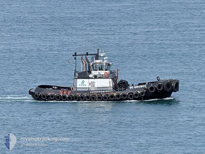
BO BRUSCO
Towing

Current Trip
| Trip Time | 2 h, 39 mins |
|---|---|
| Trip Distance | 21.95 nm |
| AVG Speed | 8.1 Knots |
| MAX Speed | 8.9 Knots |
| Draught | 0 m |
| AVG Wind | 4 knots |
| MAX Wind | 6.5 knots |
| MIN Temp | 9.3°C / 48.74°F |
| MAX Temp | 13°C / 55.4°F |
| Position Received | 1 m ago |
Current Position
| Longitude | -122.43211° |
|---|---|
| Latitude | 47.26231° |
| Status | Under way using engine |
| Speed | |
| Course | 153° |
| Area | The Coastal Waters of Southeast Alaska and British Columbia |
| Station | T-AIS |
| Position Received | 1 m ago |
Information
The current position of BO BRUSCO is in The Coastal Waters of Southeast Alaska and British Columbia with coordinates 47.26231° / -122.43211° as reported on 2025-05-19 19:13 by AIS to our vessel tracker app. The vessel's current speed is 0 Knots and is currently inside the port of TACOMA.
The vessel BO BRUSCO (MMSI: 367642530) is a Towing It's sailing under the flag of [US] USA.
In this page you can find informations about the vessels current position, last detected port calls, and current voyage information. If the vessels is not in coverage by AIS you will find the latest position.
The current position of BO BRUSCO is detected by our AIS receivers and we are not responsible for the reliability of the data. The last position was recorded while the vessel was in Coverage by the Ais receivers of our vessel tracking app.
Weather
| Temperature | 13.1°C / 55.58°F |
|---|---|
| Wind Speed | 10 knots |
| Direction | 215° SW |
| Pressure | 1017.5 hPa |
| Humidity | 80.5 % |
| Cloud Coverage | 76 % |


Featured Company
Last Port Calls
| Port | Arrival | Departure | Time In Port |
|---|---|---|---|
| 2025-05-18 21:50 | |||
| 2025-05-18 17:22 | 2025-05-18 19:11 | 1 h | |
| 2025-05-18 13:22 | 2025-05-18 15:18 | 1 h | |
| 2025-05-15 23:48 | 2025-05-18 13:17 | 2 d | |
| 2025-05-15 19:14 | 2025-05-15 21:33 | 2 h | |
| 2025-05-13 04:36 | 2025-05-15 17:16 | 2 d | |
| 2025-05-10 14:38 | 2025-05-13 04:27 | 2 d | |
| 2025-05-10 09:24 | 2025-05-10 12:00 | 2 h | |
| 2025-05-10 01:13 | 2025-05-10 07:27 | 6 h | |
| 2025-05-09 12:53 | 2025-05-10 01:08 | 12 h |
Most Visited Ports (Last year)
| Port | Arrivals | |
|---|---|---|
| 341 | ||
| 118 | ||
| 6 | ||
| 1 |
Last Trips
| Origin | Departure | Destination | Arrival | Distance | |
|---|---|---|---|---|---|
| 2025-05-18 19:11 | 2025-05-18 21:50 | 21.95 nm | |||
| 2025-05-18 15:18 | 2025-05-18 17:22 | 21.73 nm | |||
| 2025-05-18 13:17 | 2025-05-18 13:22 | 0.36 nm | |||
| 2025-05-15 21:33 | 2025-05-15 23:48 | 22.46 nm | |||
| 2025-05-15 17:16 | 2025-05-15 19:14 | 22.40 nm | |||
| 2025-05-13 04:27 | 2025-05-13 04:36 | 0.64 nm | |||
| 2025-05-10 12:00 | 2025-05-10 14:38 | 21.43 nm | |||
| 2025-05-10 07:27 | 2025-05-10 09:24 | 21.59 nm | |||
| 2025-05-10 01:08 | 2025-05-10 01:13 | 0.57 nm | |||
| 2025-05-09 12:49 | 2025-05-09 12:53 | 0.35 nm |
Events
| Time | Event | Details | Position / Dest | Info |
|---|---|---|---|---|
| 2025-05-19 13:11 | STOP Moving |
47.26230 / -122.43206
[US] TACOMA
|
Speed: Course: 164° |
|
| 2025-05-19 12:44 | START Moving |
47.26300 / -122.38895
[US] TACOMA
|
Speed: 6.9 kn Course: 310° |
|
| 2025-05-19 12:10 | STOP Moving |
47.26177 / -122.38670
[US] TACOMA
|
Speed: Course: 227° |
|
| 2025-05-19 11:03 | START Moving |
47.29073 / -122.43394
[US] TACOMA
|
Speed: 3.9 kn Course: 306° |
|
| 2025-05-19 10:45 | STOP Moving |
47.29167 / -122.43645
[US] TACOMA
|
Speed: Course: 40° |
|
| 2025-05-19 10:26 | START Moving |
47.26414 / -122.43288
[US] TACOMA
|
Speed: 3.9 kn Course: 336° |
|
| 2025-05-19 05:00 | STOP Moving |
47.26228 / -122.43210
[US] TACOMA
|
Speed: Course: 163° |
|
| 2025-05-19 04:50 | PORT ARRIVAL |
|
47.28251 / -122.44357
[US] TACOMA
|
Speed: 8.4 kn Course: 163.2° |
| 2025-05-19 02:29 | ETA Changed | 2026/01/01 00:00 |
47.56775 / -122.42416
US^0T7U>0UGM
|
Speed: 8.2 kn Course: 171.2° |
| 2025-05-19 02:11 | PORT DEPARTURE |
|
47.59915 / -122.39134
US^0T7U>0UGM
|
Speed: 8 kn Course: 239° |