
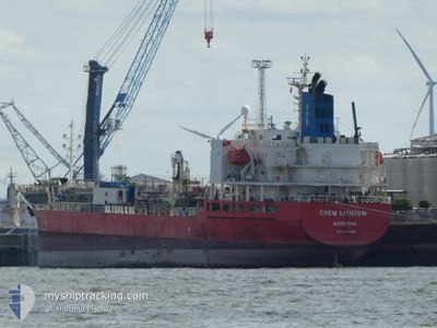
CHEM LITHIUM
Tanker B
Current Trip
| Trip Time | 4 days |
|---|---|
| Trip Distance | 1576.78 nm |
| AVG Speed | 13.3 Knots |
| MAX Speed | 15.1 Knots |
| Draught | 6.3 m |
| AVG Wind | 9.4 knots |
| MAX Wind | 29.2 knots |
| MIN Temp | 13.9°C / 57.02°F |
| MAX Temp | 19.3°C / 66.74°F |
| Position Received | 1 d ago |
Current Position
| Longitude | 5.00440° |
|---|---|
| Latitude | 43.28697° |
| Status | Under way using engine |
| Speed | 7.9 Knots |
| Course | 342.3° |
| Area | Mediterranean Sea - Western Basin |
| Station | T-AIS |
| Position Received | 1 d ago |
Info
Information
The current position of CHEM LITHIUM is in Mediterranean Sea - Western Basin with coordinates 43.28697° / 5.00440° as reported on 2025-12-13 14:23 by AIS to our vessel tracker app. The vessel's current speed is 7.9 Knots and is currently inside the port of FOS.
The vessel CHEM LITHIUM (IMO: 9815252, MMSI: 636019201) is a Tanker B It's sailing under the flag of [LR] Liberia.
In this page you can find informations about the vessels current position, last detected port calls, and current voyage information. If the vessels is not in coverage by AIS you will find the latest position.
The current position of CHEM LITHIUM is detected by our AIS receivers and we are not responsible for the reliability of the data. The last position was recorded while the vessel was in Coverage by the Ais receivers of our vessel tracking app.
The current draught of CHEM LITHIUM as reported by AIS is 6.3 meters
Weather
| Temperature | 12.3°C / 54.14°F |
|---|---|
| Wind Speed | 6 knots |
| Direction | 114° ESE |
| Pressure | 1025 hPa |
| Humidity | 77 % |
| Cloud Coverage | 41 % |
Featured Company
Last Port Calls
| Port | Arrival | Departure | Time In Port |
|---|---|---|---|
| 2025-12-13 16:25 | |||
| 2025-12-06 15:47 | 2025-12-08 19:52 | 2 d | |
| 2025-11-12 13:15 | 2025-11-14 05:39 | 1 d | |
| 2025-11-05 14:53 | 2025-11-07 10:01 | 1 d | |
| 2025-11-02 08:25 | 2025-11-04 16:44 | 2 d | |
| 2025-10-24 23:59 | 2025-10-26 16:06 | 1 d | |
| 2025-10-20 13:10 | 2025-10-20 20:39 | 7 h |
Most Visited Ports (Last year)
| Port | Arrivals | |
|---|---|---|
| 3 | ||
| 3 | ||
| 2 | ||
| 2 | ||
| 2 | ||
| 2 |
Last Trips
| Origin | Departure | Destination | Arrival | Distance | |
|---|---|---|---|---|---|
| 2025-12-08 19:52 | 2025-12-13 16:25 | 1576.78 nm | |||
| 2025-11-14 05:39 | 2025-12-06 15:47 | 3752.28 nm | |||
| 2025-11-07 10:01 | 2025-11-12 13:15 | 558.64 nm | |||
| 2025-11-04 16:44 | 2025-11-05 14:53 | 238.71 nm | |||
| 2025-10-26 16:06 | 2025-11-02 08:25 | 1923.36 nm | |||
| 2025-10-20 20:39 | 2025-10-24 23:59 | 1194.92 nm | |||
| 2025-09-05 08:31 | 2025-10-20 13:10 | 12614.76 nm |
Events
| Time | Event | Details | Position / Dest | Info |
|---|---|---|---|---|
| 2025-12-13 15:31 | STOP Moving |
43.40653 / 4.93065
[FR] FOS
|
Speed: 0.1 kn Course: 346° |
|
| 2025-12-13 15:25 | PORT ARRIVAL |
|
43.40749 / 4.93025
[FR] FOS
|
Speed: 2.3 kn Course: 327° |
| 2025-12-13 14:29 | Status Changed | Default Under way using engine |
43.29582 / 4.99966
FRFOS
|
Speed: 7.9 kn Course: 342.3° |
| 2025-12-13 14:23 | OUT of Coverage |
43.28697 / 5.00440
Mediterranean Sea - Western Basin
FRFOS
|
Speed: 7.9 kn Course: 342.3° |
|
| 2025-12-13 14:03 | Status Changed | Under way using engine Default |
43.22377 / 5.03252
FRFOS
|
Speed: 13.5 kn Course: 341° |
| 2025-12-13 13:57 | Status Changed | Default Under way using engine |
43.20308 / 5.04198
FRFOS
|
Speed: 13.5 kn Course: 334.1° |
| 2025-12-13 13:52 | Status Changed | Under way using engine Default |
43.18616 / 5.05259
FRFOS
|
Speed: 13.6 kn Course: 335° |
| 2025-12-13 13:49 | Status Changed | Default Under way using engine |
43.17544 / 5.05966
FRFOS
|
Speed: 13.8 kn Course: 335.4° |
| 2025-12-13 12:59 | Status Changed | Under way using engine Default |
42.99562 / 5.17189
FRFOS
|
Speed: 15.1 kn Course: 336° |
| 2025-12-13 12:57 | Status Changed | Default Under way using engine |
42.98766 / 5.17678
FRFOS
|
Speed: 15.1 kn Course: 335.4° |