
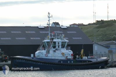
FARMAR ATHOS
Tug
Current Trip
| Trip Time | 2 days |
|---|---|
| Trip Distance | 380.75 nm |
| AVG Speed | 6.9 Knots |
| MAX Speed | 11.6 Knots |
| Draught | 5 m |
| AVG Wind | 17.4 knots |
| MAX Wind | 25.7 knots |
| MIN Temp | 5.7°C / 42.26°F |
| MAX Temp | 8.8°C / 47.84°F |
| Position Received | 2 m ago |
Current Position
| Longitude | 12.09775° |
|---|---|
| Latitude | 54.14958° |
| Status | Moored |
| Speed | |
| Course | 355° |
| Area | Baltic Sea |
| Station | T-AIS |
| Position Received | 2 m ago |
Info
Information
The current position of FARMAR ATHOS is in Baltic Sea with coordinates 54.14958° / 12.09775° as reported on 2025-12-15 19:49 by AIS to our vessel tracker app. The vessel's current speed is 0 Knots and is currently inside the port of ROSTOCK.
The vessel FARMAR ATHOS (IMO: 9714575, MMSI: 257090730) is a Tug that was built in 2014 ( 11 years old ). It's sailing under the flag of [NO] Norway.
In this page you can find informations about the vessels current position, last detected port calls, and current voyage information. If the vessels is not in coverage by AIS you will find the latest position.
The current position of FARMAR ATHOS is detected by our AIS receivers and we are not responsible for the reliability of the data. The last position was recorded while the vessel was in Coverage by the Ais receivers of our vessel tracking app.
The current draught of FARMAR ATHOS as reported by AIS is 5 meters
Weather
| Temperature | 5.5°C / 41.9°F |
|---|---|
| Wind Speed | 11 knots |
| Direction | 197° SSW |
| Pressure | 1014.6 hPa |
| Humidity | 85.6 % |
| Cloud Coverage | --- |
Featured Company
Last Port Calls
| Port | Arrival | Departure | Time In Port |
|---|---|---|---|
| 2025-12-15 15:11 | |||
| 2025-12-12 19:23 | 2025-12-13 12:19 | 16 h | |
| 2025-12-12 12:49 | 2025-12-12 13:49 | 59 m | |
| 2025-12-07 21:03 | 2025-12-12 06:21 | 4 d | |
| 2025-12-05 14:28 | 2025-12-07 20:19 | 2 d | |
| 2025-12-01 17:02 | 2025-12-04 20:09 | 3 d | |
| 2025-11-20 07:23 | 2025-11-25 22:51 | 5 d | |
| 2025-11-10 17:22 | 2025-11-18 15:17 | 7 d | |
| 2025-11-08 13:23 | 2025-11-09 13:16 | 23 h | |
| 2025-11-05 15:01 | 2025-11-07 13:13 | 1 d |
Last Trips
| Origin | Departure | Destination | Arrival | Distance | |
|---|---|---|---|---|---|
| 2025-12-13 12:19 | 2025-12-15 15:11 | 380.75 nm | |||
| 2025-12-12 13:49 | 2025-12-12 19:23 | 46.93 nm | |||
| 2025-12-12 06:21 | 2025-12-12 12:49 | 56.69 nm | |||
| 2025-12-07 20:19 | 2025-12-07 21:03 | 2.08 nm | |||
| 2025-12-04 20:09 | 2025-12-05 14:28 | 50.84 nm | |||
| 2025-11-25 22:51 | 2025-12-01 17:02 | 371.78 nm | |||
| 2025-11-18 15:17 | 2025-11-20 07:23 | 115.39 nm | |||
| 2025-11-09 13:16 | 2025-11-10 17:22 | 54.54 nm | |||
| 2025-11-07 13:13 | 2025-11-08 13:23 | 62.74 nm | |||
| 2025-11-05 09:19 | 2025-11-05 15:01 | 47.25 nm |
Events
| Time | Event | Details | Position / Dest | Info |
|---|---|---|---|---|
| 2025-12-15 14:43 | Status Changed | Moored Restricted manoeuverability |
54.14955 / 12.09778
[DE] ROSTOCK
|
Speed: Course: 357° |
| 2025-12-15 14:36 | STOP Moving |
54.14955 / 12.09766
[DE] ROSTOCK
|
Speed: 0.3 kn Course: 352° |
|
| 2025-12-15 14:11 | PORT ARRIVAL |
|
54.18816 / 12.08869
[DE] ROSTOCK
|
Speed: 7.6 kn Course: 163° |
| 2025-12-15 11:25 | Change Sea Area | German part of the Baltic Sea Danish part of the Baltic Sea |
54.41594 / 12.12665
Baltic Sea
ROSTOCK
|
Speed: 6.4 kn Course: 183° |
| 2025-12-15 10:30 | Status Changed | Restricted manoeuverability Default |
54.51070 / 12.19148
ROSTOCK
|
Speed: 6.4 kn Course: 197° |
| 2025-12-15 10:30 | IN Coverage |
54.50921 / 12.19092
Baltic Sea
ROSTOCK
|
Speed: 6.5 kn Course: 192.3° |
|
| 2025-12-15 06:34 | Status Changed | Default Restricted manoeuverability |
54.84260 / 12.58678
ROSTOCK
|
Speed: 6.7 kn Course: 200.5° |
| 2025-12-15 06:24 | OUT of Coverage |
54.86089 / 12.59834
Baltic Sea
ROSTOCK
|
Speed: 6.7 kn Course: 200.5° |
|
| 2025-12-15 06:23 | Status Changed | Restricted manoeuverability Default |
54.86209 / 12.59909
ROSTOCK
|
Speed: 6.6 kn Course: 201° |
| 2025-12-15 06:18 | Status Changed | Default Restricted manoeuverability |
54.87118 / 12.60482
ROSTOCK
|
Speed: 6.5 kn Course: 202.1° |