

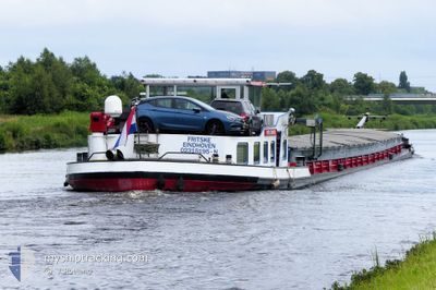
FRITSKE
Cargo

Current Trip
FRITSKE is out of coverage. Learn how you can join the community and extend the coverage to your area by clicking here!
Unknown
Destination Port
ETA*
---
| Time Travelled | 23 days |
|---|---|
| Remaining Time | --- |
| Distance Travelled | 126.59 nm |
| Remaining Distance | --- |
| AVG Speed | 5.9 Knots |
| MAX Speed | 8.7 Knots |
| AVG Wind | 8.2 knots |
| MAX Wind | 10.9 knots |
| MIN Temp | 13.6°C / 56.48°F |
| MAX Temp | 18.2°C / 64.76°F |
| Draught | 0 m |
| Position Received | 4 d ago |
Current Position
| Longitude | 10.41971° |
|---|---|
| Latitude | 52.18637° |
| Status | Under way using engine |
| Speed | |
| Course | --- |
| Area | North Sea |
| Station | T-AIS |
| Position Received | 4 d ago |
Information
The current position of FRITSKE is in North Sea with coordinates 52.18637° / 10.41971° as reported on 2025-05-14 13:34 by AIS to our vessel tracker app. The vessel's current speed is 0 Knots
The vessel FRITSKE (MMSI: 244660529) is a Cargo It's sailing under the flag of [NL] Netherlands.
In this page you can find informations about the vessels current position, last detected port calls, and current voyage information. If the vessels is not in coverage by AIS you will find the latest position.
The current position of FRITSKE is detected by our AIS receivers and we are not responsible for the reliability of the data. The last position was recorded while the vessel was in Coverage by the Ais receivers of our vessel tracking app.
Weather
| Temperature | 18.3°C / 64.94°F |
|---|---|
| Wind Speed | 13 knots |
| Direction | 296° WNW |
| Pressure | 1014.9 hPa |
| Humidity | 49 % |
| Cloud Coverage | 100 % |


Featured Company
Limited time offer - Install a base station receiver to your area and list your company on MyShipTracking Free forever!
Last Port Calls
| Port | Arrival | Departure | Time In Port |
|---|---|---|---|
| 2025-04-20 08:29 | 2025-04-25 13:47 | 5 d | |
| 2025-04-15 13:57 | 2025-04-17 22:19 | 2 d | |
| 2025-04-14 12:33 | 2025-04-15 09:50 | 21 h | |
| 2025-04-14 01:34 | 2025-04-14 02:03 | 28 m | |
| 2025-04-07 23:29 | 2025-04-14 00:30 | 6 d | |
| 2025-04-07 20:29 | 2025-04-07 21:40 | 1 h | |
| 2025-04-03 12:53 | 2025-04-07 04:45 | 3 d | |
| 2025-03-26 17:15 | 2025-03-26 17:59 | 43 m | |
| 2025-03-25 08:40 | 2025-03-25 09:49 | 1 h | |
| 2025-03-24 21:12 | 2025-03-25 06:46 | 9 h |
Most Visited Ports (Last year)
| Port | Arrivals | |
|---|---|---|
| 19 | ||
| 8 | ||
| 7 | ||
| 6 | ||
| 5 | ||
| 5 |
Last Trips
| Origin | Departure | Destination | Arrival | Distance | |
|---|---|---|---|---|---|
| 2025-04-17 22:19 | 2025-04-20 08:29 | 99.13 nm | |||
| 2025-04-15 09:50 | 2025-04-15 13:57 | 30.65 nm | |||
| 2025-04-14 02:03 | 2025-04-14 12:33 | 55.27 nm | |||
| 2025-04-14 00:30 | 2025-04-14 01:34 | 3.07 nm | |||
| 2025-04-07 21:40 | 2025-04-07 23:29 | 7.44 nm | |||
| 2025-04-07 04:45 | 2025-04-07 20:29 | 65.02 nm | |||
| 2025-03-26 17:59 | 2025-04-03 12:53 | 192.72 nm | |||
| 2025-03-25 09:49 | 2025-03-26 17:15 | 124.74 nm | |||
| 2025-03-25 06:46 | 2025-03-25 08:40 | 14.32 nm | |||
| 2025-03-24 18:30 | 2025-03-24 21:12 | 26.67 nm |
Events
| Time | Event | Details | Position / Dest | Info |
|---|---|---|---|---|
| 2025-05-14 13:34 | OUT of Coverage |
52.18637 / 10.41971
North Sea
|
Speed: Course: 0° |
|
| 2025-05-14 11:00 | STOP Moving | 0.78 nm, North East of SALZGITTER |
52.18646 / 10.41998
|
Speed: 0.3 kn Course: 511° |
| 2025-05-14 10:42 | START Moving | 1.73 nm, North of SALZGITTER |
52.20202 / 10.42595
|
Speed: 5.5 kn Course: 190.2° |
| 2025-05-14 10:29 | STOP Moving | 2.44 nm, North of SALZGITTER |
52.21456 / 10.42326
|
Speed: Course: 511° |
| 2025-05-14 09:56 | IN Coverage |
52.24538 / 10.40868
North Sea
|
Speed: 6.4 kn Course: 162.2° |
|
| 2025-05-13 19:08 | OUT of Coverage |
52.40792 / 9.73894
North Sea
|
Speed: 6.6 kn Course: 116.6° |
|
| 2025-05-13 18:58 | IN Coverage |
52.41757 / 9.71111
North Sea
|
Speed: 7.5 kn Course: 121.1° |
|
| 2025-05-13 17:33 | OUT of Coverage |
52.39912 / 9.45819
North Sea
|
Speed: 6.8 kn Course: 67.9° |
|
| 2025-05-13 17:19 | IN Coverage |
52.39238 / 9.41555
North Sea
|
Speed: 7.4 kn Course: 85.8° |
|
| 2025-05-13 14:54 | OUT of Coverage |
52.29295 / 9.01149
North Sea
|
Speed: 6.7 kn Course: 69° |