
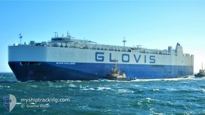
GLOVIS CHALLENGE
Vehicles Carrier
Current Trip
| Time Travelled | 13 days |
|---|---|
| Remaining Time | --- |
| Distance Travelled | 3772.61 nm |
| Remaining Distance | 2397.25 nm |
| AVG Speed | 11.2 Knots |
| MAX Speed | 16.2 Knots |
| AVG Wind | 17.3 knots |
| MAX Wind | 25 knots |
| MIN Temp | 18.7°C / 65.66°F |
| MAX Temp | 28°C / 82.4°F |
| Draught | 9.7 m |
| Position Received | 3 d ago |
Current Position
| Longitude | -46.15549° |
|---|---|
| Latitude | 14.23848° |
| Status | Under way using engine |
| Speed | 8.7 Knots |
| Course | 106.7° |
| Area | North Atlantic Ocean |
| Station | T-AIS |
| Position Received | 3 d ago |
Info
Information
The current position of GLOVIS CHALLENGE is in North Atlantic Ocean with coordinates 14.23848° / -46.15549° as reported on 2025-12-13 09:53 by AIS to our vessel tracker app. The vessel's current speed is 8.7 Knots and is heading at the port of LAGOS. The estimated time of arrival as calculated by MyShipTracking vessel tracking app is 2025-12-21 09:00 LT
The vessel GLOVIS CHALLENGE (IMO: 9590591, MMSI: 441190000) is a Vehicles Carrier that was built in 2012 ( 13 years old ). It's sailing under the flag of [KR] Korea.
In this page you can find informations about the vessels current position, last detected port calls, and current voyage information. If the vessels is not in coverage by AIS you will find the latest position.
The current position of GLOVIS CHALLENGE is detected by our AIS receivers and we are not responsible for the reliability of the data. The last position was recorded while the vessel was in Coverage by the Ais receivers of our vessel tracking app.
The current draught of GLOVIS CHALLENGE as reported by AIS is 9.7 meters
Weather
| Temperature | 25.2°C / 77.36°F |
|---|---|
| Wind Speed | 20 knots |
| Direction | 79° E |
| Pressure | 1014.5 hPa |
| Humidity | 74.1 % |
| Cloud Coverage | 48 % |
Featured Company
Last Port Calls
| Port | Arrival | Departure | Time In Port |
|---|---|---|---|
| 2025-12-01 17:38 | 2025-12-03 07:17 | 1 d | |
| 2025-11-27 07:42 | 2025-11-29 09:13 | 2 d | |
| 2025-11-24 16:21 | 2025-11-25 14:33 | 22 h | |
| 2025-11-19 14:39 | 2025-11-21 14:18 | 1 d | |
| 2025-11-14 08:35 | 2025-11-14 19:29 | 10 h | |
| 2025-11-11 02:37 | 2025-11-12 02:05 | 23 h | |
| 2025-10-06 14:52 | 2025-10-07 17:04 | 1 d | |
| 2025-10-03 17:52 | 2025-10-04 18:37 | 1 d | |
| 2025-10-03 07:17 | 2025-10-03 11:17 | 4 h | |
| 2025-10-02 06:09 | 2025-10-02 19:04 | 12 h |
Most Visited Ports (Last year)
| Port | Arrivals | |
|---|---|---|
| 5 | ||
| 5 | ||
| 4 | ||
| 3 | ||
| 2 | ||
| 2 |
Last Trips
| Origin | Departure | Destination | Arrival | Distance | |
|---|---|---|---|---|---|
| 2025-11-29 09:13 | 2025-12-01 17:38 | 519.68 nm | |||
| 2025-11-25 14:33 | 2025-11-27 07:42 | 489.84 nm | |||
| 2025-11-21 14:18 | 2025-11-24 16:21 | 469.43 nm | |||
| 2025-11-14 19:29 | 2025-11-19 14:39 | 1463.92 nm | |||
| 2025-11-12 02:05 | 2025-11-14 08:35 | 756.16 nm | |||
| 2025-10-07 17:04 | 2025-11-11 02:37 | 10733.89 nm | |||
| 2025-10-04 18:37 | 2025-10-06 14:52 | 594.61 nm | |||
| 2025-10-03 11:17 | 2025-10-03 17:52 | 82.16 nm | |||
| 2025-10-02 19:04 | 2025-10-03 07:17 | 155.15 nm | |||
| 2025-10-01 18:01 | 2025-10-02 06:09 | 145.89 nm |
Events
| Time | Event | Details | Position / Dest | Info |
|---|---|---|---|---|
| 2025-12-13 09:55 | Status Changed | Default Under way using engine |
14.23722 / -46.15089
NGLOS
|
Speed: 8.7 kn Course: 106.7° |
| 2025-12-13 09:53 | Status Changed | Under way using engine Default |
14.23848 / -46.15549
NGLOS
|
Speed: 8.4 kn Course: 104° |
| 2025-12-13 09:53 | OUT of Coverage |
14.23848 / -46.15549
North Atlantic Ocean
NGLOS
|
Speed: 8.7 kn Course: 106.7° |
|
| 2025-12-13 09:44 | Status Changed | Default Under way using engine |
14.24413 / -46.17738
NGLOS
|
Speed: 9.1 kn Course: 106.6° |
| 2025-12-13 09:14 | Status Changed | Under way using engine Default |
14.26512 / -46.25518
NGLOS
|
Speed: 9.3 kn Course: 109° |
| 2025-12-13 09:10 | Status Changed | Default Under way using engine |
14.26835 / -46.26637
NGLOS
|
Speed: 9 kn Course: 105° |
| 2025-12-13 08:22 | Status Changed | Under way using engine Default |
14.29455 / -46.39302
NGLOS
|
Speed: 9.4 kn Course: 91° |
| 2025-12-13 08:18 | Status Changed | Default Under way using engine |
14.29505 / -46.40331
NGLOS
|
Speed: 9.9 kn Course: 95.1° |
| 2025-12-13 05:46 | Status Changed | Under way using engine Default |
14.36328 / -46.80640
NGLOS
|
Speed: 9.5 kn Course: 102° |
| 2025-12-13 05:37 | Change Sea Area | High seas of the North Atlantic Ocean Guadeloupe and Martinique part of the Caribbean Sea |
14.36838 / -46.82877
North Atlantic Ocean
NGLOS
|
Speed: 9.1 kn Course: 103° |