
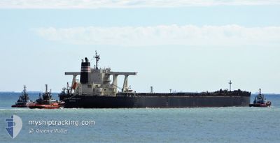
IRON SOUTHERN CROSS
Cargo
Current Trip
| Time Travelled | 1 day |
|---|---|
| Remaining Time | 17 h, 13 mins |
| Distance Travelled | 288.44 nm |
| Remaining Distance | 190.06 nm |
| AVG Speed | 10.9 Knots |
| MAX Speed | 13.6 Knots |
| AVG Wind | 15.6 knots |
| MAX Wind | 21 knots |
| MIN Temp | 0.9°C / 33.62°F |
| MAX Temp | 4°C / 39.2°F |
| Draught | 17.5 m |
| Position Received | 13 d ago |
Current Position
| Longitude | 120.25955° |
|---|---|
| Latitude | 12.82878° |
| Status | Under way using engine |
| Speed | 11.9 Knots |
| Course | 337° |
| Area | Sulu Sea |
| Station | T-AIS |
| Position Received | 13 d ago |
Info
Information
The current position of IRON SOUTHERN CROSS is in Sulu Sea with coordinates 12.82878° / 120.25955° as reported on 2025-02-11 13:42 by AIS to our vessel tracker app. The vessel's current speed is 11.9 Knots and is heading at the port of QINGDAO. The estimated time of arrival as calculated by MyShipTracking vessel tracking app is 2025-02-25 16:31 LT
The vessel IRON SOUTHERN CROSS (IMO: 9627708, MMSI: 636016772) is a Cargo It's sailing under the flag of [LR] Liberia.
In this page you can find informations about the vessels current position, last detected port calls, and current voyage information. If the vessels is not in coverage by AIS you will find the latest position.
The current position of IRON SOUTHERN CROSS is detected by our AIS receivers and we are not responsible for the reliability of the data. The last position was recorded while the vessel was in Coverage by the Ais receivers of our vessel tracking app.
The current draught of IRON SOUTHERN CROSS as reported by AIS is 17.5 meters
Weather
| Temperature | 4°C / 39.2°F |
|---|---|
| Wind Speed | 15 knots |
| Direction | 231° SW |
| Pressure | 1031.6 hPa |
| Humidity | 56.2 % |
| Cloud Coverage | 5 % |
Featured Company
Last Port Calls
| Port | Arrival | Departure | Time In Port |
|---|---|---|---|
| 2025-02-21 15:53 | 2025-02-23 20:49 | 2 d | |
| 2025-02-19 15:44 | 2025-02-20 18:09 | 1 d | |
| 2025-02-01 03:54 | 2025-02-02 13:26 | 1 d | |
| 2024-12-19 13:12 | 2024-12-31 09:24 | 11 d | |
| 2024-12-12 12:24 | 2024-12-15 12:48 | 3 d |
Most Visited Ports (Last year)
| Port | Arrivals | |
|---|---|---|
| 7 | ||
| 4 | ||
| 3 | ||
| 2 | ||
| 1 | ||
| 1 |
Last Trips
| Origin | Departure | Destination | Arrival | Distance | |
|---|---|---|---|---|---|
| 2025-02-20 18:09 | 2025-02-21 15:53 | 48.12 nm | |||
| 2025-02-02 13:26 | 2025-02-19 15:44 | 3916.74 nm | |||
| 2024-12-31 09:24 | 2025-02-01 03:54 | 3007.86 nm | |||
| 2024-12-15 12:48 | 2024-12-19 13:12 | 1056.16 nm | |||
| 2024-11-19 12:06 | 2024-12-12 12:24 | 3872.11 nm |
Events
| Time | Event | Details | Position / Dest | Info |
|---|---|---|---|---|
| 2025-02-23 12:49 | PORT DEPARTURE |
|
38.42652 / 118.01902
CNQDG
|
Speed: 12.3 kn Course: 60° |
| 2025-02-23 12:09 | START Moving |
38.37012 / 117.90401
[CN] HUANGHUA
|
Speed: 3.4 kn Course: 43° |
|
| 2025-02-21 07:53 | STOP Moving |
38.36718 / 117.90611
[CN] HUANGHUA
|
Speed: 0.3 kn Course: 234° |
|
| 2025-02-21 07:53 | PORT ARRIVAL |
|
38.36718 / 117.90611
[CN] HUANGHUA
|
Speed: 0.6 kn Course: 229° |
| 2025-02-21 03:41 | START Moving |
38.65004 / 118.40512
CNQDG
|
Speed: 4.4 kn Course: 225° |
|
| 2025-02-20 12:21 | STOP Moving |
38.65547 / 118.41165
CNQDG
|
Speed: 0.1 kn Course: 193° |
|
| 2025-02-20 10:09 | PORT DEPARTURE |
|
38.90200 / 118.50257
CNQDG
|
Speed: 5.5 kn Course: 206° |
| 2025-02-20 10:01 | START Moving |
38.91129 / 118.51051
[CN] CAOFEIDIAN
|
Speed: 3.3 kn Course: 192° |
|
| 2025-02-19 07:44 | STOP Moving |
38.91357 / 118.50653
[CN] CAOFEIDIAN
|
Speed: 0.1 kn Course: 89° |
|
| 2025-02-19 07:44 | PORT ARRIVAL |
|
38.91357 / 118.50653
[CN] CAOFEIDIAN
|
Speed: 2.2 kn Course: 65° |