
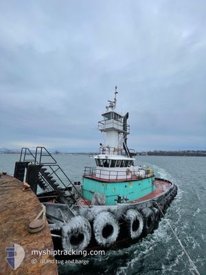
ISLAND BREEZE
Tug
Current Trip
TEXADA, BC
| Time Travelled | 11 h, 21 mins |
|---|---|
| Remaining Time | --- |
| Distance Travelled | 91.60 nm |
| Remaining Distance | --- |
| AVG Speed | 8.3 Knots |
| MAX Speed | 9.7 Knots |
| AVG Wind | 7 knots |
| MAX Wind | 9 knots |
| MIN Temp | 6.5°C / 43.7°F |
| MAX Temp | 13.6°C / 56.48°F |
| Draught | 4 m |
| Position Received | Now |
Current Position
| Longitude | -123.07490° |
|---|---|
| Latitude | 48.91833° |
| Status | Moored |
| Speed | 6 Knots |
| Course | 312° |
| Area | The Coastal Waters of Southeast Alaska and British Columbia |
| Station | T-AIS |
| Position Received | Now |
Info
Information
The current position of ISLAND BREEZE is in The Coastal Waters of Southeast Alaska and British Columbia with coordinates 48.91833° / -123.07490° as reported on 2025-02-28 03:50 by AIS to our vessel tracker app. The vessel's current speed is 6 Knots
The vessel ISLAND BREEZE (IMO: 7308762, MMSI: 367439390) is a Tug that was built in 1970 ( 55 years old ). It's sailing under the flag of [US] USA.
In this page you can find informations about the vessels current position, last detected port calls, and current voyage information. If the vessels is not in coverage by AIS you will find the latest position.
The current position of ISLAND BREEZE is detected by our AIS receivers and we are not responsible for the reliability of the data. The last position was recorded while the vessel was in Coverage by the Ais receivers of our vessel tracking app.
The current draught of ISLAND BREEZE as reported by AIS is 4 meters
Weather
| Temperature | 8.2°C / 46.76°F |
|---|---|
| Wind Speed | 6 knots |
| Direction | 302° WNW |
| Pressure | 1022 hPa |
| Humidity | 85 % |
| Cloud Coverage | 100 % |
Featured Company
Last Port Calls
| Port | Arrival | Departure | Time In Port |
|---|---|---|---|
| 2025-02-27 12:44 | 2025-02-27 16:29 | 3 h | |
| 2025-02-27 07:36 | 2025-02-27 11:35 | 3 h | |
| 2025-02-24 09:46 | 2025-02-26 06:17 | 1 d | |
| 2025-02-23 18:52 | 2025-02-23 19:54 | 1 h | |
| 2025-02-22 14:57 | 2025-02-22 15:45 | 47 m | |
| 2025-02-22 10:43 | 2025-02-22 11:14 | 30 m | |
| 2025-02-22 07:39 | 2025-02-22 08:25 | 45 m | |
| 2025-02-20 16:04 | 2025-02-22 07:02 | 1 d | |
| 2025-02-19 05:48 | 2025-02-19 06:15 | 27 m | |
| 2025-02-19 01:15 | 2025-02-19 03:09 | 1 h |
Last Trips
| Origin | Departure | Destination | Arrival | Distance | |
|---|---|---|---|---|---|
| 2025-02-27 03:35 | 2025-02-27 04:44 | 1.60 nm | |||
| 2025-02-25 22:17 | 2025-02-26 23:36 | 116.28 nm | |||
| 2025-02-23 11:54 | 2025-02-24 01:46 | 127.55 nm | |||
| 2025-02-22 07:45 | 2025-02-23 10:52 | 155.86 nm | |||
| 2025-02-22 03:14 | 2025-02-22 06:57 | 22.17 nm | |||
| 2025-02-22 00:25 | 2025-02-22 02:43 | 21.83 nm | |||
| 2025-02-21 23:02 | 2025-02-21 23:39 | 1.71 nm | |||
| 2025-02-18 22:15 | 2025-02-20 08:04 | 117.49 nm | |||
| 2025-02-18 19:09 | 2025-02-18 21:48 | 22.77 nm | |||
| 2025-02-18 00:09 | 2025-02-18 17:15 | 49.52 nm |
Events
| Time | Event | Details | Position / Dest | Info |
|---|---|---|---|---|
| 2025-02-27 20:26 | ETA Changed | 2025/02/14 10:00 |
48.11938 / -122.65260
TEXADA, BC
|
Speed: 7.9 kn Course: 328.1° |
| 2025-02-27 19:38 | ETA Changed | 2025/02/14 10:00 |
48.01298 / -122.60626
TEXADA, BC
|
Speed: 8.6 kn Course: 327.3° |
| 2025-02-27 19:26 | ETA Changed | 2025/02/14 10:00 |
47.98687 / -122.58497
TEXADA, BC
|
Speed: 9.2 kn Course: 334.1° |
| 2025-02-27 18:32 | ETA Changed | 2025/02/14 10:00 |
47.88390 / -122.46370
TEXADA, BC
|
Speed: 9.2 kn Course: 345.8° |
| 2025-02-27 18:20 | ETA Changed | 2025/02/14 10:00 |
47.85534 / -122.45339
TEXADA, BC
|
Speed: 8.7 kn Course: 346.7° |
| 2025-02-27 16:32 | Destination Changed | TEXADA, BC SEATTLE |
47.60866 / -122.39755
TEXADA, BC
|
Speed: 8.4 kn Course: 309.4° |
| 2025-02-27 16:29 | PORT DEPARTURE |
|
47.60561 / -122.39175
SEATTLE
|
Speed: 6.5 kn Course: 304° |
| 2025-02-27 16:08 | START Moving |
47.59435 / -122.36735
[US] SEATTLE
|
Speed: 3.2 kn Course: 14° |
|
| 2025-02-27 15:54 | STOP Moving |
47.59215 / -122.36646
[US] SEATTLE
|
Speed: 0.2 kn Course: 337° |
|
| 2025-02-27 15:34 | START Moving |
47.56499 / -122.34740
[US] SEATTLE
|
Speed: 5.3 kn Course: 339° |