
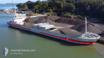
JEKERBORG
General Cargo
Current Trip
| Time Travelled | 21 h, 27 mins |
|---|---|
| Remaining Time | 2 days |
| Distance Travelled | 186.58 nm |
| Remaining Distance | 574.51 nm |
| AVG Speed | 8.6 Knots |
| MAX Speed | 10.6 Knots |
| AVG Wind | 21.4 knots |
| MAX Wind | 26.5 knots |
| MIN Temp | 1.7°C / 35.06°F |
| MAX Temp | 4.7°C / 40.46°F |
| Draught | 4.4 m |
| Position Received | 7 h, 27 m ago |
Current Position
| Longitude | 1.47772° |
|---|---|
| Latitude | 51.08066° |
| Status | Under way using engine |
| Speed | 9.3 Knots |
| Course | 229.8° |
| Area | North Sea |
| Station | T-AIS |
| Position Received | 7 h, 27 m ago |
Info
Information
The current position of JEKERBORG is in North Sea with coordinates 51.08066° / 1.47772° as reported on 2026-01-10 09:15 by AIS to our vessel tracker app. The vessel's current speed is 9.3 Knots and is heading at the port of BILBAO. The estimated time of arrival as calculated by MyShipTracking vessel tracking app is 2026-01-13 16:06 LT
The vessel JEKERBORG (IMO: 9201944, MMSI: 244580000) is a General Cargo that was built in 2000 ( 26 years old ). It's sailing under the flag of [NL] Netherlands.
In this page you can find informations about the vessels current position, last detected port calls, and current voyage information. If the vessels is not in coverage by AIS you will find the latest position.
The current position of JEKERBORG is detected by our AIS receivers and we are not responsible for the reliability of the data. The last position was recorded while the vessel was in Coverage by the Ais receivers of our vessel tracking app.
The current draught of JEKERBORG as reported by AIS is 4.4 meters
Weather
| Temperature | 4.5°C / 40.1°F |
|---|---|
| Wind Speed | 16 knots |
| Direction | 347° NNW |
| Pressure | 1019.7 hPa |
| Humidity | 74.3 % |
| Cloud Coverage | 92 % |
Featured Company
Last Port Calls
| Port | Arrival | Departure | Time In Port |
|---|---|---|---|
| 2026-01-08 19:51 | 2026-01-09 20:15 | 1 d | |
| 2026-01-08 02:36 | 2026-01-08 19:39 | 17 h | |
| 2025-12-27 11:25 | 2025-12-31 14:39 | 4 d | |
| 2025-12-19 16:15 | 2025-12-21 01:32 | 1 d | |
| 2025-12-16 06:29 | 2025-12-18 15:16 | 2 d | |
| 2025-12-12 10:23 | 2025-12-13 00:05 | 13 h | |
| 2025-12-10 09:43 | 2025-12-11 10:10 | 1 d | |
| 2025-12-05 22:38 | 2025-12-08 03:16 | 2 d | |
| 2025-12-05 15:38 | 2025-12-05 22:17 | 6 h | |
| 2025-12-03 17:19 | 2025-12-04 16:09 | 22 h |
Last Trips
| Origin | Departure | Destination | Arrival | Distance | |
|---|---|---|---|---|---|
| 2026-01-08 19:39 | 2026-01-08 19:51 | 1.77 nm | |||
| 2025-12-31 14:39 | 2026-01-08 02:36 | 273.10 nm | |||
| 2025-12-21 01:32 | 2025-12-27 11:25 | 1210.39 nm | |||
| 2025-12-18 15:16 | 2025-12-19 16:15 | 228.42 nm | |||
| 2025-12-13 00:05 | 2025-12-16 06:29 | 652.71 nm | |||
| 2025-12-11 10:10 | 2025-12-12 10:23 | 203.56 nm | |||
| 2025-12-08 03:16 | 2025-12-10 09:43 | 349.39 nm | |||
| 2025-12-05 22:17 | 2025-12-05 22:38 | 0.87 nm | |||
| 2025-12-04 16:09 | 2025-12-05 15:38 | 231.83 nm | |||
| 2025-12-02 14:19 | 2025-12-03 17:19 | 270.76 nm |
Events
| Time | Event | Details | Position / Dest | Info |
|---|---|---|---|---|
| 2026-01-10 09:20 | Status Changed | Default Under way using engine |
51.07167 / 1.46167
BILBAO
|
Speed: 9.3 kn Course: 229.8° |
| 2026-01-10 09:15 | OUT of Coverage |
51.08066 / 1.47772
North Sea
BILBAO
|
Speed: 9.3 kn Course: 229.8° |
|
| 2026-01-10 09:09 | Status Changed | Under way using engine Default |
51.09086 / 1.49682
BILBAO
|
Speed: 9 kn Course: 229° |
| 2026-01-10 08:51 | Status Changed | Default Under way using engine |
51.12137 / 1.55156
BILBAO
|
Speed: 8.5 kn Course: 230° |
| 2026-01-10 06:00 | Status Changed | Under way using engine Default |
51.39632 / 1.92846
BILBAO
|
Speed: 7.4 kn Course: 208° |
| 2026-01-10 05:57 | Status Changed | Default Under way using engine |
51.40186 / 1.93342
BILBAO
|
Speed: 7.2 kn Course: 221.9° |
| 2026-01-10 05:30 | Detected in Sea | United Kingdom part of the North Sea |
51.44688 / 1.98453
North Sea
BILBAO
|
Speed: 7.3 kn Course: 223.3° |
| 2026-01-10 05:30 | Status Changed | Under way using engine Default |
51.44688 / 1.98453
BILBAO
|
Speed: 7.8 kn Course: 224° |
| 2026-01-10 05:21 | IN Coverage |
51.44688 / 1.98453
North Sea
BILBAO
|
Speed: 7.3 kn Course: 223.3° |
|
| 2026-01-10 02:39 | OUT of Coverage |
51.74690 / 2.43353
North Sea
BILBAO
|
Speed: 9.8 kn Course: 221.2° |