

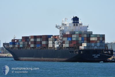
LADY JANE
Container Ship

Current Trip
SGSIN->MBA
| Time Travelled | 5 days |
|---|---|
| Remaining Time | --- |
| Distance Travelled | 2401.05 nm |
| Remaining Distance | --- |
| AVG Speed | 16.6 Knots |
| MAX Speed | 19.4 Knots |
| AVG Wind | 11.2 knots |
| MAX Wind | 21.3 knots |
| MIN Temp | 25.7°C / 78.26°F |
| MAX Temp | 29.6°C / 85.28°F |
| Draught | 11.7 m |
| Position Received | 5 d ago |
Current Position
| Longitude | 102.06104° |
|---|---|
| Latitude | 2.12535° |
| Status | Under way using engine |
| Speed | 16.7 Knots |
| Course | 305.2° |
| Area | Malacca Strait |
| Station | T-AIS |
| Position Received | 5 d ago |
Information
The current position of LADY JANE is in Malacca Strait with coordinates 2.12535° / 102.06104° as reported on 2025-04-10 10:21 by AIS to our vessel tracker app. The vessel's current speed is 16.7 Knots
The vessel LADY JANE (IMO: 9297474, MMSI: 538009624) is a Container Ship that was built in 2005 ( 20 years old ). It's sailing under the flag of [MH] Marshall Is.
In this page you can find informations about the vessels current position, last detected port calls, and current voyage information. If the vessels is not in coverage by AIS you will find the latest position.
The current position of LADY JANE is detected by our AIS receivers and we are not responsible for the reliability of the data. The last position was recorded while the vessel was in Coverage by the Ais receivers of our vessel tracking app.
The current draught of LADY JANE as reported by AIS is 11.7 meters
Weather
| Temperature | 28.8°C / 83.84°F |
|---|---|
| Wind Speed | 9 knots |
| Direction | 270° W |
| Pressure | 1010.9 hPa |
| Humidity | 69.9 % |
| Cloud Coverage | 48 % |


Featured Company
Last Port Calls
| Port | Arrival | Departure | Time In Port |
|---|---|---|---|
| 2025-04-09 20:17 | 2025-04-10 11:11 | 14 h | |
| 2025-04-05 05:05 | 2025-04-05 15:22 | 10 h | |
| 2025-03-29 01:31 | 2025-03-29 10:41 | 9 h | |
| 2025-03-23 08:33 | 2025-03-24 01:50 | 17 h | |
| 2025-02-28 21:08 | 2025-03-04 23:36 | 4 d | |
| 2025-02-13 19:40 | 2025-02-14 18:08 | 22 h | |
| 2025-02-09 08:09 | 2025-02-09 19:29 | 11 h | |
| 2025-02-04 17:14 | 2025-02-05 04:15 | 11 h | |
| 2025-02-02 10:17 | 2025-02-03 00:05 | 13 h |
Last Trips
| Origin | Departure | Destination | Arrival | Distance | |
|---|---|---|---|---|---|
| 2025-04-05 15:22 | 2025-04-09 20:17 | 1466.22 nm | |||
| 2025-03-29 10:41 | 2025-04-05 05:05 | 1069.68 nm | |||
| 2025-03-24 01:50 | 2025-03-29 01:31 | 401.80 nm | |||
| 2025-03-04 23:36 | 2025-03-23 08:33 | 6742.69 nm | |||
| 2025-02-14 18:08 | 2025-02-28 21:08 | 4207.57 nm | |||
| 2025-02-09 19:29 | 2025-02-13 19:40 | 1456.66 nm | |||
| 2025-02-05 04:15 | 2025-02-09 08:09 | 1073.68 nm | |||
| 2025-02-03 00:05 | 2025-02-04 17:14 | 405.11 nm | |||
| 2025-01-15 05:28 | 2025-02-02 10:17 | 6710.96 nm |
Events
| Time | Event | Details | Position / Dest | Info |
|---|---|---|---|---|
| 2025-04-10 10:30 | Status Changed | Default Under way using engine |
2.14836 / 102.03077
SGSIN->MBA
|
Speed: 16.7 kn Course: 305.2° |
| 2025-04-10 10:21 | OUT of Coverage |
2.12535 / 102.06104
Malacca Strait
SGSIN->MBA
|
Speed: 16.7 kn Course: 305.2° |
|
| 2025-04-10 09:33 | Status Changed | Under way using engine Default |
1.97614 / 102.22601
SGSIN->MBA
|
Speed: 17.6 kn Course: 309° |
| 2025-04-10 09:22 | IN Coverage |
1.98068 / 102.22038
Malacca Strait
SGSIN->MBA
|
Speed: 17.5 kn Course: 308.8° |
|
| 2025-04-10 04:50 | Status Changed | Default Under way using engine |
1.23683 / 103.45511
SGSIN->MBA
|
Speed: 17.6 kn Course: 283° |
| 2025-04-10 04:50 | OUT of Coverage |
1.23637 / 103.45697
Malacca Strait
SGSIN->MBA
|
Speed: 17.6 kn Course: 283° |
|
| 2025-04-10 04:50 | Change Sea Area | Malaysian part of the Malacca Strait Malaysian part of the Singapore Strait |
1.23637 / 103.45697
Malacca Strait
SGSIN->MBA
|
Speed: 17.6 kn Course: 283° |
| 2025-04-10 04:22 | Change Sea Area | Malaysian part of the Singapore Strait Indonesian part of the Singapore Strait |
1.20110 / 103.58357
Singapore Strait
SGSIN->MBA
|
Speed: 17.2 kn Course: 283.5° |
| 2025-04-10 04:08 | Change Sea Area | Indonesian part of the Singapore Strait Singaporean part of the Singapore Strait |
1.19052 / 103.64052
Singapore Strait
SGSIN->MBA
|
Speed: 12.6 kn Course: 249° |
| 2025-04-10 03:11 | PORT DEPARTURE |
|
1.26658 / 103.76407
SGSIN->MBA
|
Speed: 5.2 kn Course: 290° |