
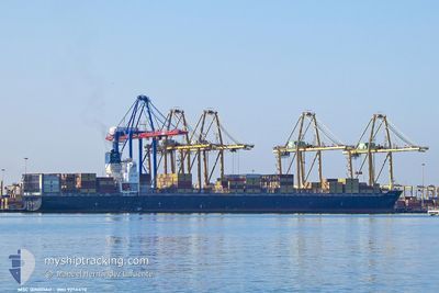
MSC QINGDAO
Cargo
Current Trip
| Time Travelled | 1 day |
|---|---|
| Remaining Time | --- |
| Distance Travelled | 428.98 nm |
| Remaining Distance | --- |
| AVG Speed | 12.6 Knots |
| MAX Speed | 15.5 Knots |
| AVG Wind | 17.2 knots |
| MAX Wind | 36 knots |
| MIN Temp | 5.8°C / 42.44°F |
| MAX Temp | 17.1°C / 62.78°F |
| Draught | 12 m |
| Position Received | 21 h, 9 m ago |
Current Position
| Longitude | 7.21538° |
|---|---|
| Latitude | 42.55747° |
| Status | Under way using engine |
| Speed | 13.7 Knots |
| Course | 216° |
| Area | Mediterranean Sea - Western Basin |
| Station | T-AIS |
| Position Received | 21 h, 9 m ago |
Info
Information
The current position of MSC QINGDAO is in Mediterranean Sea - Western Basin with coordinates 42.55747° / 7.21538° as reported on 2025-12-16 08:33 by AIS to our vessel tracker app. The vessel's current speed is 13.7 Knots and is heading at the port of MALAGA. The estimated time of arrival as calculated by MyShipTracking vessel tracking app is 2025-12-18 13:00 LT
The vessel MSC QINGDAO (IMO: 925647000, MMSI: 636019331) is a Cargo It's sailing under the flag of [LR] Liberia.
In this page you can find informations about the vessels current position, last detected port calls, and current voyage information. If the vessels is not in coverage by AIS you will find the latest position.
The current position of MSC QINGDAO is detected by our AIS receivers and we are not responsible for the reliability of the data. The last position was recorded while the vessel was in Coverage by the Ais receivers of our vessel tracking app.
The current draught of MSC QINGDAO as reported by AIS is 12 meters
Weather
| Temperature | 16.9°C / 62.42°F |
|---|---|
| Wind Speed | 4 knots |
| Direction | 340° NNW |
| Pressure | 1015.6 hPa |
| Humidity | 65.1 % |
| Cloud Coverage | 100 % |
Featured Company
Last Port Calls
| Port | Arrival | Departure | Time In Port |
|---|---|---|---|
| 2025-12-14 20:12 | 2025-12-15 23:08 | 1 d | |
| 2025-12-13 11:29 | 2025-12-14 13:24 | 1 d | |
| 2025-12-10 09:09 | 2025-12-12 07:34 | 1 d | |
| 2025-12-09 07:57 | 2025-12-09 19:47 | 11 h | |
| 2025-12-04 19:05 | 2025-12-06 03:37 | 1 d | |
| 2025-12-03 08:09 | 2025-12-04 01:16 | 17 h | |
| 2025-11-29 04:23 | 2025-12-01 00:23 | 1 d | |
| 2025-11-26 01:31 | 2025-11-27 02:33 | 1 d | |
| 2025-11-21 19:54 | 2025-11-22 23:15 | 1 d | |
| 2025-10-22 06:04 | 2025-10-24 00:28 | 1 d |
Most Visited Ports (Last year)
| Port | Arrivals | |
|---|---|---|
| 4 | ||
| 4 | ||
| 3 | ||
| 3 | ||
| 3 | ||
| 2 |
Last Trips
| Origin | Departure | Destination | Arrival | Distance | |
|---|---|---|---|---|---|
| 2025-12-14 14:24 | 2025-12-14 21:12 | 100.69 nm | |||
| 2025-12-12 08:34 | 2025-12-13 12:29 | 326.19 nm | |||
| 2025-12-09 20:47 | 2025-12-10 10:09 | 171.25 nm | |||
| 2025-12-06 05:37 | 2025-12-09 08:57 | 1057.17 nm | |||
| 2025-12-04 03:16 | 2025-12-04 21:05 | 86.19 nm | |||
| 2025-12-01 01:23 | 2025-12-03 10:09 | 1055.61 nm | |||
| 2025-11-27 03:33 | 2025-11-29 05:23 | 908.52 nm | |||
| 2025-11-22 23:15 | 2025-11-26 02:31 | 1111.49 nm | |||
| 2025-10-24 05:58 | 2025-11-21 19:54 | 10040.29 nm | |||
| 2025-10-21 08:39 | 2025-10-22 11:34 | 421.77 nm |
Events
| Time | Event | Details | Position / Dest | Info |
|---|---|---|---|---|
| 2025-12-16 09:15 | Status Changed | Default Under way using engine |
42.42556 / 7.08792
ESAGP
|
Speed: 13.7 kn Course: 216° |
| 2025-12-16 08:33 | OUT of Coverage |
42.55747 / 7.21538
Mediterranean Sea - Western Basin
ESAGP
|
Speed: 13.7 kn Course: 216° |
|
| 2025-12-16 06:07 | Change Sea Area | French part of the Mediterranean Sea - Western Basin Monégasque part of the Mediterranean Sea - Western Basin |
43.03001 / 7.67718
Mediterranean Sea - Western Basin
ESAGP
|
Speed: 14.7 kn Course: 214.8° |
| 2025-12-16 05:56 | Change Sea Area | Monégasque part of the Mediterranean Sea - Western Basin French part of the Mediterranean Sea - Western Basin |
43.06783 / 7.71347
Mediterranean Sea - Western Basin
ESAGP
|
Speed: 14.8 kn Course: 214.6° |
| 2025-12-16 05:25 | Change Sea Area | French part of the Mediterranean Sea - Western Basin Italian part of the Mediterranean Sea - Western Basin |
43.17044 / 7.81326
Mediterranean Sea - Western Basin
ESAGP
|
Speed: 14.9 kn Course: 216.2° |
| 2025-12-16 03:43 | Detected in Sea | Italian part of the Mediterranean Sea - Western Basin |
43.51462 / 8.15088
Mediterranean Sea - Western Basin
ESAGP
|
Speed: 15.3 kn Course: 217.8° |
| 2025-12-16 02:07 | Status Changed | Under way using engine Default |
43.84294 / 8.47938
ESAGP
|
Speed: 15.4 kn Course: 214° |
| 2025-12-16 02:06 | Status Changed | Default Under way using engine |
43.84818 / 8.48429
ESAGP
|
Speed: 15.4 kn Course: 214.8° |
| 2025-12-15 23:08 | PORT DEPARTURE |
|
44.38396 / 8.94806
ESAGP
|
Speed: 7.5 kn Course: 168° |
| 2025-12-15 22:50 | START Moving |
44.40511 / 8.91822
[IT] GENOVA
|
Speed: 3.1 kn Course: 133° |