
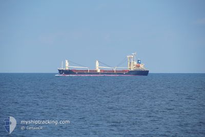
PACIFIC HORSE
Cargo
Current Trip
| Trip Time | 5 days |
|---|---|
| Trip Distance | 1118.50 nm |
| AVG Speed | 9.8 Knots |
| MAX Speed | 13.3 Knots |
| Draught | 7.5 m |
| AVG Wind | 15.4 knots |
| MAX Wind | 36 knots |
| MIN Temp | 1.3°C / 34.34°F |
| MAX Temp | 21.6°C / 70.88°F |
| Position Received | 14 h, 0 m ago |
Current Position
| Longitude | 121.72986° |
|---|---|
| Latitude | 25.19895° |
| Status | Under way using engine |
| Speed | 5.3 Knots |
| Course | 239.3° |
| Area | Eastern China Sea |
| Station | T-AIS |
| Position Received | 14 h, 0 m ago |
Info
Information
The current position of PACIFIC HORSE is in Eastern China Sea with coordinates 25.19895° / 121.72986° as reported on 2025-02-11 18:22 by AIS to our vessel tracker app. The vessel's current speed is 5.3 Knots and is currently inside the port of KEELUNG.
The vessel PACIFIC HORSE (IMO: 9694878, MMSI: 371054000) is a Cargo It's sailing under the flag of [PA] Panama.
In this page you can find informations about the vessels current position, last detected port calls, and current voyage information. If the vessels is not in coverage by AIS you will find the latest position.
The current position of PACIFIC HORSE is detected by our AIS receivers and we are not responsible for the reliability of the data. The last position was recorded while the vessel was in Coverage by the Ais receivers of our vessel tracking app.
The current draught of PACIFIC HORSE as reported by AIS is 7.5 meters
Weather
| Temperature | 19.6°C / 67.28°F |
|---|---|
| Wind Speed | 6 knots |
| Direction | 206° SSW |
| Pressure | 1016.9 hPa |
| Humidity | 83.6 % |
| Cloud Coverage | 100 % |
Featured Company
Last Port Calls
Last Trips
| Origin | Departure | Destination | Arrival | Distance | |
|---|---|---|---|---|---|
| 2025-02-06 15:17 | 2025-02-12 07:21 | 1118.50 nm | |||
| 2025-02-02 06:17 | 2025-02-04 18:35 | 225.39 nm | |||
| 2025-01-17 17:31 | 2025-01-31 07:37 | 791.14 nm | |||
| 2024-12-20 01:21 | 2025-01-15 07:05 | 3276.74 nm | |||
| 2024-12-06 11:06 | 2024-12-17 12:21 | 2881.89 nm | |||
| 2024-11-25 10:56 | 2024-12-03 05:44 | 907.95 nm |
Events
| Time | Event | Details | Position / Dest | Info |
|---|---|---|---|---|
| 2025-02-11 23:45 | STOP Moving |
25.13822 / 121.74867
[TW] KEELUNG
|
Speed: 0.3 kn Course: 237° |
|
| 2025-02-11 23:21 | PORT ARRIVAL |
|
25.15882 / 121.75407
[TW] KEELUNG
|
Speed: 9.2 kn Course: 141° |
| 2025-02-11 23:01 | START Moving | 3.32 nm, North West of KEELUNG |
25.19463 / 121.72245
TW KEL
|
Speed: 4.1 kn Course: 132° |
| 2025-02-11 18:52 | STOP Moving | 3.16 nm, North West of KEELUNG |
25.18882 / 121.71790
TW KEL
|
Speed: 0.2 kn Course: 129° |
| 2025-02-11 18:29 | Status Changed | Default Under way using engine |
25.19239 / 121.72237
TW KEL
|
Speed: 5.3 kn Course: 239.3° |
| 2025-02-11 18:22 | OUT of Coverage |
25.19895 / 121.72986
Eastern China Sea
TW KEL
|
Speed: 5.3 kn Course: 239.3° |
|
| 2025-02-11 18:13 | Draught Changed | 7.5 6.5 |
25.20682 / 121.74116
TW KEL
|
Speed: 5.2 kn Course: 227.9° |
| 2025-02-11 18:13 | Destination Changed | TW KEL JP NGO |
25.20682 / 121.74116
TW KEL
|
Speed: 5.2 kn Course: 227.9° |
| 2025-02-11 18:13 | ETA Changed | 2025/02/12 02:00 2025/02/03 06:00 |
25.20682 / 121.74116
TW KEL
|
Speed: 5.2 kn Course: 227.9° |
| 2025-02-11 17:53 | Change Sea Area | Taiwanese part of the Eastern China Sea Japanese part of the Philippine Sea |
25.22840 / 121.77625
Eastern China Sea
|
Speed: 9.7 kn Course: 241.1° |