
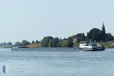
ROXY
Other Type
Current Trip
| Trip Time | 2 days |
|---|---|
| Trip Distance | 316.97 nm |
| AVG Speed | 4.8 Knots |
| MAX Speed | 7.7 Knots |
| Draught | 0 m |
| AVG Wind | 5.6 knots |
| MAX Wind | 9 knots |
| MIN Temp | 6.7°C / 44.06°F |
| MAX Temp | 18°C / 64.4°F |
| Position Received | 1 d ago |
Current Position
| Longitude | 8.45360° |
|---|---|
| Latitude | 49.33167° |
| Status | Under way using engine |
| Speed | 4.3 Knots |
| Course | 221.5° |
| Area | North Sea |
| Station | T-AIS |
| Position Received | 1 d ago |
Info
Information
The current position of ROXY is in North Sea with coordinates 49.33167° / 8.45360° as reported on 2026-02-27 07:40 by AIS to our vessel tracker app. The vessel's current speed is 4.3 Knots and is currently inside the port of KARLSRUHE.
The vessel ROXY (MMSI: 205556090) is a Other Type It's sailing under the flag of [BE] Belgium.
In this page you can find informations about the vessels current position, last detected port calls, and current voyage information. If the vessels is not in coverage by AIS you will find the latest position.
The current position of ROXY is detected by our AIS receivers and we are not responsible for the reliability of the data. The last position was recorded while the vessel was in Coverage by the Ais receivers of our vessel tracking app.
Weather
| Temperature | 17.8°C / 64.04°F |
|---|---|
| Wind Speed | 6 knots |
| Direction | 220° SW |
| Pressure | 1018.7 hPa |
| Humidity | 58.1 % |
| Cloud Coverage | 6 % |
Featured Company
Last Port Calls
| Port | Arrival | Departure | Time In Port |
|---|---|---|---|
| 2026-02-27 13:48 | |||
| 2026-02-24 14:54 | 2026-02-24 15:53 | 58 m | |
| 2026-02-23 23:31 | 2026-02-24 11:13 | 11 h | |
| 2026-02-23 18:15 | 2026-02-23 18:35 | 19 m | |
| 2026-02-23 17:24 | 2026-02-23 17:50 | 26 m | |
| 2026-02-22 15:21 | 2026-02-23 15:03 | 23 h | |
| 2026-02-21 07:30 | 2026-02-22 09:16 | 1 d | |
| 2026-02-19 17:58 | 2026-02-20 06:13 | 12 h | |
| 2026-02-16 10:49 | 2026-02-16 13:11 | 2 h | |
| 2026-02-14 10:20 | 2026-02-16 06:24 | 1 d |
Last Trips
| Origin | Departure | Destination | Arrival | Distance | |
|---|---|---|---|---|---|
| 2026-02-24 16:53 | 2026-02-27 14:48 | 316.97 nm | |||
| 2026-02-24 12:13 | 2026-02-24 15:54 | 24.74 nm | |||
| 2026-02-23 19:35 | 2026-02-24 00:31 | 46.87 nm | |||
| 2026-02-23 18:50 | 2026-02-23 19:15 | 2.75 nm | |||
| 2026-02-23 16:03 | 2026-02-23 18:24 | 19.67 nm | |||
| 2026-02-22 10:16 | 2026-02-22 16:21 | 35.56 nm | |||
| 2026-02-20 07:13 | 2026-02-21 08:30 | 121.97 nm | |||
| 2026-02-16 14:11 | 2026-02-19 18:58 | 202.46 nm | |||
| 2026-02-16 07:24 | 2026-02-16 11:49 | 17.65 nm | |||
| 2026-02-14 05:07 | 2026-02-14 11:20 | 27.95 nm |
Events
| Time | Event | Details | Position / Dest | Info |
|---|---|---|---|---|
| 2026-02-27 13:48 | PORT ARRIVAL |
|
49.01667 / 8.31167
[DE] KARLSRUHE
|
Speed: 3 kn Course: -1° |
| 2026-02-27 08:01 | Status Changed | Default Under way using engine |
49.31167 / 8.46333
HAFEN KARLSRUHE
|
Speed: 4.3 kn Course: 221.5° |
| 2026-02-27 07:40 | OUT of Coverage |
49.33167 / 8.45360
North Sea
HAFEN KARLSRUHE
|
Speed: 4.3 kn Course: 221.5° |
|
| 2026-02-26 16:12 | Status Changed | Under way using engine Default |
50.07314 / 7.77348
HAFEN KARLSRUHE
|
Speed: 4 kn Course: -1° |
| 2026-02-26 16:12 | IN Coverage |
50.07314 / 7.77348
North Sea
HAFEN KARLSRUHE
|
Speed: 4.6 kn Course: 160.8° |
|
| 2026-02-26 06:50 | Status Changed | Default Under way using engine |
50.48833 / 7.32833
HAFEN KARLSRUHE
|
Speed: 4.7 kn Course: 160.2° |
| 2026-02-26 06:24 | OUT of Coverage |
50.51588 / 7.29847
North Sea
HAFEN KARLSRUHE
|
Speed: 4.7 kn Course: 160.2° |
|
| 2026-02-26 05:01 | Status Changed | Under way using engine Default |
50.58913 / 7.21369
HAFEN KARLSRUHE
|
Speed: 4 kn Course: -1° |
| 2026-02-26 04:47 | IN Coverage |
50.58913 / 7.21369
North Sea
HAFEN KARLSRUHE
|
Speed: 3.9 kn Course: 148.4° |
|
| 2026-02-26 03:48 | OUT of Coverage |
50.67007 / 7.19248
North Sea
HAFEN KARLSRUHE
|
Speed: 4.3 kn Course: 157° |