
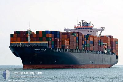
SANTA VIOLA
Container Ship
Current Trip
| Time Travelled | 1 day |
|---|---|
| Remaining Time | --- |
| Distance Travelled | 316.38 nm |
| Remaining Distance | --- |
| AVG Speed | 9.1 Knots |
| MAX Speed | 17.2 Knots |
| AVG Wind | 14.1 knots |
| MAX Wind | 18.9 knots |
| MIN Temp | 0.6°C / 33.08°F |
| MAX Temp | 6°C / 42.8°F |
| Draught | 11.8 m |
| Position Received | 14 m ago |
Current Position
| Longitude | -73.46638° |
|---|---|
| Latitude | 40.50171° |
| Status | At anchor |
| Speed | 0.2 Knots |
| Course | 82° |
| Area | North Atlantic Ocean |
| Station | T-AIS |
| Position Received | 14 m ago |
Info
Information
The current position of SANTA VIOLA is in North Atlantic Ocean with coordinates 40.50171° / -73.46638° as reported on 2025-02-12 19:22 by AIS to our vessel tracker app. The vessel's current speed is 0.2 Knots
The vessel SANTA VIOLA (IMO: 9295373, MMSI: 256570000) is a Container Ship that was built in 2005 ( 20 years old ). It's sailing under the flag of [MT] Malta.
In this page you can find informations about the vessels current position, last detected port calls, and current voyage information. If the vessels is not in coverage by AIS you will find the latest position.
The current position of SANTA VIOLA is detected by our AIS receivers and we are not responsible for the reliability of the data. The last position was recorded while the vessel was in Coverage by the Ais receivers of our vessel tracking app.
The current draught of SANTA VIOLA as reported by AIS is 11.8 meters
Weather
| Temperature | 1.9°C / 35.42°F |
|---|---|
| Wind Speed | 18 knots |
| Direction | 63° ENE |
| Pressure | 1024 hPa |
| Humidity | 82.3 % |
| Cloud Coverage | 100 % |
Featured Company
Last Port Calls
| Port | Arrival | Departure | Time In Port |
|---|---|---|---|
| 2025-02-10 08:08 | 2025-02-11 08:59 | 1 d | |
| 2025-01-28 06:50 | 2025-01-29 21:52 | 1 d | |
| 2025-01-23 02:51 | 2025-01-25 02:59 | 2 d | |
| 2025-01-19 03:40 | 2025-01-20 10:29 | 1 d | |
| 2025-01-05 14:02 | 2025-01-07 04:24 | 1 d | |
| 2025-01-03 02:24 | 2025-01-03 14:00 | 11 h | |
| 2024-12-27 09:50 | 2024-12-30 00:41 | 2 d | |
| 2024-12-12 05:55 | 2024-12-14 20:51 | 2 d | |
| 2024-12-09 04:04 | 2024-12-11 10:23 | 2 d | |
| 2024-12-03 19:58 | 2024-12-05 05:13 | 1 d |
Most Visited Ports (Last year)
| Port | Arrivals | |
|---|---|---|
| 9 | ||
| 8 | ||
| 8 | ||
| 8 | ||
| 8 | ||
| 7 |
Last Trips
| Origin | Departure | Destination | Arrival | Distance | |
|---|---|---|---|---|---|
| 2025-01-29 22:52 | 2025-02-10 03:08 | 4264.42 nm | |||
| 2025-01-25 03:59 | 2025-01-28 07:50 | 127.66 nm | |||
| 2025-01-20 10:29 | 2025-01-23 03:51 | 491.83 nm | |||
| 2025-01-06 23:24 | 2025-01-19 03:40 | 3702.24 nm | |||
| 2025-01-03 09:00 | 2025-01-05 09:02 | 290.37 nm | |||
| 2024-12-29 19:41 | 2025-01-02 21:24 | 299.62 nm | |||
| 2024-12-14 21:51 | 2024-12-27 04:50 | 3712.05 nm | |||
| 2024-12-11 11:23 | 2024-12-12 06:55 | 302.59 nm | |||
| 2024-12-05 06:13 | 2024-12-09 05:04 | 284.75 nm | |||
| 2024-12-03 08:25 | 2024-12-03 20:58 | 116.09 nm |
Events
| Time | Event | Details | Position / Dest | Info |
|---|---|---|---|---|
| 2025-02-12 18:55 | Status Changed | At anchor Default |
40.50208 / -73.46658
USORF>USNYC
|
Speed: 0.2 kn Course: 78° |
| 2025-02-12 18:43 | Status Changed | Default At anchor |
40.50161 / -73.46632
USORF>USNYC
|
Speed: 0.6 kn Course: 70° |
| 2025-02-12 18:28 | Status Changed | At anchor Default |
40.50200 / -73.46655
USORF>USNYC
|
Speed: 0.3 kn Course: 66° |
| 2025-02-12 18:16 | Status Changed | Default At anchor |
40.50187 / -73.46622
USORF>USNYC
|
Speed: 0.5 kn Course: 98° |
| 2025-02-12 18:04 | Status Changed | At anchor Default |
40.50176 / -73.46640
USORF>USNYC
|
Speed: 0.2 kn Course: 79° |
| 2025-02-12 17:55 | Status Changed | Default At anchor |
40.50145 / -73.46603
USORF>USNYC
|
Speed: 0.3 kn Course: 73° |
| 2025-02-12 17:40 | Status Changed | At anchor Default |
40.50162 / -73.46635
USORF>USNYC
|
Speed: 0.6 kn Course: 60° |
| 2025-02-12 17:37 | Status Changed | Default At anchor |
40.50135 / -73.46622
USORF>USNYC
|
Speed: 0.1 kn Course: 64° |
| 2025-02-12 17:34 | Status Changed | At anchor Default |
40.50126 / -73.46610
USORF>USNYC
|
Speed: 0.5 kn Course: 64° |
| 2025-02-12 17:16 | Status Changed | Default At anchor |
40.50178 / -73.46635
USORF>USNYC
|
Speed: 0.2 kn Course: 77° |