
SKYFALL
Cargo
Current Trip
| Time Travelled | 2 days |
|---|---|
| Remaining Time | 18 h, 9 mins |
| Distance Travelled | 158.43 nm |
| Remaining Distance | 102.00 nm |
| AVG Speed | 5.6 Knots |
| MAX Speed | 8.3 Knots |
| AVG Wind | 11.1 knots |
| MAX Wind | 18 knots |
| MIN Temp | -0.8°C / 30.56°F |
| MAX Temp | 5.3°C / 41.54°F |
| Draught | 2 m |
| Position Received | 1 h, 15 m ago |
Current Position
| Longitude | 7.29836° |
|---|---|
| Latitude | 50.51648° |
| Status | Under way using engine |
| Speed | 4.2 Knots |
| Course | 158° |
| Area | North Sea |
| Station | T-AIS |
| Position Received | 1 h, 15 m ago |
Info
Information
The current position of SKYFALL is in North Sea with coordinates 50.51648° / 7.29836° as reported on 2026-01-09 15:26 by AIS to our vessel tracker app. The vessel's current speed is 4.2 Knots and is heading at the port of MANNHEIM. The estimated time of arrival as calculated by MyShipTracking vessel tracking app is 2026-01-10 11:51 LT
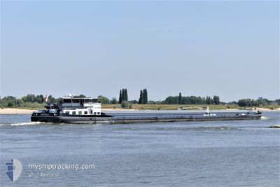
The vessel SKYFALL (MMSI: 244660175) is a Cargo It's sailing under the flag of [NL] Netherlands.
In this page you can find informations about the vessels current position, last detected port calls, and current voyage information. If the vessels is not in coverage by AIS you will find the latest position.
The current position of SKYFALL is detected by our AIS receivers and we are not responsible for the reliability of the data. The last position was recorded while the vessel was in Coverage by the Ais receivers of our vessel tracking app.
The current draught of SKYFALL as reported by AIS is 2 meters
Weather
| Temperature | 1.7°C / 35.06°F |
|---|---|
| Wind Speed | 13 knots |
| Direction | 221° SW |
| Pressure | 987.7 hPa |
| Humidity | 95.9 % |
| Cloud Coverage | 100 % |
Featured Company
Last Port Calls
| Port | Arrival | Departure | Time In Port |
|---|---|---|---|
| 2026-01-07 13:35 | 2026-01-07 14:34 | 59 m | |
| 2026-01-07 06:52 | 2026-01-07 09:45 | 2 h | |
| 2026-01-06 12:06 | 2026-01-06 23:42 | 11 h | |
| 2026-01-04 15:44 | 2026-01-06 11:40 | 1 d | |
| 2026-01-02 15:13 | 2026-01-02 15:36 | 22 m | |
| 2026-01-01 21:29 | 2026-01-02 06:25 | 8 h | |
| 2026-01-01 11:06 | |||
| 2025-12-21 23:49 | 2025-12-28 17:28 | 6 d | |
| 2025-12-18 19:33 | 2025-12-18 20:40 | 1 h | |
| 2025-12-17 12:18 | 2025-12-17 12:39 | 21 m |
Last Trips
| Origin | Departure | Destination | Arrival | Distance | |
|---|---|---|---|---|---|
| 2026-01-07 09:45 | 2026-01-07 13:35 | 30.17 nm | |||
| 2026-01-06 23:42 | 2026-01-07 06:52 | 56.12 nm | |||
| 2026-01-06 11:40 | 2026-01-06 12:06 | 0.54 nm | |||
| 2026-01-02 15:36 | 2026-01-04 15:44 | 76.93 nm | |||
| 2026-01-02 06:25 | 2026-01-02 15:13 | 75.08 nm | |||
| 2026-01-01 11:06 | 2026-01-01 21:29 | 82.04 nm | |||
| 2025-12-18 20:40 | 2025-12-21 23:49 | 263.99 nm | |||
| 2025-12-17 12:39 | 2025-12-18 19:33 | 139.30 nm | |||
| 2025-12-16 23:46 | 2025-12-17 12:18 | 43.98 nm | |||
| 2025-12-16 09:28 | 2025-12-16 11:57 | 19.68 nm |
Events
| Time | Event | Details | Position / Dest | Info |
|---|---|---|---|---|
| 2026-01-09 15:26 | OUT of Coverage |
50.51648 / 7.29836
North Sea
|
Speed: 4.2 kn Course: 157.9° |
|
| 2026-01-09 14:12 | Status Changed | Under way using engine Default |
50.59775 / 7.21101
MANNHEIM
|
Speed: 6 kn Course: 177° |
| 2026-01-09 13:45 | Status Changed | Default Under way using engine |
50.64167 / 7.21167
MANNHEIM
|
Speed: 5.3 kn Course: 152.5° |
| 2026-01-09 09:11 | Status Changed | Under way using engine Default |
50.89833 / 6.99050
MANNHEIM
|
Speed: 4.7 kn Course: 139° |
| 2026-01-09 09:03 | Status Changed | Default Under way using engine |
50.90677 / 6.97975
MANNHEIM
|
Speed: 4.9 kn Course: 156° |
| 2026-01-09 05:13 | Status Changed | Under way using engine Default |
51.15167 / 6.85521
MANNHEIM
|
Speed: Course: -1° |
| 2026-01-09 05:13 | START Moving | 0.92 nm, South East of HOLTHAUSEN |
51.15167 / 6.85521
MANNHEIM
|
Speed: 4.7 kn Course: 215° |
| 2026-01-09 05:05 | IN Coverage |
51.14476 / 6.84884
North Sea
|
Speed: 5.4 kn Course: 198° |
|
| 2026-01-08 19:09 | STOP Moving | 0.94 nm, South East of HOLTHAUSEN |
51.15333 / 6.85833
MANNHEIM
|
Speed: Course: -1° |
| 2026-01-08 17:37 | OUT of Coverage |
51.18122 / 6.75467
North Sea
|
Speed: 5.7 kn Course: 72.8° |