
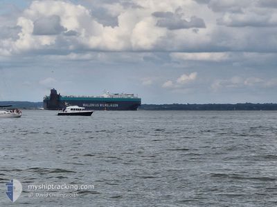
TONSBERG
Vehicles Carrier
Current Trip
| Time Travelled | 5 days |
|---|---|
| Remaining Time | 3 days |
| Distance Travelled | 1985.47 nm |
| Remaining Distance | 1799.17 nm |
| AVG Speed | 14.6 Knots |
| MAX Speed | 19.4 Knots |
| AVG Wind | 19 knots |
| MAX Wind | 34 knots |
| MIN Temp | -1.1°C / 30.02°F |
| MAX Temp | 16.1°C / 60.98°F |
| Draught | 9.2 m |
| Position Received | 5 d ago |
Current Position
| Longitude | -73.24416° |
|---|---|
| Latitude | 40.38242° |
| Status | Under way using engine |
| Speed | 14.2 Knots |
| Course | 97.7° |
| Area | North Atlantic Ocean |
| Station | T-AIS |
| Position Received | 5 d ago |
Info
Information
The current position of TONSBERG is in North Atlantic Ocean with coordinates 40.38242° / -73.24416° as reported on 2025-02-03 02:23 by AIS to our vessel tracker app. The vessel's current speed is 14.2 Knots and is heading at the port of BREMERHAVEN. The estimated time of arrival as calculated by MyShipTracking vessel tracking app is 2025-02-12 06:04 LT
The vessel TONSBERG (IMO: 9515383, MMSI: 249904000) is a Vehicles Carrier that was built in 2011 ( 14 years old ). It's sailing under the flag of [MT] Malta.
In this page you can find informations about the vessels current position, last detected port calls, and current voyage information. If the vessels is not in coverage by AIS you will find the latest position.
The current position of TONSBERG is detected by our AIS receivers and we are not responsible for the reliability of the data. The last position was recorded while the vessel was in Coverage by the Ais receivers of our vessel tracking app.
The current draught of TONSBERG as reported by AIS is 9.2 meters
Weather
| Temperature | 7.4°C / 45.32°F |
|---|---|
| Wind Speed | 4 knots |
| Direction | 279° W |
| Pressure | 1028.1 hPa |
| Humidity | 52.6 % |
| Cloud Coverage | 83 % |
Featured Company
Last Port Calls
| Port | Arrival | Departure | Time In Port |
|---|---|---|---|
| 2025-02-01 09:31 | 2025-02-02 22:46 | 1 d | |
| 2025-01-28 11:37 | 2025-01-29 05:43 | 18 h | |
| 2025-01-25 22:13 | 2025-01-27 23:16 | 2 d | |
| 2025-01-24 08:38 | 2025-01-25 09:12 | 1 d | |
| 2025-01-20 10:43 | 2025-01-21 22:23 | 1 d | |
| 2025-01-14 00:59 | 2025-01-14 20:31 | 19 h | |
| 2024-12-18 23:53 | 2024-12-19 10:21 | 10 h | |
| 2024-12-15 03:43 | 2024-12-16 04:45 | 1 d | |
| 2024-12-12 22:44 | 2024-12-14 04:48 | 1 d | |
| 2024-12-09 23:20 | 2024-12-10 12:01 | 12 h |
Most Visited Ports (Last year)
| Port | Arrivals | |
|---|---|---|
| 4 | ||
| 3 | ||
| 3 | ||
| 3 | ||
| 3 | ||
| 3 |
Last Trips
| Origin | Departure | Destination | Arrival | Distance | |
|---|---|---|---|---|---|
| 2025-01-29 00:43 | 2025-02-01 04:31 | 652.13 nm | |||
| 2025-01-27 18:16 | 2025-01-28 06:37 | 169.82 nm | |||
| 2025-01-25 04:12 | 2025-01-25 17:13 | 34.83 nm | |||
| 2025-01-21 17:23 | 2025-01-24 03:38 | 737.58 nm | |||
| 2025-01-14 15:31 | 2025-01-20 05:43 | 1923.36 nm | |||
| 2024-12-19 19:21 | 2025-01-13 19:59 | 8445.81 nm | |||
| 2024-12-16 13:45 | 2024-12-19 08:53 | 1179.42 nm | |||
| 2024-12-14 12:48 | 2024-12-15 12:43 | 289.48 nm | |||
| 2024-12-10 20:01 | 2024-12-13 06:44 | 683.13 nm | |||
| 2024-12-03 20:21 | 2024-12-10 07:20 | 2375.63 nm |
Events
| Time | Event | Details | Position / Dest | Info |
|---|---|---|---|---|
| 2025-02-03 02:29 | Status Changed | Default Under way using engine |
40.37954 / -73.21546
DE BRV
|
Speed: 14.2 kn Course: 97.7° |
| 2025-02-03 02:23 | OUT of Coverage |
40.38242 / -73.24416
North Atlantic Ocean
DE BRV
|
Speed: 14.2 kn Course: 97.7° |
|
| 2025-02-02 22:46 | PORT DEPARTURE |
|
40.57728 / -74.03496
DE BRV
|
Speed: 13.4 kn Course: 167° |
| 2025-02-02 21:07 | START Moving |
40.69352 / -74.13842
[US] NEW YORK
|
Speed: 3.1 kn Course: 322° |
|
| 2025-02-02 20:48 | Status Changed | Under way using engine Moored |
40.69640 / -74.14188
[US] NEW YORK
|
Speed: Course: 294° |
| 2025-02-02 17:51 | ETA Changed | 2025/02/12 09:00 2025/02/12 20:00 |
40.69637 / -74.14194
[US] NEW YORK
|
Speed: Course: 294° |
| 2025-02-02 11:31 | Status Changed | Moored Default |
40.69638 / -74.14194
[US] NEW YORK
|
Speed: Course: 294° |
| 2025-02-02 11:25 | Status Changed | Default Moored |
40.69638 / -74.14194
[US] NEW YORK
|
Speed: Course: 294° |
| 2025-02-01 17:04 | Status Changed | Moored Default |
40.69636 / -74.14191
[US] NEW YORK
|
Speed: Course: 294° |
| 2025-02-01 17:01 | Status Changed | Default Moored |
40.69637 / -74.14192
[US] NEW YORK
|
Speed: Course: 294° |