
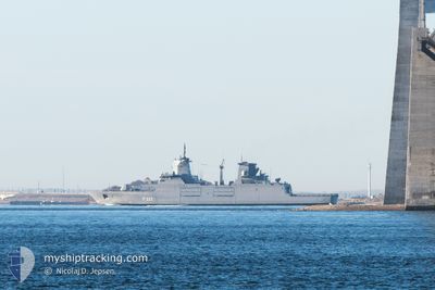
UN WARSHIP F222
Military ops
Current Trip
-
| Time Travelled | 3 days |
|---|---|
| Remaining Time | --- |
| Distance Travelled | 452.65 nm |
| Remaining Distance | --- |
| AVG Speed | 7.2 Knots |
| MAX Speed | 7.2 Knots |
| AVG Wind | 12.3 knots |
| MAX Wind | 26 knots |
| MIN Temp | 11.4°C / 52.52°F |
| MAX Temp | 19.6°C / 67.28°F |
| Draught | 6.3 m |
| Position Received | 1 m ago |
Current Position
| Longitude | 34.72875° |
|---|---|
| Latitude | 33.46532° |
| Status | Under way using engine |
| Speed | 3.9 Knots |
| Course | 90° |
| Area | Mediterranean Sea - Eastern Basin |
| Station | T-AIS |
| Position Received | 1 m ago |
Information
The current position of UN WARSHIP F222 is in Mediterranean Sea - Eastern Basin with coordinates 33.46532° / 34.72875° as reported on 2025-03-22 05:56 by AIS to our vessel tracker app. The vessel's current speed is 3.9 Knots
The vessel UN WARSHIP F222 (MMSI: 211920000) is a Military ops It's sailing under the flag of [DE] Germany.
In this page you can find informations about the vessels current position, last detected port calls, and current voyage information. If the vessels is not in coverage by AIS you will find the latest position.
The current position of UN WARSHIP F222 is detected by our AIS receivers and we are not responsible for the reliability of the data. The last position was recorded while the vessel was in Coverage by the Ais receivers of our vessel tracking app.
The current draught of UN WARSHIP F222 as reported by AIS is 6.3 meters
Weather
| Temperature | 13.3°C / 55.94°F |
|---|---|
| Wind Speed | 2 knots |
| Direction | 94° E |
| Pressure | 1020.2 hPa |
| Humidity | 49.3 % |
| Cloud Coverage | 98 % |
Featured Company
Last Port Calls
| Port | Arrival | Departure | Time In Port |
|---|---|---|---|
| 2025-03-13 07:47 | 2025-03-18 08:41 | 5 d | |
| 2025-03-03 07:31 | 2025-03-07 08:20 | 4 d | |
| 2025-02-18 08:02 | 2025-02-24 08:11 | 6 d | |
| 2025-02-06 08:13 | 2025-02-10 07:38 | 3 d | |
| 2025-01-28 07:43 | 2025-01-28 11:21 | 3 h | |
| 2025-01-23 07:36 | 2025-01-27 08:15 | 4 d | |
| 2025-01-15 07:39 | 2025-01-15 13:25 | 5 h | |
| 2025-01-13 12:44 |
Last Trips
| Origin | Departure | Destination | Arrival | Distance | |
|---|---|---|---|---|---|
| 2025-03-07 10:20 | 2025-03-13 09:47 | 664.15 nm | |||
| 2025-02-24 10:11 | 2025-03-03 09:31 | 984.92 nm | |||
| 2025-02-10 10:38 | 2025-02-18 10:02 | 1117.98 nm | |||
| 2025-01-28 13:21 | 2025-02-06 11:13 | 1080.41 nm | |||
| 2025-01-27 10:15 | 2025-01-28 09:43 | 162.34 nm | |||
| 2025-01-15 15:25 | 2025-01-23 09:36 | 1043.75 nm | |||
| 2025-01-13 14:44 | 2025-01-15 09:39 | 259.73 nm |
Events
| Time | Event | Details | Position / Dest | Info |
|---|---|---|---|---|
| 2025-03-22 04:23 | IN Coverage |
33.46027 / 34.60955
Mediterranean Sea - Eastern Basin
|
Speed: 3.9 kn Course: 87° |
|
| 2025-03-21 23:12 | OUT of Coverage |
33.44117 / 34.83452
Mediterranean Sea - Eastern Basin
|
Speed: 2.7 kn Course: 320.5° |
|
| 2025-03-21 21:11 | IN Coverage |
33.44852 / 34.67928
Mediterranean Sea - Eastern Basin
|
Speed: 3.9 kn Course: 89.7° |
|
| 2025-03-21 18:39 | OUT of Coverage |
33.43987 / 34.78853
Mediterranean Sea - Eastern Basin
|
Speed: 3.8 kn Course: 357° |
|
| 2025-03-21 18:39 | IN Coverage |
33.43987 / 34.78853
Mediterranean Sea - Eastern Basin
|
Speed: 3.8 kn Course: 357° |
|
| 2025-03-21 17:27 | OUT of Coverage |
33.34955 / 34.78780
Mediterranean Sea - Eastern Basin
|
Speed: 7.9 kn Course: 1.9° |
|
| 2025-03-21 11:06 | IN Coverage |
33.36757 / 34.60798
Mediterranean Sea - Eastern Basin
|
Speed: 4.3 kn Course: 49.9° |
|
| 2025-03-21 09:48 | OUT of Coverage |
33.34898 / 34.73968
Mediterranean Sea - Eastern Basin
|
Speed: 4.3 kn Course: 231.2° |
|
| 2025-03-21 08:35 | IN Coverage |
33.40835 / 34.63787
Mediterranean Sea - Eastern Basin
|
Speed: 6.2 kn Course: 123° |
|
| 2025-03-21 06:04 | OUT of Coverage |
33.49872 / 34.59103
Mediterranean Sea - Eastern Basin
|
Speed: 6.6 kn Course: 157.7° |