

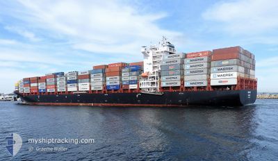
WIELAND
Cargo A

Current Trip
| Time Travelled | 9 days |
|---|---|
| Remaining Time | --- |
| Distance Travelled | 2984.45 nm |
| Remaining Distance | --- |
| AVG Speed | 13.5 Knots |
| MAX Speed | 16.4 Knots |
| AVG Wind | 12.8 knots |
| MAX Wind | 19.8 knots |
| MIN Temp | 24.1°C / 75.38°F |
| MAX Temp | 28.6°C / 83.48°F |
| Draught | 9.2 m |
| Position Received | 8 d ago |
Current Position
| Longitude | -75.66617° |
|---|---|
| Latitude | 25.46733° |
| Status | Under way using engine |
| Speed | 13.3 Knots |
| Course | 119° |
| Area | North Atlantic Ocean |
| Station | T-AIS |
| Position Received | 8 d ago |
Information
The current position of WIELAND is in North Atlantic Ocean with coordinates 25.46733° / -75.66617° as reported on 2025-05-14 15:22 by AIS to our vessel tracker app. The vessel's current speed is 13.3 Knots and is heading at the port of ITAPOA. The estimated time of arrival as calculated by MyShipTracking vessel tracking app is 2025-05-29 19:00 LT
The vessel WIELAND (IMO: 9654464, MMSI: 255805563) is a Cargo A It's sailing under the flag of [PT] Portugal.
In this page you can find informations about the vessels current position, last detected port calls, and current voyage information. If the vessels is not in coverage by AIS you will find the latest position.
The current position of WIELAND is detected by our AIS receivers and we are not responsible for the reliability of the data. The last position was recorded while the vessel was in Coverage by the Ais receivers of our vessel tracking app.
The current draught of WIELAND as reported by AIS is 9.2 meters
Weather
| Temperature | 27.5°C / 81.5°F |
|---|---|
| Wind Speed | 15 knots |
| Direction | 103° ESE |
| Pressure | 1013.4 hPa |
| Humidity | 79.8 % |
| Cloud Coverage | 10 % |


Featured Company
Last Port Calls
| Port | Arrival | Departure | Time In Port |
|---|---|---|---|
| 2025-05-13 20:38 | 2025-05-13 20:43 | 5 m | |
| 2025-05-13 04:35 | 2025-05-13 20:28 | 15 h | |
| 2025-05-13 04:06 | 2025-05-13 04:19 | 12 m | |
| 2025-05-10 13:39 | 2025-05-11 14:24 | 1 d | |
| 2025-05-07 20:32 | 2025-05-08 08:02 | 11 h | |
| 2025-05-05 20:24 | 2025-05-07 01:03 | 1 d | |
| 2025-04-27 03:17 | 2025-04-27 16:33 | 13 h | |
| 2025-04-18 08:14 | 2025-04-18 08:49 | 34 m | |
| 2025-04-08 08:17 | 2025-04-09 23:09 | 1 d | |
| 2025-03-25 05:41 | 2025-03-26 06:25 | 1 d |
Last Trips
| Origin | Departure | Destination | Arrival | Distance | |
|---|---|---|---|---|---|
| 2025-05-13 16:28 | 2025-05-13 16:38 | 0.44 nm | |||
| 2025-05-13 00:19 | 2025-05-13 00:35 | 0.73 nm | |||
| 2025-05-11 10:24 | 2025-05-13 00:06 | 443.12 nm | |||
| 2025-05-08 04:02 | 2025-05-10 09:39 | 621.17 nm | |||
| 2025-05-06 21:03 | 2025-05-07 16:32 | 249.35 nm | |||
| 2025-04-27 13:33 | 2025-05-05 16:24 | 3302.03 nm | |||
| 2025-04-18 05:49 | 2025-04-27 00:17 | 2088.83 nm | |||
| 2025-04-09 20:09 | 2025-04-18 05:14 | 1226.98 nm | |||
| 2025-03-26 02:25 | 2025-04-08 05:17 | 4806.46 nm | |||
| 2025-03-25 01:29 | 2025-03-25 01:41 | 0.64 nm |
Events
| Time | Event | Details | Position / Dest | Info |
|---|---|---|---|---|
| 2025-05-14 15:35 | Status Changed | Default Under way using engine |
25.44283 / -75.61717
BRIOA
|
Speed: 13.3 kn Course: 119° |
| 2025-05-14 15:22 | OUT of Coverage |
25.46733 / -75.66617
North Atlantic Ocean
BRIOA
|
Speed: 13.3 kn Course: 119° |
|
| 2025-05-14 15:22 | Status Changed | Under way using engine Default |
25.46767 / -75.66650
BRIOA
|
Speed: 13.3 kn Course: 120° |
| 2025-05-14 15:12 | IN Coverage |
25.46733 / -75.66617
North Atlantic Ocean
BRIOA
|
Speed: 13.3 kn Course: 119° |
|
| 2025-05-14 14:37 | Status Changed | Default Under way using engine |
25.55067 / -75.82484
BRIOA
|
Speed: 13.4 kn Course: 118° |
| 2025-05-14 14:06 | Status Changed | Under way using engine Default |
25.60483 / -75.93466
BRIOA
|
Speed: 13.5 kn Course: 119° |
| 2025-05-14 14:06 | OUT of Coverage |
25.60483 / -75.93466
North Atlantic Ocean
BRIOA
|
Speed: 13.4 kn Course: 118° |
|
| 2025-05-14 14:03 | Status Changed | Default Under way using engine |
25.61017 / -75.94550
BRIOA
|
Speed: 13.4 kn Course: 118° |
| 2025-05-14 13:40 | Status Changed | Under way using engine Default |
25.65183 / -76.03016
BRIOA
|
Speed: 13.3 kn Course: 119° |
| 2025-05-14 13:40 | IN Coverage |
25.65183 / -76.03016
North Atlantic Ocean
BRIOA
|
Speed: 13.3 kn Course: 118° |