
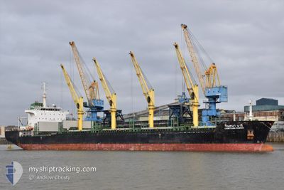
CHINTANA NAREE
Bulk Carrier
Current Trip
| Time Travelled | 9 days |
|---|---|
| Remaining Time | 12 days |
| Distance Travelled | 2526.79 nm |
| Remaining Distance | 3254.93 nm |
| AVG Speed | 10.1 Noeuds |
| MAX Speed | 12.5 Noeuds |
| AVG Wind | 8.3 knots |
| MAX Wind | 27 knots |
| MIN Temp | 13.4°C / 56.12°F |
| MAX Temp | 17.4°C / 63.32°F |
| Tirant d eau | 9.1 m |
| Position reçue | 2 d depuis |
Current Position
| Longitude | -7.44529° |
|---|---|
| Latitude | 35.72505° |
| Etat | Under way using engine |
| Vitesse | 11.4 Noeuds |
| Parcours | 256° |
| Zone | North Atlantic Ocean |
| Station | T-AIS |
| Position reçue | 2 d depuis |
Info
Information
The current position of CHINTANA NAREE is in North Atlantic Ocean with coordinates 35.72505° / -7.44529° as reported on 2025-02-21 09:38 by AIS to our vessel tracker app. The vessel's current speed is 11.4 Noeuds and is heading at the port of CAPE CANAVERAL. The estimated time of arrival as calculated by MyShipTracking vessel tracking app is 2025-03-08 11:24 LT
The vessel CHINTANA NAREE (IMO: 9464039, MMSI: 566699000) is a Bulk Carrier that was built in 2013 ( 12 Age ). It's sailing under the flag of [SG] Singapore.
In this page you can find informations about the vessels current position, last detected port calls, and current voyage information. If the vessels is not in coverage by AIS you will find the latest position.
The current position of CHINTANA NAREE is detected by our AIS receivers and we are not responsible for the reliability of the data. The last position was recorded while the vessel was in Coverage by the Ais receivers of our vessel tracking app.
The current draught of CHINTANA NAREE as reported by AIS is 9.1 meters
Weather
| Temperature | 17.2°C / 62.96°F |
|---|---|
| Wind Speed | 6 knots |
| Direction | 223° SW |
| Pressure | 1030 hPa |
| Humidity | 78.6 % |
| Cloud Coverage | 81 % |
Featured Company
Last Trips
| Origin | Departure | Destination | Arrival | Distance | |
|---|---|---|---|---|---|
| 2025-01-31 18:29 | 2025-02-09 10:01 | 579.45 nm | |||
| 2025-01-08 20:14 | 2025-01-27 04:27 | 2031.32 nm | |||
| 2024-12-24 20:32 | 2025-01-02 15:41 | 1427.23 nm | |||
| 2024-12-23 19:24 | 2024-12-24 09:49 | 152.85 nm | |||
| 2024-11-04 17:43 | 2024-12-21 11:35 | 11932.03 nm |
Events
| Heure | Evenement | Détails | Position/ Destination | Info |
|---|---|---|---|---|
| 2025-02-21 09:39 | Etat Changé | Default Under way using engine |
35.72429 / -7.44884
USPCV
|
Vitesse: 11.4 kn Parcours: 256° |
| 2025-02-21 09:38 | Etat Changé | Under way using engine Default |
35.72505 / -7.44529
USPCV
|
Vitesse: 10.8 kn Parcours: 254° |
| 2025-02-21 09:38 | Hors de la zone couverte |
35.72505 / -7.44529
North Atlantic Ocean
USPCV
|
Vitesse: 11.4 kn Parcours: 256° |
|
| 2025-02-21 09:38 | Changement de zone | Moroccan part of the North Atlantic Ocean Spanish part of the North Atlantic Ocean |
35.72505 / -7.44529
North Atlantic Ocean
USPCV
|
Vitesse: 11.4 kn Parcours: 256° |
| 2025-02-21 09:31 | Dans la zone couverte |
35.72505 / -7.44529
North Atlantic Ocean
USPCV
|
Vitesse: 11.4 kn Parcours: 256° |
|
| 2025-02-21 03:49 | Etat Changé | Default Under way using engine |
35.95314 / -6.13530
USPCV
|
Vitesse: 12.1 kn Parcours: 268.2° |
| 2025-02-21 03:48 | Hors de la zone couverte |
35.95321 / -6.13066
North Atlantic Ocean
USPCV
|
Vitesse: 12.1 kn Parcours: 268.2° |
|
| 2025-02-21 03:47 | Detecté en mer | Spanish part of the North Atlantic Ocean |
35.95325 / -6.12716
North Atlantic Ocean
USPCV
|
Vitesse: 11.7 kn Parcours: 268.9° |
| 2025-02-21 03:36 | Etat Changé | Under way using engine Default |
35.95410 / -6.08587
USPCV
|
Vitesse: 11.8 kn Parcours: 268° |
| 2025-02-21 03:27 | Etat Changé | Default Under way using engine |
35.95478 / -6.04775
USPCV
|
Vitesse: 11.7 kn Parcours: 268.8° |