

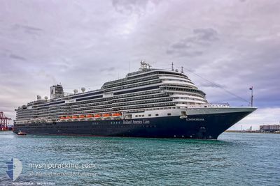
KONINGSDAM
Passenger

Current Trip
| Time Travelled | 51 mins |
|---|---|
| Remaining Time | 6 h, 11 mins |
| Distance Travelled | 7.43 nm |
| Remaining Distance | --- |
| AVG Speed | 13.3 Noeuds |
| MAX Speed | 13.9 Noeuds |
| AVG Wind | 1 knots |
| MAX Wind | 1 knots |
| MIN Temp | 5.2°C / 41.36°F |
| MAX Temp | 5.2°C / 41.36°F |
| Tirant d eau | 8.2 m |
| Position reçue | 1 d depuis |
Current Position
| Longitude | -132.01663° |
|---|---|
| Latitude | 54.45346° |
| Etat | Under way using engine |
| Vitesse | 16.7 Noeuds |
| Parcours | 285.9° |
| Zone | The Coastal Waters of Southeast Alaska and British Columbia |
| Station | T-AIS |
| Position reçue | 1 d depuis |
Information
The current position of KONINGSDAM is in The Coastal Waters of Southeast Alaska and British Columbia with coordinates 54.45346° / -132.01663° as reported on 2025-06-02 03:08 by AIS to our vessel tracker app. The vessel's current speed is 16.7 Noeuds and is heading at the port of SKAGWAY. The estimated time of arrival as calculated by MyShipTracking vessel tracking app is 2025-06-03 06:02 LT
The vessel KONINGSDAM (IMO: 9692557, MMSI: 244830547) is a Passenger It's sailing under the flag of [NL] Netherlands.
In this page you can find informations about the vessels current position, last detected port calls, and current voyage information. If the vessels is not in coverage by AIS you will find the latest position.
The current position of KONINGSDAM is detected by our AIS receivers and we are not responsible for the reliability of the data. The last position was recorded while the vessel was in Coverage by the Ais receivers of our vessel tracking app.
The current draught of KONINGSDAM as reported by AIS is 8.2 meters
Weather
| Temperature | 5.2°C / 41.36°F |
|---|---|
| Wind Speed | 1 knots |
| Direction | 42° NE |
| Pressure | 1027.5 hPa |
| Humidity | 96.4 % |
| Cloud Coverage | 100 % |


Featured Company
Last Port Calls
| Port | Arrival | Departure | Time In Port |
|---|---|---|---|
| 2025-06-02 11:49 | 2025-06-02 23:00 | 11 h | |
| 2025-05-31 06:12 | 2025-05-31 16:41 | 10 h | |
| 2025-05-29 09:46 | 2025-05-29 19:08 | 9 h | |
| 2025-05-27 06:12 | 2025-05-27 19:48 | 13 h | |
| 2025-05-26 12:04 | 2025-05-26 23:12 | 11 h | |
| 2025-05-24 05:55 | 2025-05-24 16:26 | 10 h | |
| 2025-05-22 09:40 | 2025-05-22 19:08 | 9 h | |
| 2025-05-20 06:16 | 2025-05-20 20:12 | 13 h | |
| 2025-05-19 12:08 | 2025-05-19 23:08 | 10 h | |
| 2025-05-17 06:09 | 2025-05-17 16:40 | 10 h |
Last Trips
| Origin | Departure | Destination | Arrival | Distance | |
|---|---|---|---|---|---|
| 2025-05-31 16:41 | 2025-06-02 11:49 | 779.09 nm | |||
| 2025-05-29 19:08 | 2025-05-31 06:12 | 532.24 nm | |||
| 2025-05-27 19:48 | 2025-05-29 09:46 | 552.50 nm | |||
| 2025-05-26 23:12 | 2025-05-27 06:12 | 97.65 nm | |||
| 2025-05-24 16:26 | 2025-05-26 12:04 | 779.14 nm | |||
| 2025-05-22 19:08 | 2025-05-24 05:55 | 531.80 nm | |||
| 2025-05-20 20:12 | 2025-05-22 09:40 | 549.68 nm | |||
| 2025-05-19 23:08 | 2025-05-20 06:16 | 98.09 nm | |||
| 2025-05-17 16:40 | 2025-05-19 12:08 | 778.11 nm | |||
| 2025-05-15 19:12 | 2025-05-17 06:09 | 530.30 nm |
Events
| Heure | Evenement | Détails | Position/ Destination | Info |
|---|---|---|---|---|
| 2025-06-03 07:00 | PORT DE DEPART |
|
58.27269 / -134.37016
CA VAN > US JNU
|
Vitesse: 7.8 kn Parcours: 126° |
| 2025-06-03 06:49 | Démarrage |
58.29028 / -134.40436
[US] JUNEAU
|
Vitesse: 6.7 kn Parcours: 163° |
|
| 2025-06-02 20:21 | Arret |
58.29789 / -134.40626
[US] JUNEAU
|
Vitesse: 0.2 kn Parcours: 327° |
|
| 2025-06-02 19:49 | Port d'arrivée |
|
58.27582 / -134.37605
[US] JUNEAU
|
Vitesse: 7.6 kn Parcours: 313° |
| 2025-06-02 17:16 | Démarrage |
57.72529 / -133.67371
CA VAN > US JNU
|
Vitesse: 6.7 kn Parcours: 336° |
|
| 2025-06-02 17:01 | Arret |
57.72142 / -133.67127
CA VAN > US JNU
|
Vitesse: 0.1 kn Parcours: 10° |
|
| 2025-06-02 03:16 | Etat Changé | Default Under way using engine |
54.46389 / -132.08223
CA VAN > US JNU
|
Vitesse: 16.7 kn Parcours: 285.9° |
| 2025-06-02 03:08 | Hors de la zone couverte |
54.45346 / -132.01663
The Coastal Waters of Southeast Alaska and British Columbia
CA VAN > US JNU
|
Vitesse: 16.7 kn Parcours: 285.9° |
|
| 2025-06-02 02:49 | Changement de zone | United States (Alaska) part of the The Coastal Waters of Southeast Alaska and British Columbia Canadian part of the The Coastal Waters of Southeast Alaska and British Columbia |
54.43067 / -131.87645
The Coastal Waters of Southeast Alaska and British Columbia
CA VAN > US JNU
|
Vitesse: 16.2 kn Parcours: 284.7° |
| 2025-06-01 22:18 | Etat Changé | Under way using engine Default |
53.53693 / -130.82002
CA VAN > US JNU
|
Vitesse: 20.6 kn Parcours: 348° |