
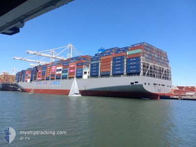
WAN HAI A11
Cargo A
Current Trip
| Time Travelled | 7 days |
|---|---|
| Remaining Time | --- |
| Distance Travelled | 2422.19 nm |
| Remaining Distance | --- |
| AVG Speed | 15 Noeuds |
| MAX Speed | 20.3 Noeuds |
| AVG Wind | 18.9 knots |
| MAX Wind | 33.8 knots |
| MIN Temp | 3.9°C / 39.02°F |
| MAX Temp | 13.1°C / 55.58°F |
| Tirant d eau | 10.6 m |
| Position reçue | 10 d depuis |
Current Position
| Longitude | 114.11940° |
|---|---|
| Latitude | 22.24516° |
| Etat | Under way using engine |
| Vitesse | 11.9 Noeuds |
| Parcours | 138.9° |
| Zone | South China Sea |
| Station | T-AIS |
| Position reçue | 10 d depuis |
Info
Information
The current position of WAN HAI A11 is in South China Sea with coordinates 22.24516° / 114.11940° as reported on 2025-02-01 04:00 by AIS to our vessel tracker app. The vessel's current speed is 11.9 Noeuds and is heading at the port of XIAMEN. The estimated time of arrival as calculated by MyShipTracking vessel tracking app is 2025-02-02 16:00 LT
The vessel WAN HAI A11 (IMO: 9941128, MMSI: 563196300) is a Cargo A It's sailing under the flag of [SG] Singapore.
In this page you can find informations about the vessels current position, last detected port calls, and current voyage information. If the vessels is not in coverage by AIS you will find the latest position.
The current position of WAN HAI A11 is detected by our AIS receivers and we are not responsible for the reliability of the data. The last position was recorded while the vessel was in Coverage by the Ais receivers of our vessel tracking app.
The current draught of WAN HAI A11 as reported by AIS is 10.6 meters
Weather
| Temperature | 11.8°C / 53.24°F |
|---|---|
| Wind Speed | 27 knots |
| Direction | 281° W |
| Pressure | 1003.6 hPa |
| Humidity | 62.3 % |
| Cloud Coverage | 95 % |
Featured Company
Last Port Calls
| Port | Arrival | Departure | Time In Port |
|---|---|---|---|
| 2025-02-03 16:16 | 2025-02-04 05:12 | 12 h | |
| 2025-01-31 00:09 | 2025-02-01 10:09 | 1 d | |
| 2025-01-22 17:33 | 2025-01-30 14:45 | 7 d | |
| 2025-01-20 03:25 | 2025-01-22 08:53 | 2 d | |
| 2024-12-29 15:11 | 2024-12-31 16:30 | 2 d | |
| 2024-12-17 05:09 | 2024-12-22 04:20 | 4 d |
Last Trips
| Origin | Departure | Destination | Arrival | Distance | |
|---|---|---|---|---|---|
| 2025-02-01 10:09 | 2025-02-03 16:16 | 548.39 nm | |||
| 2025-01-30 14:45 | 2025-01-31 00:09 | 89.81 nm | |||
| 2025-01-22 08:53 | 2025-01-22 17:33 | 80.57 nm | |||
| 2024-12-31 16:30 | 2025-01-20 03:25 | 7491.94 nm | |||
| 2024-12-22 04:20 | 2024-12-29 15:11 | 462.56 nm | |||
| 2024-11-25 13:32 | 2024-12-17 05:09 | 6788.68 nm |
Events
| Heure | Evenement | Détails | Position/ Destination | Info |
|---|---|---|---|---|
| 2025-02-06 20:53 | Démarrage | 5.75 nm, North West of YANGSHAN |
30.64430 / 122.03195
CNXMN
|
Vitesse: 4.6 kn Parcours: 177° |
| 2025-02-06 06:35 | Arret | 5.9 nm, North West of YANGSHAN |
30.65021 / 122.03193
CNXMN
|
Vitesse: Parcours: 106° |
| 2025-02-05 18:49 | Démarrage | 13.72 nm, South East of NINGBO |
29.77244 / 122.02052
CNXMN
|
Vitesse: 3.3 kn Parcours: 93° |
| 2025-02-05 04:12 | Arret | 13.3 nm, South East of NINGBO |
29.77702 / 122.01432
CNXMN
|
Vitesse: 0.3 kn Parcours: 225° |
| 2025-02-04 21:13 | Démarrage |
29.64136 / 123.03677
CNXMN
|
Vitesse: 3.8 kn Parcours: 291° |
|
| 2025-02-04 21:00 | Arret |
29.63352 / 123.03527
CNXMN
|
Vitesse: Parcours: 48° |
|
| 2025-02-03 21:12 | PORT DE DEPART |
|
25.15700 / 121.33851
CNXMN
|
Vitesse: 7.4 kn Parcours: 259° |
| 2025-02-03 20:57 | Démarrage |
25.15850 / 121.38108
[TW] TAIPEI
|
Vitesse: 4.8 kn Parcours: 234° |
|
| 2025-02-03 08:49 | Arret |
25.16093 / 121.38368
[TW] TAIPEI
|
Vitesse: Parcours: 243° |
|
| 2025-02-03 08:16 | Port d'arrivée |
|
25.15204 / 121.36118
[TW] TAIPEI
|
Vitesse: 10.2 kn Parcours: 92° |