
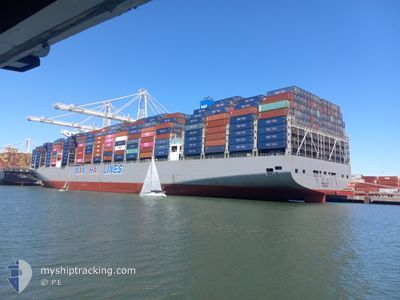
WAN HAI A11
Cargo A
Current Trip
| Trip Time | 8 days |
|---|---|
| Trip Distance | 1706.20 nm |
| AVG Speed | 12.1 Knots |
| MAX Speed | 12.1 Knots |
| Draught | 11.2 m |
| AVG Wind | 8.5 knots |
| MAX Wind | 24.9 knots |
| MIN Temp | 25.6°C / 78.08°F |
| MAX Temp | 33°C / 91.4°F |
| Position Received | 4 d ago |
Current Position
| Longitude | 106.92346° |
|---|---|
| Latitude | 20.58156° |
| Status | Under way using engine |
| Speed | 14.5 Knots |
| Course | 156.7° |
| Area | South China Sea |
| Station | T-AIS |
| Position Received | 4 d ago |
Information
The current position of WAN HAI A11 is in South China Sea with coordinates 20.58156° / 106.92346° as reported on 2025-05-28 22:23 by AIS to our vessel tracker app. The vessel's current speed is 14.5 Knots and is currently inside the port of CAI MEP.
The vessel WAN HAI A11 (IMO: 9941128, MMSI: 563196300) is a Cargo A It's sailing under the flag of [SG] Singapore.
In this page you can find informations about the vessels current position, last detected port calls, and current voyage information. If the vessels is not in coverage by AIS you will find the latest position.
The current position of WAN HAI A11 is detected by our AIS receivers and we are not responsible for the reliability of the data. The last position was recorded while the vessel was in Coverage by the Ais receivers of our vessel tracking app.
The current draught of WAN HAI A11 as reported by AIS is 11.2 meters
Weather
| Temperature | 28.8°C / 83.84°F |
|---|---|
| Wind Speed | 10 knots |
| Direction | 202° SSW |
| Pressure | 1007.7 hPa |
| Humidity | 82 % |
| Cloud Coverage | 100 % |
Featured Company
Last Port Calls
| Port | Arrival | Departure | Time In Port |
|---|---|---|---|
| 2025-06-01 14:17 | |||
| 2025-05-22 06:29 | 2025-05-23 19:52 | 1 d | |
| 2025-05-01 05:42 | 2025-05-03 04:44 | 1 d | |
| 2025-04-23 02:02 | 2025-04-29 06:38 | 6 d | |
| 2025-04-05 12:22 | 2025-04-06 01:40 | 13 h | |
| 2025-04-02 13:09 | 2025-04-03 07:04 | 17 h |
Last Trips
| Origin | Departure | Destination | Arrival | Distance | |
|---|---|---|---|---|---|
| 2025-05-23 19:52 | 2025-06-01 14:17 | 1706.20 nm | |||
| 2025-05-03 04:44 | 2025-05-22 06:29 | 6366.52 nm | |||
| 2025-04-29 06:38 | 2025-05-01 05:42 | 437.83 nm | |||
| 2025-04-06 01:40 | 2025-04-23 02:02 | 6064.57 nm | |||
| 2025-04-03 07:04 | 2025-04-05 12:22 | 558.33 nm | |||
| 2025-03-30 15:54 | 2025-04-02 13:09 | 1029.79 nm |
Events
| Time | Event | Details | Position / Dest | Info |
|---|---|---|---|---|
| 2025-06-01 07:18 | STOP Moving |
10.53996 / 107.02817
[VN] CAI MEP
|
Speed: 0.3 kn Course: 181° |
|
| 2025-06-01 07:17 | PORT ARRIVAL |
|
10.53996 / 107.02817
[VN] CAI MEP
|
Speed: 1.3 kn Course: 153° |
| 2025-05-28 22:29 | Status Changed | Default Under way using engine |
20.55532 / 106.93079
VNTCT
|
Speed: 14.5 kn Course: 156.7° |
| 2025-05-28 22:23 | OUT of Coverage |
20.58156 / 106.92346
South China Sea
VNTCT
|
Speed: 14.5 kn Course: 156.7° |
|
| 2025-05-28 22:22 | Status Changed | Under way using engine Default |
20.58398 / 106.92235
VNTCT
|
Speed: 10.4 kn Course: 158° |
| 2025-05-28 22:13 | Status Changed | Default Under way using engine |
20.61123 / 106.91006
VNTCT
|
Speed: 5.6 kn Course: 230.2° |
| 2025-05-28 21:48 | Draught Changed | 11.2 10.7 |
20.64030 / 106.94612
VNTCT
|
Speed: 9.8 kn Course: 252.7° |
| 2025-05-28 21:48 | Destination Changed | VNTCT VNHPH |
20.64030 / 106.94612
VNTCT
|
Speed: 9.8 kn Course: 252.7° |
| 2025-05-28 21:48 | ETA Changed | 2025/05/30 06:00 2025/05/28 01:00 |
20.64030 / 106.94612
VNTCT
|
Speed: 9.8 kn Course: 252.7° |
| 2025-05-28 21:30 | Status Changed | Under way using engine Default |
20.65104 / 107.00105
VNHPH
|
Speed: 11.1 kn Course: 226° |