
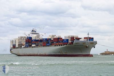
CMA CGM VOLTAIRE
Container Ship
Current Trip
PANAMA
| Time Travelled | 5 days |
|---|---|
| Remaining Time | --- |
| Distance Travelled | 1486.90 nm |
| Remaining Distance | --- |
| AVG Speed | 13.9 Knopen |
| MAX Speed | 21.3 Knopen |
| AVG Wind | 7.4 knots |
| MAX Wind | 19 knots |
| MIN Temp | 20.9°C / 69.62°F |
| MAX Temp | 30.5°C / 86.9°F |
| Diepgang | 11.8 M |
| Positie ontvangen | 8 m geleden |
Current Position
| Lengtegraad | -76.25434° |
|---|---|
| Breedtegraat | 10.25436° |
| Status | Under way using engine |
| Snelheid | 19.9 Knopen |
| Koers | 95.2° |
| Gebied | Caribbean Sea |
| Station | T-AIS |
| Positie ontvangen | 8 m geleden |
Info
Information
The current position of CMA CGM VOLTAIRE is in Caribbean Sea with coordinates 10.25436° / -76.25434° as reported on 2025-03-15 03:17 by AIS to our vessel tracker app. The vessel's current speed is 19.9 Knopen
The vessel CMA CGM VOLTAIRE (IMO: 9635652, MMSI: 229877000) is a Container Ship that was built in 2013 ( 12 Jaar oud ). It's sailing under the flag of [MT] Malta.
In this page you can find informations about the vessels current position, last detected port calls, and current voyage information. If the vessels is not in coverage by AIS you will find the latest position.
The current position of CMA CGM VOLTAIRE is detected by our AIS receivers and we are not responsible for the reliability of the data. The last position was recorded while the vessel was in Coverage by the Ais receivers of our vessel tracking app.
The current draught of CMA CGM VOLTAIRE as reported by AIS is 11.8 meters
Weather
| Temperature | 27.2°C / 80.96°F |
|---|---|
| Wind Speed | 15 knots |
| Direction | 28° NNE |
| Pressure | 1011 hPa |
| Humidity | 76.1 % |
| Cloud Coverage | 100 % |
Featured Company
Last Port Calls
| Port | Arrival | Departure | Time In Port |
|---|---|---|---|
| 2025-03-06 23:38 | 2025-03-09 09:18 | 2 d | |
| 2025-03-05 05:49 | 2025-03-05 18:10 | 12 h | |
| 2025-03-02 22:00 | 2025-03-02 22:15 | 15 m | |
| 2025-02-27 17:14 | 2025-02-28 12:10 | 18 h | |
| 2025-02-24 14:43 | 2025-02-26 09:07 | 1 d | |
| 2025-02-22 09:57 | 2025-02-23 07:17 | 21 h | |
| 2025-02-20 12:38 | 2025-02-21 05:07 | 16 h | |
| 2025-02-12 20:53 | 2025-02-13 15:09 | 18 h | |
| 2025-02-07 19:59 | 2025-02-09 12:24 | 1 d | |
| 2025-02-04 09:11 | 2025-02-05 04:23 | 19 h |
Most Visited Ports (Last year)
| Port | Arrivals | |
|---|---|---|
| 11 | ||
| 7 | ||
| 6 | ||
| 6 | ||
| 6 | ||
| 6 |
Last Trips
| Origin | Departure | Destination | Arrival | Distance | |
|---|---|---|---|---|---|
| 2025-03-05 18:10 | 2025-03-06 23:38 | 230.13 nm | |||
| 2025-03-02 22:15 | 2025-03-05 05:49 | 710.73 nm | |||
| 2025-02-28 12:10 | 2025-03-02 22:00 | 697.11 nm | |||
| 2025-02-26 09:07 | 2025-02-27 17:14 | 489.92 nm | |||
| 2025-02-23 07:17 | 2025-02-24 14:43 | 492.00 nm | |||
| 2025-02-21 05:07 | 2025-02-22 09:57 | 554.58 nm | |||
| 2025-02-13 15:09 | 2025-02-20 12:38 | 3300.79 nm | |||
| 2025-02-09 12:24 | 2025-02-12 20:53 | 517.82 nm | |||
| 2025-02-05 04:23 | 2025-02-07 19:59 | 187.33 nm | |||
| 2025-02-02 08:37 | 2025-02-04 09:11 | 409.77 nm |
Events
| Tijd | Evenement | Details | Positie / Bestemming | Info |
|---|---|---|---|---|
| 2025-03-15 03:16 | Wijzig zee gebeid | Colombian part of the Caribbean Sea Panamanian part of the Caribbean Sea |
10.25524 / -76.26306
Caribbean Sea
|
Snelheid: 20 kn Koers: 96° |
| 2025-03-15 03:15 | Status Changed | Under way using engine Default |
10.25571 / -76.26762
PANAMA
|
Snelheid: 20 kn Koers: 93° |
| 2025-03-15 02:56 | Binnenbereik |
10.25524 / -76.26306
Caribbean Sea
|
Snelheid: 20 kn Koers: 96° |
|
| 2025-03-14 18:24 | Status Changed | Default Under way using engine |
10.21061 / -79.36053
PANAMA
|
Snelheid: 21 kn Koers: 87.9° |
| 2025-03-14 18:15 | Status Changed | Under way using engine Default |
10.20890 / -79.41713
PANAMA
|
Snelheid: 21 kn Koers: 85° |
| 2025-03-14 18:15 | Binnenbereik |
10.20890 / -79.41713
Caribbean Sea
|
Snelheid: 21 kn Koers: 87.9° |
|
| 2025-03-14 18:15 | Buitenbereik |
10.20890 / -79.41713
Caribbean Sea
|
Snelheid: 21 kn Koers: 87.9° |
|
| 2025-03-14 07:07 | Start beweging | 0.67 nm, West of MOIN |
10.00647 / -83.09019
PANAMA
|
Snelheid: 3.2 kn Koers: 109° |
| 2025-03-13 12:17 | Stop beweging | 1.25 nm, West of MOIN |
10.01094 / -83.09966
PANAMA
|
Snelheid: Koers: 108° |
| 2025-03-12 21:40 | Buitenbereik |
9.64085 / -80.17483
Caribbean Sea
|
Snelheid: 19.3 kn Koers: 278.5° |