
EASTERN HIGHWAY
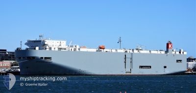
Vehicles Carrier
Current Trip
| Time Travelled | 1 day |
|---|---|
| Remaining Time | 4 days |
| Distance Travelled | 660.40 nm |
| Remaining Distance | 1925.00 nm |
| AVG Speed | 16.2 Knopen |
| MAX Speed | 19 Knopen |
| AVG Wind | 6.6 knots |
| MAX Wind | 11.4 knots |
| MIN Temp | 22.4°C / 72.32°F |
| MAX Temp | 27.4°C / 81.32°F |
| Diepgang | 7.1 M |
| Positie ontvangen | 1 d geleden |
Current Position
| Lengtegraad | 57.29576° |
|---|---|
| Breedtegraat | 24.89729° |
| Status | Under way using engine |
| Snelheid | 16.4 Knopen |
| Koers | 115.5° |
| Gebied | Gulf of Oman |
| Station | T-AIS |
| Positie ontvangen | 1 d geleden |
Information
The current position of EASTERN HIGHWAY is in Gulf of Oman with coordinates 24.89729° / 57.29576° as reported on 2025-03-10 15:31 by AIS to our vessel tracker app. The vessel's current speed is 16.4 Knopen and is heading at the port of ENNORE. The estimated time of arrival as calculated by MyShipTracking vessel tracking app is 2025-03-16 06:45 LT
The vessel EASTERN HIGHWAY (IMO: 9325764, MMSI: 538007611) is a Vehicles Carrier that was built in 2006 ( 19 Jaar oud ). It's sailing under the flag of [MH] Marshall Is.
In this page you can find informations about the vessels current position, last detected port calls, and current voyage information. If the vessels is not in coverage by AIS you will find the latest position.
The current position of EASTERN HIGHWAY is detected by our AIS receivers and we are not responsible for the reliability of the data. The last position was recorded while the vessel was in Coverage by the Ais receivers of our vessel tracking app.
The current draught of EASTERN HIGHWAY as reported by AIS is 7.1 meters
Weather
| Temperature | 26.2°C / 79.16°F |
|---|---|
| Wind Speed | 9 knots |
| Direction | 34° NE |
| Pressure | 1014.6 hPa |
| Humidity | 69.7 % |
| Cloud Coverage | --- |
Featured Company
Last Port Calls
| Port | Arrival | Departure | Time In Port |
|---|---|---|---|
| 2025-03-07 18:31 | 2025-03-09 23:25 | 2 d | |
| 2025-03-07 04:18 | 2025-03-07 12:42 | 8 h | |
| 2025-03-06 02:21 | 2025-03-06 07:14 | 4 h | |
| 2025-02-25 05:42 | 2025-02-25 15:39 | 9 h | |
| 2025-02-18 21:08 | 2025-02-19 07:45 | 10 h | |
| 2025-02-16 12:13 | 2025-02-17 00:33 | 12 h | |
| 2025-02-14 21:58 | 2025-02-15 12:39 | 14 h | |
| 2025-02-11 21:46 | 2025-02-12 04:12 | 6 h | |
| 2025-02-10 23:09 | 2025-02-11 07:05 | 7 h | |
| 2025-01-25 10:49 | 2025-01-28 13:51 | 3 d |
Most Visited Ports (Last year)
| Port | Arrivals | |
|---|---|---|
| 4 | ||
| 4 | ||
| 3 | ||
| 3 | ||
| 2 | ||
| 2 |
Last Trips
| Origin | Departure | Destination | Arrival | Distance | |
|---|---|---|---|---|---|
| 2025-03-07 16:42 | 2025-03-07 22:31 | 54.54 nm | |||
| 2025-03-06 11:14 | 2025-03-07 08:18 | 300.38 nm | |||
| 2025-02-25 23:39 | 2025-03-06 06:21 | 3292.46 nm | |||
| 2025-02-19 15:45 | 2025-02-25 13:42 | 2243.13 nm | |||
| 2025-02-17 08:33 | 2025-02-19 05:08 | 397.00 nm | |||
| 2025-02-15 21:39 | 2025-02-16 20:13 | 402.76 nm | |||
| 2025-02-12 13:12 | 2025-02-15 06:58 | 1028.99 nm | |||
| 2025-02-11 16:05 | 2025-02-12 06:46 | 186.56 nm | |||
| 2025-01-29 00:51 | 2025-02-11 08:09 | 4945.70 nm | |||
| 2025-01-21 16:17 | 2025-01-25 21:49 | 709.14 nm |
Events
| Tijd | Evenement | Details | Positie / Bestemming | Info |
|---|---|---|---|---|
| 2025-03-10 15:38 | Status Changed | Default Under way using engine |
24.88411 / 57.32592
IN ENR
|
Snelheid: 16.4 kn Koers: 115.5° |
| 2025-03-10 15:31 | Buitenbereik |
24.89729 / 57.29576
Gulf of Oman
IN ENR
|
Snelheid: 16.4 kn Koers: 115.5° |
|
| 2025-03-10 14:10 | Wijzig zee gebeid | Omani part of the Gulf of Oman United Arab Emirates part of the Gulf of Oman |
25.06569 / 56.93164
Gulf of Oman
IN ENR
|
Snelheid: 16.6 kn Koers: 118.8° |
| 2025-03-10 11:43 | Wijzig zee gebeid | United Arab Emirates part of the Gulf of Oman Omani part of the Gulf of Oman |
25.66740 / 56.75558
Gulf of Oman
IN ENR
|
Snelheid: 17.3 kn Koers: 173.6° |
| 2025-03-10 10:55 | Wijzig zee gebeid | Omani part of the Gulf of Oman Omani part of the Persian Gulf |
25.90406 / 56.73803
Gulf of Oman
IN ENR
|
Snelheid: 17.3 kn Koers: 176.5° |
| 2025-03-10 10:53 | Status Changed | Under way using engine Default |
25.91698 / 56.73719
IN ENR
|
Snelheid: 17.4 kn Koers: 178° |
| 2025-03-10 10:47 | Binnenbereik |
25.90406 / 56.73803
Gulf of Oman
IN ENR
|
Snelheid: 17.3 kn Koers: 176.5° |
|
| 2025-03-10 06:06 | Status Changed | Default Under way using engine |
26.22087 / 55.96875
IN ENR
|
Snelheid: 15.6 kn Koers: 55.1° |
| 2025-03-10 06:00 | Buitenbereik |
26.20625 / 55.94576
Persian Gulf
IN ENR
|
Snelheid: 15.6 kn Koers: 55.1° |
|
| 2025-03-10 05:49 | Wijzig zee gebeid | Omani part of the Persian Gulf United Arab Emirates part of the Persian Gulf |
26.17383 / 55.90859
Persian Gulf
IN ENR
|
Snelheid: 15.5 kn Koers: 41.1° |