
EASTERN HIGHWAY
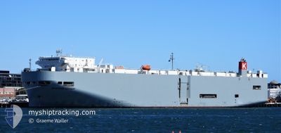
Vehicles Carrier
Current Trip
| Time Travelled | 5 days |
|---|---|
| Remaining Time | 7 days |
| Distance Travelled | 1917.34 морская миля |
| Remaining Distance | 3039.68 морская миля |
| AVG Speed | 15.5 Узлы |
| MAX Speed | 17.8 Узлы |
| AVG Wind | 13.1 knots |
| MAX Wind | 23 knots |
| MIN Temp | 14.6°C / 58.28°F |
| MAX Temp | 29.1°C / 84.38°F |
| Осадка | 7.1 м |
| Позиция Получена | 2 d тому назад |
Current Position
| Долгота | 154.08403° |
|---|---|
| Широта | -26.42346° |
| Статус | Under way using engine |
| Скорость | 15.4 Узлы |
| Курс | 0.7° |
| Район | Coral Sea |
| Станция | T-AIS |
| Позиция Получена | 2 d тому назад |
Info
Information
The current position of EASTERN HIGHWAY is in Coral Sea with coordinates -26.42346° / 154.08403° as reported on 2025-01-31 11:00 by AIS to our vessel tracker app. The vessel's current speed is 15.4 Узлы and is heading at the port of HITACHINAKA. The estimated time of arrival as calculated by MyShipTracking vessel tracking app is 2025-02-10 05:25 LT
The vessel EASTERN HIGHWAY (IMO: 9325764, MMSI: 538007611) is a Vehicles Carrier that was built in 2006 ( 19 лет ). It's sailing under the flag of [MH] Marshall Is.
In this page you can find informations about the vessels current position, last detected port calls, and current voyage information. If the vessels is not in coverage by AIS you will find the latest position.
The current position of EASTERN HIGHWAY is detected by our AIS receivers and we are not responsible for the reliability of the data. The last position was recorded while the vessel was in Coverage by the Ais receivers of our vessel tracking app.
The current draught of EASTERN HIGHWAY as reported by AIS is 7.1 meters
Weather
| Temperature | 28.7°C / 83.66°F |
|---|---|
| Wind Speed | 7 knots |
| Direction | 171° S |
| Pressure | 1004.3 hPa |
| Humidity | 78.6 % |
| Cloud Coverage | 100 % |
Featured Company
Last Port Calls
| Port | Arrival | Departure | Time In Port |
|---|---|---|---|
| 2025-01-25 10:49 | 2025-01-28 13:51 | 3 d | |
| 2025-01-19 10:06 | 2025-01-21 05:17 | 1 d | |
| 2025-01-10 15:13 | 2025-01-12 03:21 | 1 d | |
| 2024-12-29 22:53 | 2025-01-03 14:37 | 4 d | |
| 2024-12-07 23:33 | 2024-12-08 13:20 | 13 h |
Last Trips
| Origin | Departure | Destination | Arrival | Distance | |
|---|---|---|---|---|---|
| 2025-01-21 16:17 | 2025-01-25 21:49 | 709.14 морская миля | |||
| 2025-01-12 14:21 | 2025-01-19 21:06 | 948.11 морская миля | |||
| 2025-01-04 00:37 | 2025-01-11 02:13 | 1438.49 морская миля | |||
| 2024-12-08 20:20 | 2024-12-30 08:53 | 4538.12 морская миля | |||
| 2024-11-27 11:17 | 2024-12-08 06:33 | 3000.11 морская миля |
Events
| Время | Событие | Детали | Позиция / Направление | Информация |
|---|---|---|---|---|
| 2025-01-31 11:08 | Статус изменился | Default Under way using engine |
-26.38916 / 154.08412
JP HIC
|
Скорость: 15.4 kn Курс: 0.7° |
| 2025-01-31 11:00 | Статус изменился | Under way using engine Default |
-26.42346 / 154.08403
JP HIC
|
Скорость: 15.3 kn Курс: 0° |
| 2025-01-31 11:00 | Вне покрытия |
-26.42346 / 154.08403
Coral Sea
JP HIC
|
Скорость: 15.4 kn Курс: 0.7° |
|
| 2025-01-31 10:44 | В покрытии |
-26.42346 / 154.08403
Coral Sea
JP HIC
|
Скорость: 15.4 kn Курс: 0.7° |
|
| 2025-01-31 08:24 | Статус изменился | Default Under way using engine |
-27.09223 / 154.08829
JP HIC
|
Скорость: 15.3 kn Курс: 357° |
| 2025-01-31 08:24 | Статус изменился | Under way using engine Default |
-27.09394 / 154.08838
JP HIC
|
Скорость: 15.3 kn Курс: 357° |
| 2025-01-31 08:24 | Вне покрытия |
-27.09394 / 154.08838
Coral Sea
JP HIC
|
Скорость: 15.3 kn Курс: 357° |
|
| 2025-01-31 08:20 | Статус изменился | Default Under way using engine |
-27.10968 / 154.08934
JP HIC
|
Скорость: 15.3 kn Курс: 356.4° |
| 2025-01-31 08:19 | Статус изменился | Under way using engine Default |
-27.11395 / 154.08956
JP HIC
|
Скорость: 15.3 kn Курс: 357° |
| 2025-01-31 08:19 | Изменение морского района | Australian part of the Coral Sea Australian part of the Tasman Sea |
-27.11395 / 154.08956
Coral Sea
JP HIC
|
Скорость: 15.3 kn Курс: 356.4° |