

EASTERN HIGHWAY
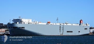
Vehicles Carrier

Current Trip
| Trip Time | 16 days |
|---|---|
| Trip Distance | 6281.66 nm |
| AVG Speed | 16.1 Knop |
| MAX Speed | 21.7 Knop |
| Djupgående | 8.2 m |
| AVG Wind | 13.3 knots |
| MAX Wind | 29.8 knots |
| MIN Temp | 11.9°C / 53.42°F |
| MAX Temp | 31.2°C / 88.16°F |
| Position mottagen | 3 d sen |
Current Position
| Longitud | -105.56806° |
|---|---|
| Latitude | 19.40116° |
| Status | Under way using engine |
| Fart | 15.2 Knop |
| Kurs | 124.7° |
| Område | North Pacific Ocean |
| Station | T-AIS |
| Position mottagen | 3 d sen |
Information
The current position of EASTERN HIGHWAY is in North Pacific Ocean with coordinates 19.40116° / -105.56806° as reported on 2025-06-07 19:46 by AIS to our vessel tracker app. The vessel's current speed is 15.2 Knop and is currently inside the port of LAZARO CARDENAS.
The vessel EASTERN HIGHWAY (IMO: 9325764, MMSI: 538007611) is a Vehicles Carrier that was built in 2006 ( 19 År gammal ). It's sailing under the flag of [MH] Marshall Is.
In this page you can find informations about the vessels current position, last detected port calls, and current voyage information. If the vessels is not in coverage by AIS you will find the latest position.
The current position of EASTERN HIGHWAY is detected by our AIS receivers and we are not responsible for the reliability of the data. The last position was recorded while the vessel was in Coverage by the Ais receivers of our vessel tracking app.
The current draught of EASTERN HIGHWAY as reported by AIS is 8.2 meters
Weather
| Temperature | 28.1°C / 82.58°F |
|---|---|
| Wind Speed | 2 knots |
| Direction | 345° NNW |
| Pressure | 1010.2 hPa |
| Humidity | 80.1 % |
| Cloud Coverage | 63 % |


Featured Company
Last Port Calls
| Port | Arrival | Departure | Time In Port |
|---|---|---|---|
| 2025-06-09 19:01 | |||
| 2025-05-23 21:38 | 2025-05-24 06:18 | 8 h | |
| 2025-05-22 21:46 | 2025-05-23 06:38 | 8 h | |
| 2025-05-21 22:18 | 2025-05-22 06:00 | 7 h | |
| 2025-05-18 17:21 | 2025-05-18 20:14 | 2 h | |
| 2025-05-09 10:08 | 2025-05-10 09:56 | 23 h | |
| 2025-04-25 03:59 | 2025-04-26 03:39 | 23 h | |
| 2025-04-23 02:59 | 2025-04-24 20:59 | 1 d | |
| 2025-04-21 21:50 | 2025-04-22 08:22 | 10 h | |
| 2025-04-06 06:59 | 2025-04-07 10:14 | 1 d |
Last Trips
| Origin | Departure | Destination | Arrival | Distance | |
|---|---|---|---|---|---|
| 2025-05-24 15:18 | 2025-06-09 14:01 | 6281.66 nm | |||
| 2025-05-23 15:38 | 2025-05-24 06:38 | 133.22 nm | |||
| 2025-05-22 15:00 | 2025-05-23 06:46 | 136.73 nm | |||
| 2025-05-19 04:14 | 2025-05-22 07:18 | 1078.92 nm | |||
| 2025-05-10 16:56 | 2025-05-19 01:21 | 2302.21 nm | |||
| 2025-04-26 07:39 | 2025-05-09 17:08 | 4398.31 nm | |||
| 2025-04-25 00:59 | 2025-04-25 07:59 | 52.98 nm | |||
| 2025-04-22 12:22 | 2025-04-23 06:59 | 272.92 nm | |||
| 2025-04-07 19:14 | 2025-04-22 01:50 | 5877.38 nm | |||
| 2025-04-05 08:41 | 2025-04-06 15:59 | 401.38 nm |
Events
| Tid | Event | Detaljer | Position / Dest | Information |
|---|---|---|---|---|
| 2025-06-09 19:28 | STOPPAR förflyttning |
17.94898 / -102.17203
[MX] LAZARO CARDENAS
|
Fart: 0.3 kn Kurs: 205° |
|
| 2025-06-09 19:01 | ANLÄNDER HAMN |
|
17.93060 / -102.17389
[MX] LAZARO CARDENAS
|
Fart: 6.9 kn Kurs: 305° |
| 2025-06-09 18:21 | STARTAR förflyttning | 4.87 nm, South East of LAZARO CARDENAS |
17.86411 / -102.13438
MX LZC
|
Fart: 7.2 kn Kurs: 336° |
| 2025-06-09 17:45 | STOPPAR förflyttning | 5.11 nm, South East of LAZARO CARDENAS |
17.85964 / -102.13399
MX LZC
|
Fart: 0.3 kn Kurs: 42° |
| 2025-06-07 19:52 | Status ändrad | Default Under way using engine |
19.38699 / -105.54630
MX LZC
|
Fart: 15.2 kn Kurs: 124.7° |
| 2025-06-07 19:46 | UTANFÖR täckningsområde |
19.40116 / -105.56806
North Pacific Ocean
MX LZC
|
Fart: 15.2 kn Kurs: 124.7° |
|
| 2025-06-07 19:45 | Status ändrad | Under way using engine Default |
19.40211 / -105.56953
MX LZC
|
Fart: 15.2 kn Kurs: 125° |
| 2025-06-07 19:43 | Status ändrad | Default Under way using engine |
19.40642 / -105.57618
MX LZC
|
Fart: 15.1 kn Kurs: 123.8° |
| 2025-06-07 18:08 | Status ändrad | Under way using engine Default |
19.64065 / -105.93235
MX LZC
|
Fart: 15.4 kn Kurs: 125° |
| 2025-06-07 17:52 | Status ändrad | Default Under way using engine |
19.68022 / -105.99249
MX LZC
|
Fart: 15.8 kn Kurs: 123.6° |