
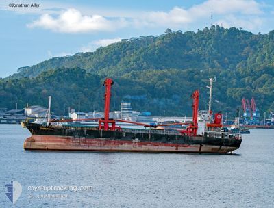
KM.SAHABAT SEJATI 8
Cargo
Current Trip
PANJANG
| Time Travelled | 7 days |
|---|---|
| Remaining Time | --- |
| Distance Travelled | 383.61 nm |
| Remaining Distance | --- |
| AVG Speed | 7.8 Knopen |
| MAX Speed | 10.8 Knopen |
| AVG Wind | 6.5 knots |
| MAX Wind | 16.7 knots |
| MIN Temp | 22.9°C / 73.22°F |
| MAX Temp | 30.9°C / 87.62°F |
| Diepgang | 6.8 M |
| Positie ontvangen | 17 d geleden |
Current Position
| Lengtegraad | 109.31713° |
|---|---|
| Breedtegraat | -5.93098° |
| Status | Under way using engine |
| Snelheid | 5.3 Knopen |
| Koers | 279.2° |
| Gebied | Java Sea |
| Station | T-AIS |
| Positie ontvangen | 17 d geleden |
Info
Information
The current position of KM.SAHABAT SEJATI 8 is in Java Sea with coordinates -5.93098° / 109.31713° as reported on 2025-01-21 20:19 by AIS to our vessel tracker app. The vessel's current speed is 5.3 Knopen
The vessel KM.SAHABAT SEJATI 8 (IMO: 8403325, MMSI: 525015135) is a Cargo It's sailing under the flag of [ID] Indonesia.
In this page you can find informations about the vessels current position, last detected port calls, and current voyage information. If the vessels is not in coverage by AIS you will find the latest position.
The current position of KM.SAHABAT SEJATI 8 is detected by our AIS receivers and we are not responsible for the reliability of the data. The last position was recorded while the vessel was in Coverage by the Ais receivers of our vessel tracking app.
The current draught of KM.SAHABAT SEJATI 8 as reported by AIS is 6.8 meters
Weather
| Temperature | 26.1°C / 78.98°F |
|---|---|
| Wind Speed | 4 knots |
| Direction | 335° NNW |
| Pressure | 1011 hPa |
| Humidity | 85.4 % |
| Cloud Coverage | 100 % |
Featured Company
Last Port Calls
| Port | Arrival | Departure | Time In Port |
|---|---|---|---|
| 2025-01-31 23:56 | 2025-02-01 00:12 | 15 m | |
| 2025-01-24 00:24 | 2025-01-24 00:28 | 4 m | |
| 2025-01-08 12:22 | 2025-01-16 19:43 | 8 d | |
| 2024-12-25 03:41 | 2025-01-05 22:28 | 11 d | |
| 2024-12-09 05:14 | 2024-12-18 02:10 | 8 d | |
| 2024-12-02 22:01 |
Last Trips
| Origin | Departure | Destination | Arrival | Distance | |
|---|---|---|---|---|---|
| 2025-01-24 07:28 | 2025-02-01 06:56 | 4.20 nm | |||
| 2025-01-17 02:43 | 2025-01-24 07:24 | 505.88 nm | |||
| 2025-01-06 06:28 | 2025-01-08 19:22 | 208.00 nm | |||
| 2024-12-18 10:10 | 2024-12-25 11:41 | 330.25 nm | |||
| 2024-12-03 06:01 | 2024-12-09 13:14 | 370.15 nm |
Events
| Tijd | Evenement | Details | Positie / Bestemming | Info |
|---|---|---|---|---|
| 2025-02-04 07:44 | Stop beweging |
-2.98797 / 104.81044
PANJANG
|
Snelheid: 0.1 kn Koers: -1° |
|
| 2025-02-04 01:04 | Start beweging | 12.04 nm, South West of MENTOK |
-2.17220 / 104.98734
PANJANG
|
Snelheid: 7.2 kn Koers: 265° |
| 2025-02-03 09:18 | Stop beweging | 11.67 nm, South West of MENTOK |
-2.17248 / 104.99447
PANJANG
|
Snelheid: 0.1 kn Koers: -1° |
| 2025-02-01 10:00 | Start beweging | 1.41 nm, South East of PANJANG |
-5.47746 / 105.29187
PANJANG
|
Snelheid: 4 kn Koers: -1° |
| 2025-02-01 00:32 | Stop beweging | 1.43 nm, South East of PANJANG |
-5.48016 / 105.29017
PANJANG
|
Snelheid: 0.1 kn Koers: -1° |
| 2025-02-01 00:12 | Vertrekhaven |
|
-5.47510 / 105.29185
PANJANG
|
Snelheid: 5.4 kn Koers: -1° |
| 2025-01-31 23:56 | Aankomsthaven |
|
-5.46285 / 105.30740
[ID] PANJANG
|
Snelheid: 4.7 kn Koers: -1° |